Day one of a seven day hike on the Bibbulmun Track, this 15.3 kilometre day of walking takes walkers from Northcliffe to Gardner campsite. A relatively easy and flat day of walking, the trail follows the Gardner River, crossing over at multiple points. Recovering from severe bushfires and fairly unremarkable walking as a result, the newly constructed rammed earth shelter at Gardner provides a pleasant trail highlight
Distance: 15.3 km (one way)
Gradient: Relatively gentle over its entire length, with some minor dips through seasonal creeks
Quality of Path: Largely clear and well maintained. Sections can be inundated through Winter and Spring
Quality of Signage: Largely well signed, with the Waugal providing very clear directional information.
Experience Required: Previous Bushwalking Experience Recommended
Time: 3-4 Hours
Steps: Some formal steps at the numerous bridges
Best Time to Visit: Late Winter/Spring, but doable from Autumn-Spring
Entry Fee: No
Getting There: The Northcliffe Trailhead is located in near the corner of Windy Harbour Rd and Muirillup Rd, across the road from the Northcliffe Visitor Centre.Entry Fee: No
Although the mild weather of the Summer of 2017 meant that Alissa and I could get in a number of hikes early in the walking season, it was the first week of the April school holidays that we were most looking forward to. Having completed Balingup to Pemberton on the Bibbulmun in September/October and walked the Overland Track in Tasmania over Christmas, we were looking forward to our next week-long hike - the Bibbulmun Track section from Northcliffe to Walpole. Other than a few 1-3 day hikes between North Bannister and Balingup, this would be our last stretch of the Track to be completed as one long multi-day hike and would finally link up all our completed sections from Balingup all the way through to Albany.
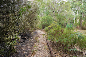
Our walk started almost identically to when we did Northcliffe to Pemberton just over a year ago, with Alissa and I joining the trail at a major orange post indicating the distances to Kalamunda and Albany as the trail traverses a disused section of railway tracks. Initially, we thought that this might be a rail trail for maybe the first half of the day, however the railway line lasted for little more than a kilometre before we left the trail and were following old vehicle tracks.
The sandy old vehicle tracks provided for relatively easy if not entirely inspiring walking, with burnt trees on either side of the track revealing the scars of the 2015 Northcliffe Fires.
As we'd previously noticed walking from Gregory Brook to Donnelly River Village, the constantly shedding bark of Karri trees means that fire has a less obvious scarring effect on Karri forests than Jarrah, and we enjoyed a section of the vehicle track that passed through recovering Karris.
Upon reaching Wheatley Coast Rd, the track heads along the road's verge before turning into a slightly swampy area.
This swampy area does not last long, with the track then running through a nature corridor alongside Wheatley Coast Rd and some pleasant farmland.
The track eventually crosses Wheatley Coast Rd, leading to the first views of the Gardner River for the day. Being mid-Autumn and early in the hiking season, the water levels were relatively low, with the river gently flowing over the rocks at a feature viewpoint along this stretch of the track.
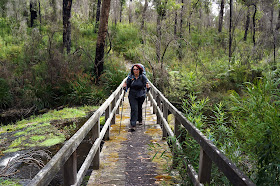
Not long after the feature viewpoint, the track crosses one of the many footbridges it traverses on its way to Gardner campsite, before rising up and away from the river.
Alissa and I were surprised to find the track once again running alongside Wheatley Coast Road before dipping back down to follow the river. This seemed a bit pointless - surely there was a way to keep the track right along the river without it having to run along the road!
The track once again crosses the Gardner River over a wooden footbridge, finally leading us away from Wheatley Coast Rd.
As good as it was to get away from Wheatley Coast Rd, the walking immediately after was pleasant enough but not overly exciting, as it traversed an old, sandy vehicle track through an uninspiring mix of jarrah and reedy riverine plants with little in the way of views.
Although it can't be helped, the aftermath of the Northcliffe fires were a definite scar on this section, with the Jarrah featuring the typically 'shaggy' appearance of trees recovering from such devastation. Even worse, the more open forest canopy had encouraged an extremely dense and tall undestorey to grow, completely obscuring any views of the nearby river.
The one good thing I can say about this old vehicle track was that it was fairly flat for the most part, with only the occasional dip to cross a stream or creek. Although most of these creeks were running dry at this time of year, the fact that a few were already flowing across the track indicated that this would be a fairly muddy and/or waterlogged section in a few months time.
After walking along such an unremarkable vehicle track for over an hour with nothing in the way of river views, it was a great relief to reach the longest of the bridges crossing the Gardner River. At this point, the river was deeper and wider than earlier and provided a lovely vantage point from which to taken in the river's tranquil beauty.
Across the bridge, the track skirts a private property as it follows another old vehicle track through Karri forest.
The Karris had clearly been burnt in 2015, and the area had a similar appearance to the Karri forests in the nearby Boorara-Gardner National Park along the walk trail to Lane Poole Falls. The dense understorey common to the Karri forests had obviously relished the more open canopy and had grown out of control along the track, brushing up against us as we pushed through.
The Gardner River is crossed yet again, leading us back along the sandy vehicle track from earlier in the day.
As with earlier in the day, the sandy vehicle track was far from thrilling walking, and we were glad when the road eventually brought us to Gardner campsite 3.5 hours after leaving Northcliffe. Had we not started late due to having to catch the bus into town, Alissa and I would have considered pushing on to Lake Maringup, however we were nevertheless happy to ease on into the walk with a short first day.
Destroyed in the 2015 fires, the replacement hut at Gardner had been recently completed before we walked this section, with the hut having been left roofless for quite some time.
One of four huts destroyed over that particularly destructive Summer, the replacement hut has been made from rammed earth as a variation on the 'Nornalup' style hut common to the Southern Half of the track. Alissa and I agreed that these new huts were a good idea, as they maintained the aesthetic of the wooden huts while the more durable construction material will allow for a faster rebuild should a fire go through the area in the future.
Although clearly scarred by the fire and having the sandy appearance of much of the day's walking, the hut's close proximity to the Gardner River provided for some lovely views; in spite of everything that it has endured, Gardner is a lovely spot for a campsite that will only get better as the surrounding forests recover.
When we recently walked from Cosy Corner to Albany, Alissa and I were amazed to have a Bibbulmun Track hut all to ourselves as we hadn't had that luxury since walking from Albany to Denmark in the Winter of 2012! Being the school holidays, Alissa and I knew that track would be busier that usual, but as 5 o'clock came and went we realised that no one else was coming and that we once again had a hut to ourselves.
Having spent a fair bit of money on Backcountry Cuisine meals for both our eight day hike from Balingup to Pemberton and on the Overland Track, my mission for 2017 has been to start dehydrating our own home cooked meals, and for the first night we had Mac & Cheese I made by dehydrating pasta, cheddar and blue cheese and vacuum sealing it with the other dry ingredients. The results were excellent - far better than any of the packet Mac and Cheeses we've had on the track. After playing a few rounds of Monty Python Fluxx and having our ration of two squares of Lindt Chocolate and a 50mL dram of whisky, we went to bed after a relatively short first day on the track.
While having a bit of a debrief about the day's walking, Alissa and I agreed that Northcliffe to Gardner had not been been a particularly engaging section of the track, with much of the river views obscured by the dense understorey and such lengthy periods spent along dull old vehicle tracks. The ravages of the bushfire definitely had their effect as well, however I can't imagine that this section was ever that much more beautiful or engaging before the fire. Although probably a bit unfair, Alissa and I couldn't help but think of the first day of our last week-long hike on the Overland Track, where the first day was absolutely incredible. The days in and out of towns on the Bibbulmun Track can be a bit less interesting, so Alissa and I chalked up this sections flaws to a lack of a more suitably picturesque alternative. Still, Gardner is a lovely spot for a campsite, and the novelty of having the hut to ourselves definitely lifted our spirits and filled us with anticipation for our next day of hiking to Lake Maringup.


No comments:
Post a Comment