

An incredible off-track challenge in State Forest 14, the North Dandalup Walk GPS Route explore an area downstream of North Dandalup Dam. Descending to the North Dandalup River, the kilometre of walking upstream past waterfalls and cascades is one of the finest kilometres of walking in the Perth Region. A great off-track route, this a must do for experienced odd-track walkers
Distance: 15 km (loop)
Gradient: Alternates between relatively easy, gentle gradients and section of very steep difficult terrain, with some scrambling required
Quality of Path: Ranges from well formed vehicle tracks, informal bush pads and completely off-track sections with no obvious path through often thick scrub. Several parts of this walk are unmarked and map reading skills are essential. The rocky scrambles would be very slippery after rain - extra caution must be taken.
Quality of Signage: Non-existent; apart from some sections of the Munda Biddi. This walk is an unmarked route and map reading skills are essential. Route information is available from Walk GPS.
Experience Required: Previous Bushwalking Experience Required. This is a navigationally difficult walk that is highly unsuitable for all but experienced hikers who are comfortable with off-track navigation.
Time: 7-8 Hours, including lunch
Steps: Many informal steps, plus some scrambling required
Best Time to Visit: Late Winter/Mid Spring
Entry Fee: No, however access to the GPS file requires a subscription to Walk GPS.
Entry Fee: No, however access to the GPS file requires a subscription to Walk GPS.
Getting There: The trail starts from Hines Rd. Heading south from Serpentine, the turn off to Hines Road is 16.5 kilometres down South Western Highway. Exact location available from Walk GPS.

Having thoroughly enjoyed the Three Mountains Walk GPS Route two weeks earlier, Alissa and I decided to return to the Walk GPS well for another adventure in the Perth region. This time, Alissa and I headed down South Western Hwy to tackle the North Dandalup Walk. Recommended by route designer Dave Osborne himself, the photos of rugged granite river walking looked so incredible that we just had to see it for ourselves.
Starting from Hines Rd, the walking initially passes through unpromising regrowth Jarrah that looks to have been fairly recently planted. Looking at the satellite footage, the whole area is a bit of a bald spot that suggests that trees were either recently harvested or that it was once a rural property that was returned to crown land.

The first 600 metres are fairly easy as they follow the old vehicle tracks through the forest. After the 600 metre mark, the walk goes off track and relies heavily on the GPX file Dave has created for the route. As such, this walk should not be attempted by anyone who does not have experience with using a GPS device or app, and I cannot stress how important it is to have the GPX file ready to go before arriving at the start. As with other GPS-based routes we've undertaken, Alissa and I thoroughly recommend the ViewRanger app as the Skyline function uses augmented reality to put markers in real space and even put arrows pointing towards the next waypoint.

Having done three Walk GPS routes previously, Alissa and I knew that Dave loves granite formations almost more than I do. Heading through the forest, Alissa and I came to our first landmark as we headed over a small granite outcrop in the middle of the forest.

Having seen better granite formations before, Alissa and I were more excited by the views that followed as we reached a viewpoint overlooking the rolling farmland beyond the forest. Framed by a large Eucalypt, this was the first excellent view of the walk.

From the viewpoint, the route descends towards the North Dandalup River Valley, passing by a few granite outcrops before steeply dropping off towards a water pipeline and gravel road.

After climbing over the water pipeline, Alissa and I found ourselves on the gravel road as it made its way to a dip in the road. As we've discovered from doing a few of these Walk GPS routes, the sections along vehicle tracks become a real treat as they provide an easy break away from the navigational challenges found elsewehere.
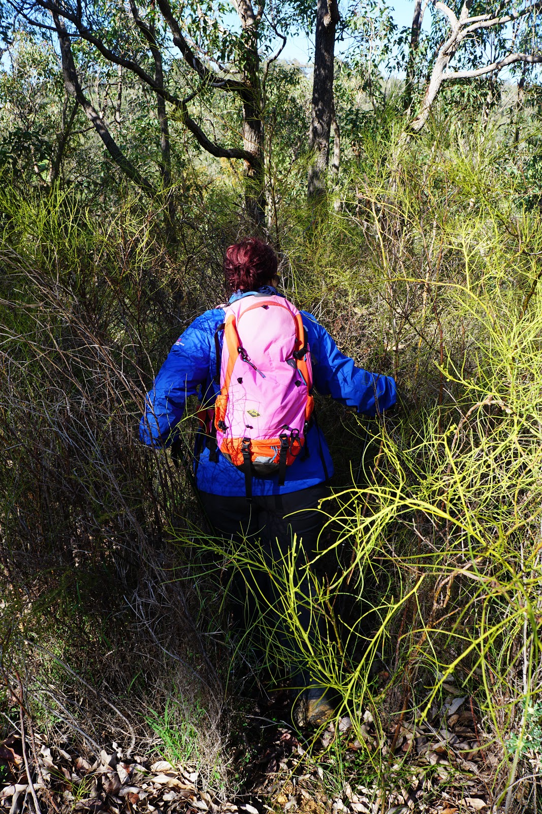
The easy going on-track walking did not last very long at all. As the road dips down before rising uphill towards the dam, Alissa and I had to push straight through thick scrub to descend towards the river, and then follow the river bank diagonally to a designated crossing point.

As we cleared the thick scrub and sighted the river crossing point, Alissa and I entered what is arguably one of the most staggeringly beautiful kilometres of walking in the entire Darling Scarp.

There is a reason I consider August and September to be the best time for bushwalking in the Perth region, and it is exemplified in the photo above. With a wet June, July and early August, the river was flowing well as it cascaded down the rocks. Meanwhile, the wildflowers were beginning to bloom, and we were lucky to spot some lovely Donkey Orchids right by the water's edge.

With the water flowing fairly fast, the crossing was a bit of a challenging one that got our feet pretty wet as we had to fight our way through some very thick heath to get to the other side of the river.

The walking on the other side of the river was fairly easy, as it headed along fairly easy going, open Wandoo woodlands and along granite shelves. At some points, the watercourse was fairly deep, with substantially tall walls of granite on either side.

The Wandoo-lined river was the very definition of lush; Alissa and I couldn't get over how beautiful this area was, and we hadn't even reached the best part yet.

Continuing along, the river courses over many granite boulders. With steep terrain on the other side, the route continues upstream to find a more reasonable place to make the river crossing.

As the route enters the deeper valley, it passes through an area of large boulders before crossing over to the other side.

This is potentially dangerous and tricky work; while Dave has a suggested route, Alissa and I had to make our own decision about the best way to pick our way through to the other side. Our initial plan had been to cross at a series of rocks to the right of the picture above before we realised there was a flatter and more accessible point a bit further down. This is the sort of thing that you really need to cut your teeth on with easier walks in less remote areas, and I would recommend doing some safer river crossings on the Bibbulmun or Cape to Cape Tracks before attempting something like this.

Nevertheless, the challenge of the track was amply rewarded; once on the other side of the river, Alissa and I were astounded by the view of a massive granite bluff to the south-west of the route.

Panning around to the left, we were impressed by the view of a massive eagle's nest in the trees. The Eagle View Walk Trail in John Forrest National Park used to feature a viewpoint overlooking a similar eagle's nest, however this tree was burnt down in a fire and the meaning was changed to mean a more symbolic 'eagle's view' since it has views towards the city. This true eagle's view is vastly superior.

As if there weren't enough wow moments, the route then crosses over the top of a small waterfall. The view of the granite bluff, the eagle's nest and the waterfall crossing are all within 50 metres. Alissa was so amazed and impressed by the sheer quality of the scenery on offer than she offered up the best, most succinct praise that this was 'Tasmanian level beautiful'.

As if to ensure that Alissa's praise was not sheer hyperbole, we had excellent views of yet another waterfall from the other side of the river. Tasmanian level beautiful indeed.

The route continues following the river upstream as it passes several jumbles of granite boulders along the watercourse. At times the route follows the river fairly closely, while at other times its rises up through the heath and heads up high along the banks of the river.

Following the Walk GPS route, Alissa and I headed across the river in a shallow section as we made our way to the largest waterfall of the walk. After the easy, shallow crossing, the walking became a fairly difficult clamber over boulders with thick scrub before we emerge at a large pool at the base of the falls.

While small compared to National Park Falls or Lesmurdie Falls, this apparently unnamed waterfall was nevertheless impressive enough that it seems unbelievable that there isn't a walk trail to this area, and that the area is not even protected as a national park when comparatively uninspiring areas like Beelu and Korung National Park are given such a lofty title. I couldn't even find a name for this area other than the utterly utilitarian 'State Forest 14'.


Alissa had great fears that the route would entail scrambling up the waterfall itself, however the route somewhat more sensibly made its way up alongside the waterfall on a vegetated slope rather than clambering up the slippery rocks.

From the top of the falls, Alissa and I were able to look back across the valley to the granite bluff and the farmland just outside of the forest. While we were down in the valley, we had no way of knowing that the farmland was so close by; it truly felt like a wild place far away from the modern world.

Continuing up along the river, the walking continued to be a fun adventure, with many smaller pools and cascades along the granite.

We had feared that the best bits of the walk would be over once we were on top of the falls, but we needn't have worried; while more open than the dense, lush forest below, this upper level had its own rugged beauty that felt like an extended version of Rocky Pool as seen along the Piesse Gully Loop in Kalamunda National Park.


The exciting section sadly came to an end as we rose up steeply to reach the top of the valley slope.

As we rose up, Alissa and I could see the wall of North Dandalup Dam in the background. At the bottom of the dam is a popular day use area with a swimming pool made from the old Pipehead Dam.

After successfully negotiating the rocky slope and saying goodbye to the North Dandalup River Valley, Alissa and I were given a consolation prize in the form of a clear and easy to follow old forestry track that leads right to Dandalup campsite on the Munda Biddi.

In spite of seriously pursuing bushwalking as a hobby for 15 years, it may surprise readers just as much as it did Alissa to know that I'd never actually been to a Munda Biddi hut before! Arriving at the hut, Alissa and I were pretty impressed by the quality of the facilities on offer as they are actually superior to the Bibbulmun Track. A small shelter is provided just for bicycles, and then the hut itself was an impressively huge facility that would easily sleep 32 people comfortably on the four bunk levels, and could easily fit even more into the front and rear spaces.

The rear balcony featuring an outstanding aspect facing the forest that makes the excellent Monadnocks campsite look dull by comparison. This is a really great campsite, and I can see why so many northbound cyclists wrote in the hut logbook that this was one of their favourite huts on the entire Munda Biddi so far.

With such an excellent location and a long way to go before we reached the next picnic area near the end of the walk, Alissa and I made use of the world class facilities by having lunch at the hut. Unfortunately, other users of the facilities did not have the same adherence to Leave No Trace principles and we were appalled to see multiple 2 litre bottles of Coke just left in the hut half-finished and a still smouldering pile of embers that had been lit in the balcony area. This was extremely disappointing given that it had been left unattended right next to a wooden railing. This is symptomatic of why we can't have nice things like a walk trail through this area - people are given great facilities and then abuse them.

For those looking to do a shorter versions of the walk, it is possible to cut the bottom loop of the walk off by following the Munda Biddi towards North Dandalup Dam, however Alissa and I were looking to complete the entire walk so headed down the vehicle track after lunch.

The gloriously easy on track walking soon ended as Alissa and I had to once again refer to ViewRanger as we headed off track through the forest.

After making our way down another valley slope, Alissa and I crossed a creek that we assumed to be a tributary of the Dandalup River.

After crossing the creek, the track crosses over yet again and steeply ascends out of the valley. At this point, Alissa was starting to tire and I have to admit that the walking through this section was a whole lot less special than the outstanding walking we had encountered earlier. Nevertheless, this was still pretty enjoyable walking that would be on par with many sections of the Bibbulmun Track in terms of quality.

Reaching the top of the valley, Alissa and I emerged out of the forest at a granite outcrop, because of course the route would. Interestingly, there were the remains of a retaining wall across the granite and it made Alissa and I wonder what had been here in the past.

From the granite, Alissa and I were back on a easy going walk track for the longest and most sustained on-track stretch of the walk so far.

Passing by several rural properties, the route follows a series of vehicle tracks along powerlines and several more rural properties before running along a very old vehicle track that has largely grown over and returned to nature.

Unlike the road walking along the Bibbulmun that still looks like a road instead of going back to nature, this old road really looked like it hadn't been used as a vehicle track for a very, very long time. This is the model for how all vehicle tracks turned into walking tracks should be; too often, they are clearly used either by service vehicles or people illegally driving on forestry roads and maintain a used road appearance.

The vehicle track slowly faded away we reached another valley slope, and Alissa and I were surprised by the fact the route appeared to go downhill and then veer wildly too the left. This made sense when we emerged from the forest at yet another granite dome!

From here, the route heads downhill towards another creek. With moss growing along the massive expanse of granite, I was definitely reminded of the section of the Bibbulmun right near the Canning River. As I was heading down the granite, I saw a creature slowly crawling along the other side of the creek and I became really excited when I realised it was an echidna! I ran as fast as I could to cross the creek, only to find that I had veered too far right and couldn't make it to the other side. I had to double back and when I got to the other side I couldn't see the echidna anywhere. As I was about to take a photo of Alissa, she pointed down below at some scrub and I realised the echidna was still right there!

Curled in a ball with its head tucked under a rock, I was able to get really close to the echidna and photograph it up close. This was our fifth echidna encounter, however it was easily the closest we'd even gotten to one.

Alissa and I decided to wait around quietly, and after 15 minutes the echidna took off. Being so close to one walking around in front us rather than having it just curled up made this our best echidna experience to date, and it made us very glad that we were doing this extended loop.

After the echidna walked off, Alissa and I continued along the route as it passed over yet another granite outcrop.

From the outcrop the route rises up a granite ridge as it heads towards an old vehicle track.

In spite of having stonework retaining walls on both sides, the road was heavily overgrown - which meant it was perfect for walking. With my phone battery having suddenly experienced a rapid decrease in power, the vehicle track was a welcome change of pace as it meant being able to put the phone away and simply walk on autopilot.

The old vehicle track joins onto Del Park Rd - the main road that goes over North Dandalup Dam. This road is used by the Munda Biddi and passes by a series of semi-rural properties.

The route leaves Del Park Rd to follow a side road. At this point our GPS situation grew pretty dire as my phone was on 2%. With this in mind, I tried to send Alissa the GPX file via Airdrop but the phone died before I could send. To add insult to injury, I put my phone in my pocket, only to realise that I had put it into the underarm vents of my raincoat. Realising what I had done, I tried to save the phone but it was too late - the phone fell from my jacket onto the ground, landing screen side down and shattering the display.

Thankfully, Alissa and I had memorised all that we needed to know about the route up until North Dandalup Dam, and this entire stretch ran along either the Munda Biddi or a vehicle track so was pretty easy going navigationally.

Along the Munda Biddi, Alissa and I reached the trail junction that leads to Dardanup campsite. While the second loop after the campsite did feature some nice walking and our echidna sighting, a shorter version cutting out the lower end of the circuit would be a more solid 'greatest hits' version that would be pretty much excellent from start to finish.

Walking north along the Munda Biddi, the forest was really good Jarrah, with several mature trees making this an enjoyable stretch of track.

Returning to Del Park Road, the road goes over North Dandalup Dam. To the left, the view looked back towards the beautiful North Dandalup River Valley.

Looking over the lake formed by the dam, Alissa and I were amazed by how blue the water was. The dam was built in 1994 and is the most recent dam constructed to serve Perth, and features and interesting monitoring station that had a certain Brutalist beauty. Alissa quite aptly pointed out that it looked like something that Steve Zissou might use as a research station.

Crossing the dam wall and passing the car park and a day use area, Alissa and I continued along the road and had to find our way back off track as per the Walk GPS route. Just before reaching a stretch of road with solid metal railings, we found a gap in the bush that took us onto a vehicle track. While I hadn't seen it at the time, a white arrow painted on the road is a helpful guide.

From here, Alissa and I had some slightly risky off-track walking to do. We had no working GPS or map, but we are both quite good at reading the landscape and orienting ourselves. We had to trust our instincts, and also think about what Dave would do in terms of picking a route. As such, Alissa and I aimed ourselves at granite outcrops and used them to guide our way back to the car.

Passing close by a series of semi-rural properties and crossing some lovely streams, Alissa and I joined an old vehicle track that brought us back to the car. While we had some experience to fall back on, walking without a map and enough charge on our phones is a bit of a risky move that highlighted the need to have the ViewRanger GPX file on both our phones and to have our batter pack charger fully charged in the future.
This was our third Walk GPS walk this season (and fourth overall) and I have to say that these walks just keep getting better and better. While it dropped off a bit in terms of excitement after Dandalup campsite, the one kilometre of walking up the North Dandalup River would have to be up there as one the most solid kilometres of walking Alissa and I have had the pleasure of experiencing in the Perth Hills. Alissa said it best when she described the quality of scenery as being 'Tasmania level beautiful', and it is totally unbelievable that there isn't some kind of walk trail through this area. How this area is not a national park, conservation park or nature reserve is totally beyond me as it is far more impressive than Beelu and Korung National Park - which would have to be amongst the most overstated national parks in Australia.
While the walking was fantastic, I should warn potential walkers that this is a very challenging walk along slippery and potentially dangerous terrain - it should not be tackled lightly and most definitely should not be attempted by people who don't have the WalkGPS GPX file. While there is a small cost involved to subscribe to Dave's page, Alissa and I have definitely had our money's worth doing his walks this season as they have really reinvigorated our love for the Perth region as a bushwalking destination. For those who have cut their teeth on some easier off track walks and are prepared for the challenges, the North Dandalup Walk GPS Route is a must do that will definitely impress. Highly recommended.


This site is really cool! I found here alot of information that I was looking for. I am really happy to be a part of This site!.crownbestreview
ReplyDelete