

One of Western Australia's greatest day walks, the Le Grand Coastal Trail is a suitably grand tour of the spectacular coastline in Cape Le Grand National Park. Starting at Rossiter Bay, the trail alternates between rugged, granite headlands and some of the most beautiful beaches in Australia. A truly outstanding bushwalk, this is a must do that is worth doing in spite of the somewhat challenging logistics
Distance: 15 km (one way)
Gradient: A mix of moderately steep descents and ascents, with more gentle sections and some flat beach walking
Quality of Path: Largely clear and well maintained; a mix of unmodified granite walking, purpose built walk trails and stretches of beach walking. Some sections through the heathlands are quite overgrown, particularly between Hellfire Bay and Le Grand Beach
Quality of Signage: Largely well signed, with wooden pegs marking the way, and informative trailheads at all section stages
Experience Required: Previous Bushwalking Experience Required
Time: 6-7 Hours
Steps: Many formal and informal steps along the track, particularly along the ascent and descents from the beaches
Best Time to Visit: Autumn-Spring
Entry Fee: Yes. National Park fees apply
Getting There: From Esperance, take Fisheries Rd east and then turn right onto Merivale Rd. Continue on Merivale for 25 kilometres, and then turn right onto Cape Le Grand Rd. The western terminus is located at the end of the road. For the eastern terminus, turn off Cape Le Grand Rd onto Lucky Bay Rd and follow it eastwards past Lucky Bay to the road's end at Rossiter Bay.Entry Fee: Yes. National Park fees apply

For years, there has been one day walk in Western Australia sitting elusively high on my to-do list - the Cape Le Grand Coastal Trail. An early entry to Trails WA's Top Trails list, the eight hour + drive from Perth meant it was never going to be as easy as walks in the South West to tick off the bucket list. Alissa and I had intended to visit the area back in April 2018 but had to cancel after I accepted a job on the Gold Coast, so it was delayed until a south coast WA road trip in 2019. Fires over the Summer burnt through the park and closed the walk, and it looked like I might have to walk only part of it, so when a ranger confirmed the walk was open all the way I was ecstatic that I would finally be able to complete the Le Grand Coastal Trail.

Being a somewhat inconvenient one way walk that takes most of the day to walk, Alissa agreed to be my support driver while I walked the trail solo. To keep the Sun behind me, we set off early to the eastern trailhead at Rossiter Bay, with Alissa meeting me at the trail's checkpoints - Lucky Bay, Thistle Cove, Hellfire Bay and Le Grand Beach. From Rossiter Bay, the trail is a well compacted gravel trail that gently heads uphill and away from the bay. Along this first stretch of the trail, I encountered a small family of kangaroos that look at me quizzically as I took their photo before bolting off to the south.

After the initial compacted track, the trail heads up towards the granite formation that serves as the anchor for the first stretch from Rossiter Bay.

Unaware at the time of how much of this trail is under granite, I was delighted by this rugged scenery - if it was even half as rugged the Tagon Coastal Trail had been just the day before, I was really going to love this walk.

In my haste to get started, I realised that I had not taken a photo of Rossiter Bay at the trailhead. With the sun right in from of me as I looked back to Rossiter Bay, the photo above sadly does not do justice to the view back down from this first high vantage point.

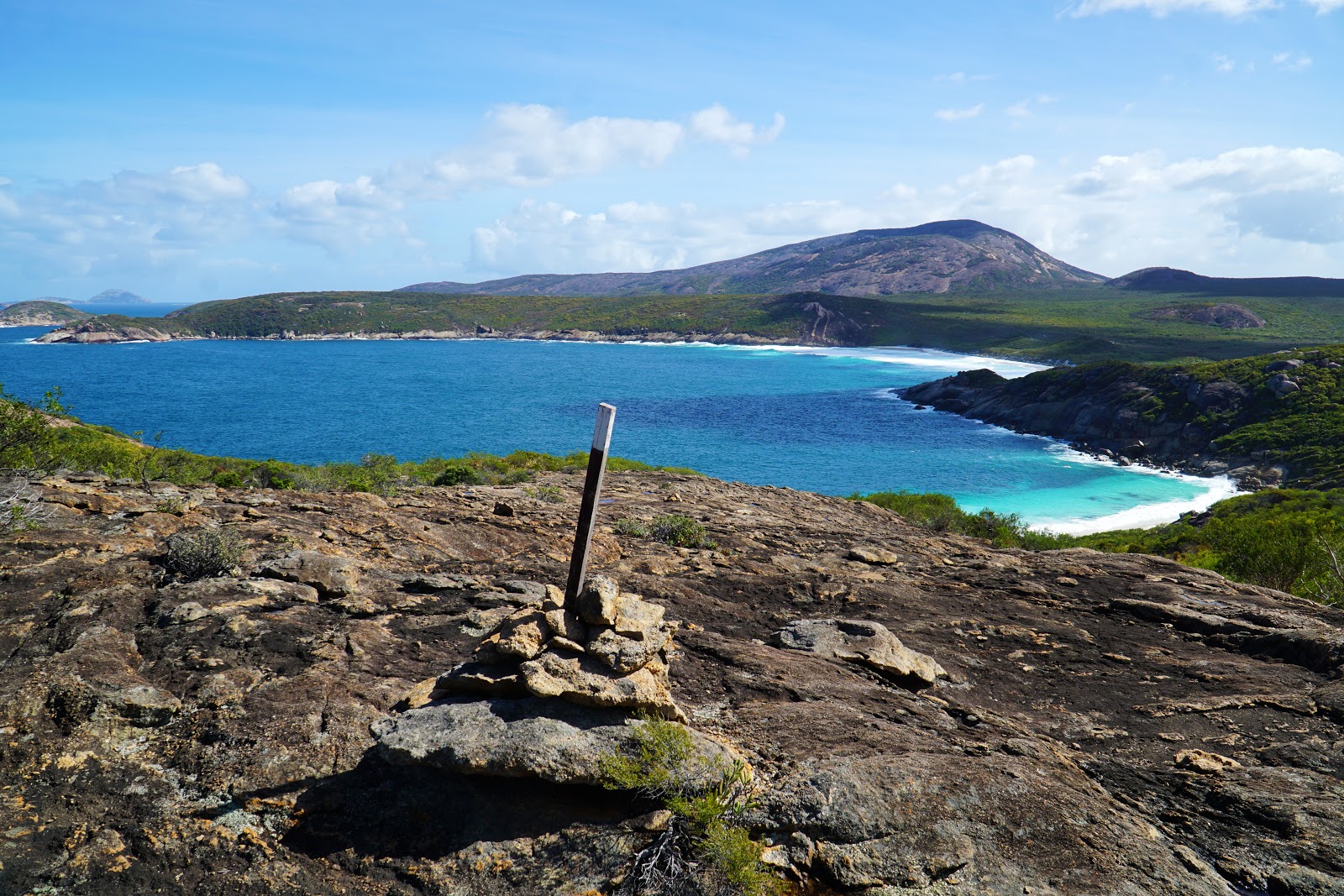
That being said, the view was even better looking northwest towards the spectacular landscape I would be exploring for the rest of the day. To the left I could see Mississippi Hill, with the super famous Lucky Bay to its right while the distinctive Frenchmans Peak could be seen in the distance.

Dipping down into so eroded, sandy track through the heathlands and then back onto granite outcrops, the trail continues on its westward trajectory to Mississippi Hill, with the trail running just to its right before make the descent to Lucky Bay.

Heading down through a jumble of granite boulders, the perfect crescent of Lucky Bay could be seen below. From this angle it didn't seem quite as grand as its Tasmanian counterpart Wineglass Bay when seen from Mt Amos, however I was still pretty excited to be walking on one of the most famous beaches in Australia.

Just before reaching the beach, a lookout platform provides a great vantage point to check out the bay.

While most visitors to Lucky Bay will know the more commonly visited western half of the beach near the campsite and day use area, the smaller cove at its southeastern end is arguably its most stunning area. Most of the photos I've seen of the main part of Lucky Bay seemed perfectly beautiful but not unlike many other beaches on WA's south coast, but this smaller cove section was the first of many outstanding beach views over the course of the day that made me think that the hype was justified.

From the lookout point, a boardwalk leads down a flight of stairs along a granite headland before leading to the main beach of Lucky Bay.

At approximately 2.3 kilometres to the day use area, Lucky Bay is the longest beach walk of the Le Grand Coastal Trail. Thankfully the sand here was mostly firm under foot, and didn't bring back any of the painful memories of walking the 7 kilometre slog of Mazzoletti Beach on the Bibbulmun Track. With its mostly compacted, squeaky sand, the beach made for relatively fast beach walking.
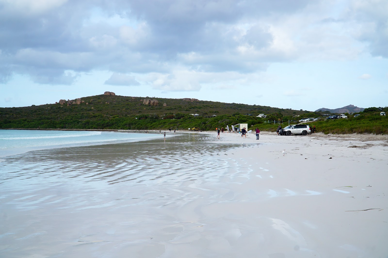
After about half an hour of walking, I found myself at the touristy end of Lucky Bay, with four wheel drives already lined up on the beach. I looked to the car park above and could see Alissa hopping out of the X-Trail to meet me.

One of the most famous aspects of Lucky Bay is the fact that there is a kangaroo colony that lives on the beach, and while I did get a shot of some kangaroos it wasn't the lazing kangaroo on the beach shot that the park is famous for. Instead, I got a shot of three behind a parked up four wheel drive with the annoying buzz of a drone flying overhead. While I've not really spoken about it much on the blog, I have quite a strong dislike for the overuse of drone photography to promote national parks. While drone photographs and videos are often incredible, they also sell a viewpoint of an area that is often not humanly possible to see. You can be rest assured that any photograph on the Long Way's Better is from a #realisticangle and is a view you too should be able to experience (weather and climate change permitting of course)!

While I think that there are actually even better beaches further along the trail, one can't argue that Lucky Bay is not a stunning cove. The sands of the beach are said to be the whitest in Australia, and while I think the sample set was only beaches that wanted to boast that they were the whitest and didn't include similarly white beaches that don't have as strong advocates (like my beloved Fitzgerald Beach), the view of the white sand, turquoise waters and granite headlands does make it a stunning part of the Australian coastline.

A nice feature of Lucky bay is the Lucky Bean Cafe - a food truck that parks up on the beach and sells coffees and simple food. With a late lunch in my future, I decided that stopping for a coffee and morning tea of damper and quandong jam with Alissa was worth a slightly later arrival at the trail's end, and allowed me to appreciate Lucky Bay for a bit longer.

From the beach, the trail runs behind a wall of thick heath towards the day use area and campsite.

A lot of work has recently gone into upgrading the Lucky Bay campsite, however the original trailhead for the second section of the walk is still in place next to a barbecue shelter.

Some track work has almost certainly been involved here in the intervening years as the trail strangely goes down to the beach, heads a few metres to the west...

... and the heads back into the dense heathlands.

At this point, I could see a trail closed sign behind an overgrown section, showing that the trail did indeed once have a less nonsensical alignment than it currently does. Satisfied that I was definitely going the right way, I said goodbye to Alissa who would meet me again at Thistle Cove.

Section 2 of the Le Grand Coastal Trail is the easiest part of the whole walk, and owing to its close proximity to Lucky Bay makes it the most frequently walked section of the track. Lucky for them, this convenient section also has some of the trail's best scenery.

But before continuing along the trail proper, I decided to take a short 50 metre detour to check out a cairn commemorating Matthew Flinders. Flinders, arguably one of Australia's most famous explorers and the man to popularise the name 'Australia', Flinders named Lucky Bay after pulling into the bay as shelter from a rough storm after gruelling journey through the rocky Recherche Archipelago.

While I was here, I decided to make an impromptu off-track visit up the granite headlands to get a bird's eye view of Lucky Bay. While this is not a marked trail, the relatively easy scrambling and good views has made it a popular area to visit, and there were more people climbing up here than I encountered over the entire third and fourth section of the walk.

Back on the actual trail, another trailhead provides clear indication of which way walkers should go as the track begins a very gentle ascent.

Almost immediately after ascending, the trail descends again, providing excellent views of a small unnamed rocky cove along the granite headlands. What I really love about this trail is the way even little, unnamed details like these are taken in by the track; whoever planned this route really thought about what a hiker would find interesting and exciting to see.

From the rocky cove, the trail rises up again and leads to a series of rounded, rocky cliffs overlooking the eastern end of Lucky Bay and several of the small islands of the Recherche Archipelago.

The excellent route of the trail continued as I made my way along an extended stretch of walking under unmodified granite terrain. Marked by obvious fence pickets along the rock, this was one of the busiest sections of the entire walk with many young families enjoying the trail experience. And why wouldn't they; this was epic, rugged scenery that we were all experiencing on what I would describe as a relatively easy section of trail!

At the high point of the granite headland, a cairn featured a metal plaque pointing the direction of all the nearby features.

From the cairn, the trail descends more unmodified granite terrain as it leads to Whistling Rock and the stunning Thistle Cove. Seeing the road leading to Whistling Rock, I knew that I was getting close to my second checkpoint and seeing Alissa again, who greeted as I approached the car park.

Located on top of a granite headland, Whistling Rock was sadly not whistling at the time of our visit, and to be honest I was fine with this if it meant the fine weather I was experiencing rather than the windy and rainy weather that the area had experiences for the last three days.

From Whistling Rock, the track skirts the edge of the car park before passing another trailhead on the way to Thistle Cove.

With the trail heading across the top of a granite outcrop, the view of Thistle Cove is spectacular. Alissa and I were wowed by how beautiful this beach looked, and we agreed it was superior in appearance to Lucky Bay while being quieter. The families enjoying their time on the beach seemed to agree with us that this was a magical place.
Saying goodbye to Alissa again as she drove to the next checkpoint, I descended the granite outcrop as I made my way onto the beach. A creek runs just behind the rock, but at the time of our visit it was not emptying out into the ocean.

The main beach of Thistle Cove is a just shy of one kilometre of fairly uncomplicated beach walking, which allowed me the opportunity to power on through while still enjoying the views.

After rising up over a small granite outcrop that divides the cove, the trail heads to a smaller beach on the other side. Blocked by the granite headlands protecting the cove, this beach is extremely gentle and calm, and would be a great place to swim safely away from the crowds. The way the granite headlands protect the cove reminded me a lot of the Wilsons Promontory Southern Circuit, particularly the calm waters of Sealers and Refuge Coves.

At the other end of the small beach, the trail markers appear to crazily point directly upwards. I cursed under my breath at what seemed impossibly steep; surely even in the slightly more laissez faire 1990s this would have been considered way to steep to climb! As I made my way up the granite, I found that it was grippy enough to support my weight but it was so steep that it made the unsanctioned climb up to Peak Head in Torndirrup National Park. seem tame by comparison. I was very glad it wasn't raining as this would have been near suicidal.

A few metres up the rock, I looked to my right and saw a marker in the distance, which indicated to me that the marker pointing up was probably in the wrong position. Looking up ahead of where I had been heading, impromptu cairns suggested people have successfully made their way up the rock, however I felt it was safer for me to slide down a bit and follow the edge of the rock to the marker - particularly since I was by myself.

The edge of the granite outcrop is a bit overgrown, but I was able to head along it safely to the next lot of markers along.

Clearing the edge of the steep section, the trail rises in a more gentle fashion up the granite slope.


As I was coming to expect from this trail, more spectacular granite walking ensued as I made my way along the high point of the granite headlands as it overlooks the coastline.

Heading inland slightly, the trail skirts around near the bottom of a rounded peak known as Boulder Hill. At the time, I thought that maybe the trail would actually head over Boulder Hill, but at the foot of the hill, the trail took a sharp left and began a steep descent.

This was one of those 'the trail goes where?!?!' moments as the markers indicated an extremely steep descent down a granite slope that would have led to a slide right into the Southern Ocean had I slipped. Once again, I was extremely grateful for the fine weather I was experiencing; while I was a bit on the hot side, it was better than rain making this a super slippery slide into the wild ocean.

Just before reaching sea level, the trail turns right and head across a dip in the granite to the next outcrop along.

Given how excessively risk averse trail construction has become in Western Australia, it was interesting to see the trail run so close to the waters of an unnamed bay, with walkers then required to scramble along the rocks. Had there not been an old metal marker on one of the rocks I would have been certain I had made a serious navigational mistake, but I was glad to see WA being a bit ballsy for once by not sanding away the adventurous element as a result of risk assessing it to oblivion.

Adventurous would definitely be the word I would use to describe the next section, which was arguably the most 'previous bushwalking experience required' section of the walk. At this point, the markers indicate that the trail has to be followed by stepping across a series of boulders to the next slab of coastal granite beyond. Pretty straightforward.

Except of course, that it wasn't. At the time of my visit, it was either high tide, the swell was still up or a combination of both, as when the water surged into the bay it covered the rocks I needed to stand on to get to the other side. As such I had to carefully time my crossing, waiting for the water to flow back out into the ocean and wait for a lull in the surge to make it across to the other side.

On the other side, the trail became a bit vague. An opening in the heath suggested a trail through the back while markers seemed to indicate following the granite along to a small beach at the end of the bay. I decided to stick with the markers and see if I could make it to the other side without getting my feet wet.

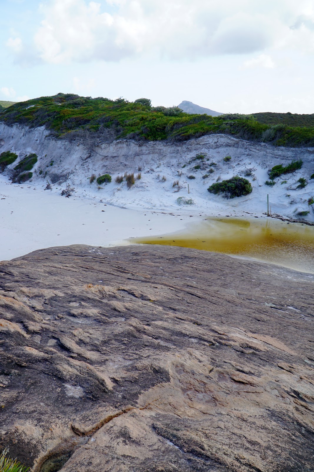
A small beach of yellow sand - the only such beach of the entire walk - represented the further corner of this small cove, and it had the most pronounced and extreme difference it water levels whenever the water surged in. In a lull I clambered across to the dry rocks to the right of the photo above and found myself stranded momentarily as the water surged back in, covering all the lower granite rocks below.

Seeing an easy scramble on the other side of the cove, I waited for the water levels to drop. Once it did, I raced my way across the sludgy sands of the beach, over the large granite pebbles and scrambled with enough time to take this picture before the water levels rose high once again. After all that adventure I realised that there was what appeared to be an easier way across through the heath, but I wouldn't have had it any other way; this was a fun part of the walk, and the kind of mildly dangerous (but not really) adventurous moments that require you to stop and think for a moment rather than experiencing it all on autopilot.

From the cove, the trail rises up another section of tall granite headlands, with views back across to Boulder Hill and the steep section I had descended earlier on my way to the cove.

Continuing ascending and then following the high point of the ridge, the trail stays slightly inland across the top of the granite headland towards Hellfire Bay.

Before reaching Hellfire Bay itself, the trail provides views of the small but stunning Little Hellfire Bay. Owing perhaps to its westward facing orientation, the beach was relatively calm and looked like a good swimming spot. From the headland along the beach, the trail descends to a well formed track that makes its way to the true Hellfire Bay.

On my way to Hellfire Bay, I came across an Ornate Crevice Dragon sunbathing on the rocks. These lizards can be found throughout the park, but most are very shy and quickly retreat at the first sign of a human walking by. This particular individual was fairly calm, and only darted into a crevice at the last minute.

Leaving the granite behind, a well constructed series of steps leads to Hellfire Bay's car park and day use area. I could see Alissa clambering on the rocks to the left of the photo above, giving me the trademark wolf salute we give each other from the distance in the style of Wes Anderson's adaptation of the Fantastic Mr. Fox.

While less convenient that Lucky Bay and its campsite right next door, Hellfire Bay was really busy - easily the busiest day use area we had encountered over the entire track. It didn't help that it was now around lunchtime, which explained the sudden surge of people picnicking and barbecuing near the beach. By this point the day was really heating up, and I found that the 1.5 litre bottle of water I had packed for the day was empty. Alissa thankfully had about 600mLs of water on her and I was able to take it with me for the fourth and final stage of the Le Grand Coastal Trail to Le Grand Beach.

Hellfire Bay was another dependably excellent beach, and would be tied with Thistle Cove for my favourite beach of the walk. Hellfire Bay sounds like a rather hellish place, but its name is derived from the brilliantly blue colour of St Elmo's Fire, rather than anything particularly Satanic.

While this photo does not do justice to it, Le Grand is such a special place that it is not just home to the whitest confirmed beach in Australia (Lucky Bay), but also its second whitest (Hellfire Bay).

At the western end of Hellfire Bay, a creek flows into the ocean. The combination of the creek and the ripples in the sand once again brought back memories of the Wilsons Promontory Southern Circuit, particularly the point where Growler Creek crosses Oberon Bay on the last day of the circuit (in a clockwise direction).

At the very end of the beach, the trail rises up between the granite headland and the overgrown heath.

The stretch from Hellfire Bay to Le Grand Beach is considered the hardest part of the Le Grand Coastal Trail, and it is perhaps not surprising that it is also by far the most overgrown and poorly maintained leg of the walk. At some point also the ascent from Hellfire Bay, I wasn't sure which way to go as the most clear path would lead to a dead end. It was only looking beyond for the markers that revealed the correct way to ascend through the heath and onto the granite.

Looking back at Hellfire Bay, I had my last truly coastal view for what would be a fair while as the final stretch stayed mostly inland.

After descending from the granite headlands, the trail dropped down into a long stretch of heathlands that seemed to go on forever, in spite of the rounded hills indicating that there would be a rocky light at the end of the tunnel.

The trail through the heath was in a very poor state of maintenance, with the trail being barely distinguishable at times. Comically, for all the prominent markers across the granite peaks, the wooden pegs were so low here that they were below knee height and overshadowed by the heath that was predominantly higher!

Reaching a series of small granite outcrops, I could see that the heath walking was reaching its end as I would follow and almost continuous granite ridge for the rest of the walk.
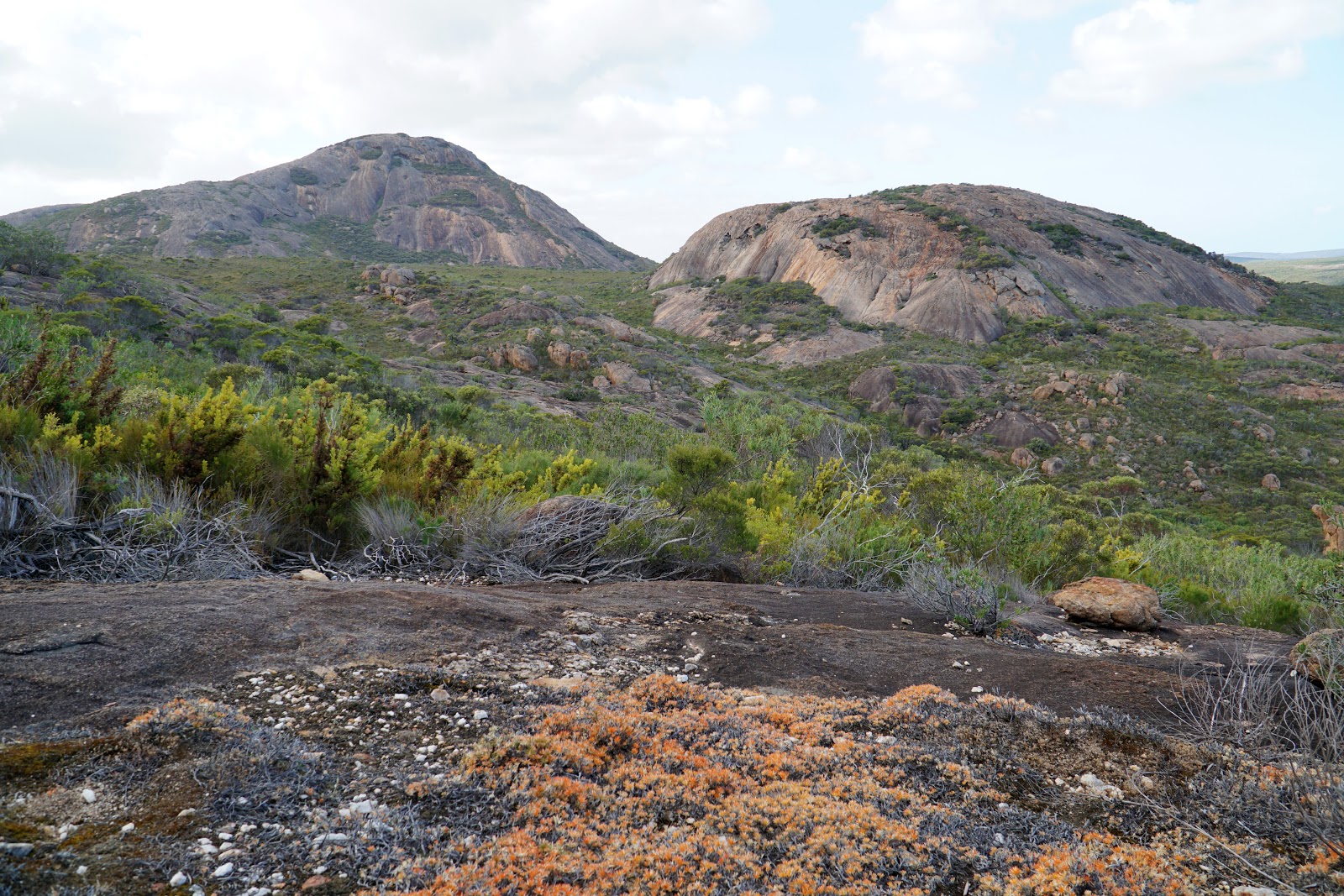
Making my way across the ridge, the views of the surrounding peaks were excellent. While not as towering as the Hazards Range of Freycinet National Park, the rugged landscape through this section was similar and similarly impressive.

While the lack of coastal views were initially a bit of a disappointment and a slight step back from the Thistle Cove to Hellfire Bay section, it was something I had to put into perspective; if this had been a granite peak walk like Mt Lindesay or over the Monadnocks on the Bibbulmun Track where there are no coastal views, this would be considered just as good as either of those.

With all the rain over the last few days, it as interesting to see a number of gnamma holes filled with water along the granite in the foothills below Mt Le Grand. One of the only missed opportunities of the Le Grand Coastal Trail is that there is no marked route to the summit, although the relatively gentle granite slopes in places does make it relatively straightforward. A marked side trip would be a great little project that would only really cost a handful of markers and a trailhead at the junction or at the Le Grand Beach car park.

Continuing along the ridge, the trail passes the section of the trail that had been closed due to the bushfire earlier in the year. The firefighters did a commendable job, having stopped the fire from spreading that far from the peak and falling short of the track itself. There was a section where they had clearly cut back the track to create a wide fire break which was entirely sensible and understandable, but did make the really narrow, overgrown heath section seem even more comically poorly maintained.

Skirting the edge of Mt Le Grand, the trail heads towards the lower peak nearer to Le Grand Beach. I knew that this peak marked the end of the track; just beyond, the trail would descend to Le Grand Beach and the end of the walk.

I was intrigued to see a creek flowing over the rock, with a number of pools along the way. I thought to myself that if I had run out of water, I could have filled up my bottle and used my Steripen to make it safe to drink. Not long after the creek crossing, I was pleasantly surprised to find Alissa waiting for me after having decided to not just wait at the car park but to head up the track and join me for the last leg of the walk.

At the base of the lower peak, the trail heads into an area of eucalpyt mallee and then heads across open heathland.

The view from this point was excellent as it served as an exceptional lookout point to see Frenchmans Peak, which Alissa and I would be tackling after a late lunch (because I hadn't done enough hiking today!).

After taking in the views of Frenchmans Peak, it was a steep descent to the Le Grand Beach car park and campground and the final trailhead of the Le Grand Coastal Trail.

For a walk that had been on my to-do list for such a long time and having been hyped up significantly by Tourism WA's regular promotion of Cape Le Grand National Park as one of the best national parks in the state, I had been concerned that the Le Grand Coastal Trail would not live up to expectations. I needn't have worried; while the one way nature is a bit inconvenient, this was a truly outstanding coastal walk that was entirely worthy of the hype, and an easy shoe-in for being one of the most spectacular coastal day walks you'll find anywhere in Australia.
I would compare it very favourably with long time favourites like the Bald Head Walk Trail near Albany, as well as similarly popular coastal areas like Freycinet National Park and the Wilsons Promontory Southern Circuit. Having only just completed the second edition of our Top 10 Day Walks in Western Australia, I can definitely say that Le Grand Coastal Trail will be included when I eventually get around to Edition Three. This is a truly great bushwalk, and one that should be on everyone's bucket list.


Like you I've always wanted to do this one Donavon, the logistics have done my head in though, maybe I'll do it as an out and back overnighter one day? It looks a bit rougher than I'd imagined but the beaches look stunning. Thanks for posting it.
ReplyDeleteAnother awesome blog post as usual. My “To Hike” list is getting longer and longer!
ReplyDelete