

A short but moderately steep loop walk in Shannon National Park, the Rocks Walk explores a stunning section of mixed forest to two granite formations. Starting at Shannon Dam surrounded by Karri trees, the trail rises up the Mokare Rock before descending to a side trip to Smeather's Rock. Featuring excellent lookout points and beautiful forest walking, this is a worth the detour to check out while in the Northcliffe area
Distance: 5.5 km ('tadpole' loop)
Gradient: Alternates between some steep ascents and descents with gentle sections.
Quality of Path: A mix of purpose built walk trail, some boardwalk and repurposed vehicle tracks
Quality of Signage: Generally well signed, with clear trailheads and markers at junctions. Very little directional information otherwise
Experience Required: Some Bushwalking Experience Recommended
Time: 1 Hours
Steps: Several informal steps near Mokare Rock
Best Time to Visit: Autumn-Spring, though late Winter/ early Spring would be the most spectacular time to visit
Best Time to Visit: Autumn-Spring, though late Winter/ early Spring would be the most spectacular time to visit
Entry Fee: No
Getting There: The trail starts at Shannon Dam. From Pemberton, head south Wheatley Coast Rd, then turn left onto Middleton Rd before Northcliffe. At the end of Middleton Rd, turn right onto South Western Hwy and turn left towards Shannon Dam opposite Shannon Campsite and Lower Shannon Dam Rd. Follow signs to the car park. Trailhead is located on the shores of the lake. 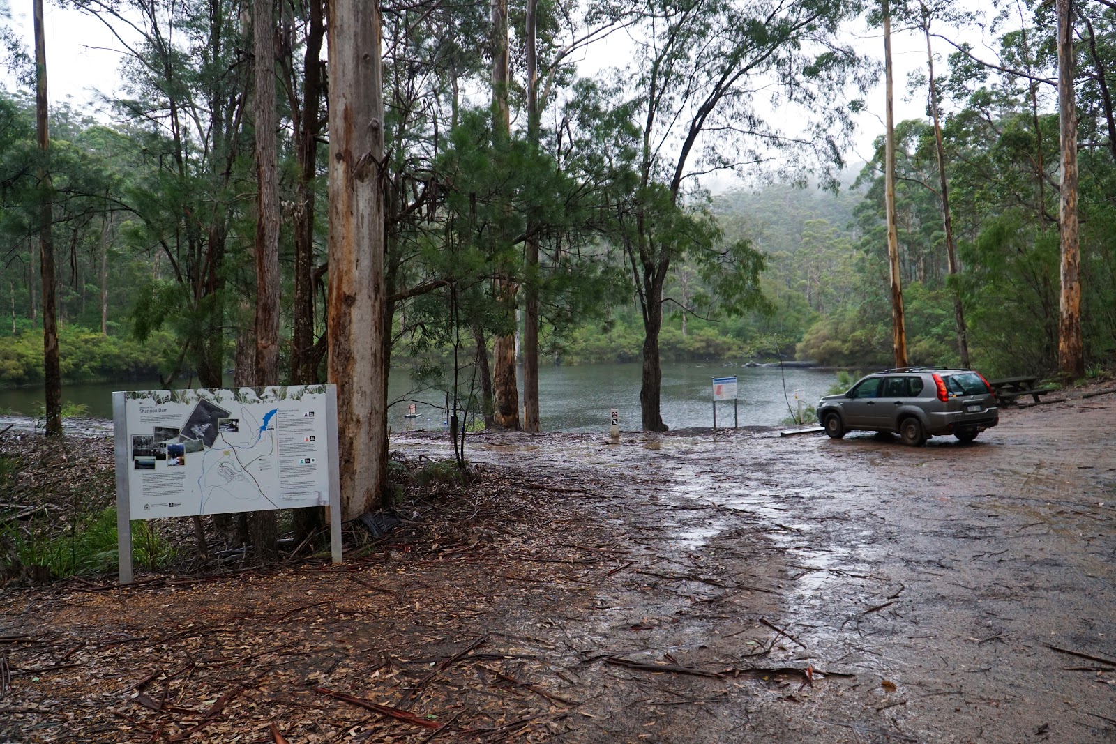
After completing the Beedelup and Lefroy Brook Loop Walks earlier in the day, Alissa and I headed south to Shannon National Park for our third and final short walk for the day to tackle the Rocks Walk. A walk we'd intended to do for several years, the walk had been closed due to the devastating bushfires that went through the park a few years ago, so we were excited to finally tick this one off our list.

While the weather had been sunny during the Beedelup Loop Walk and grey with a light drizzle while on the Lefroy Brook Loop Walk, the rain had increased in intensity as we hopped out of the car. I'm a firm believer that rain should not stop you from heading out for a walk (especially given that winter is one of the best times to go bushwalking in Western Australia), however I had to convince Alissa that it would be worth walking out in the pouring rain.

From the car park, the trail passes over a dam wall with views of the artificial lake that has been created. Having visited Pemberton many times over more than two decades, this area was a pleasant surprise to me as it seems like a bit of a hidden gem.

At the end of the wall, the trail crosses a bridge over a spillway as the trail begins its loop.

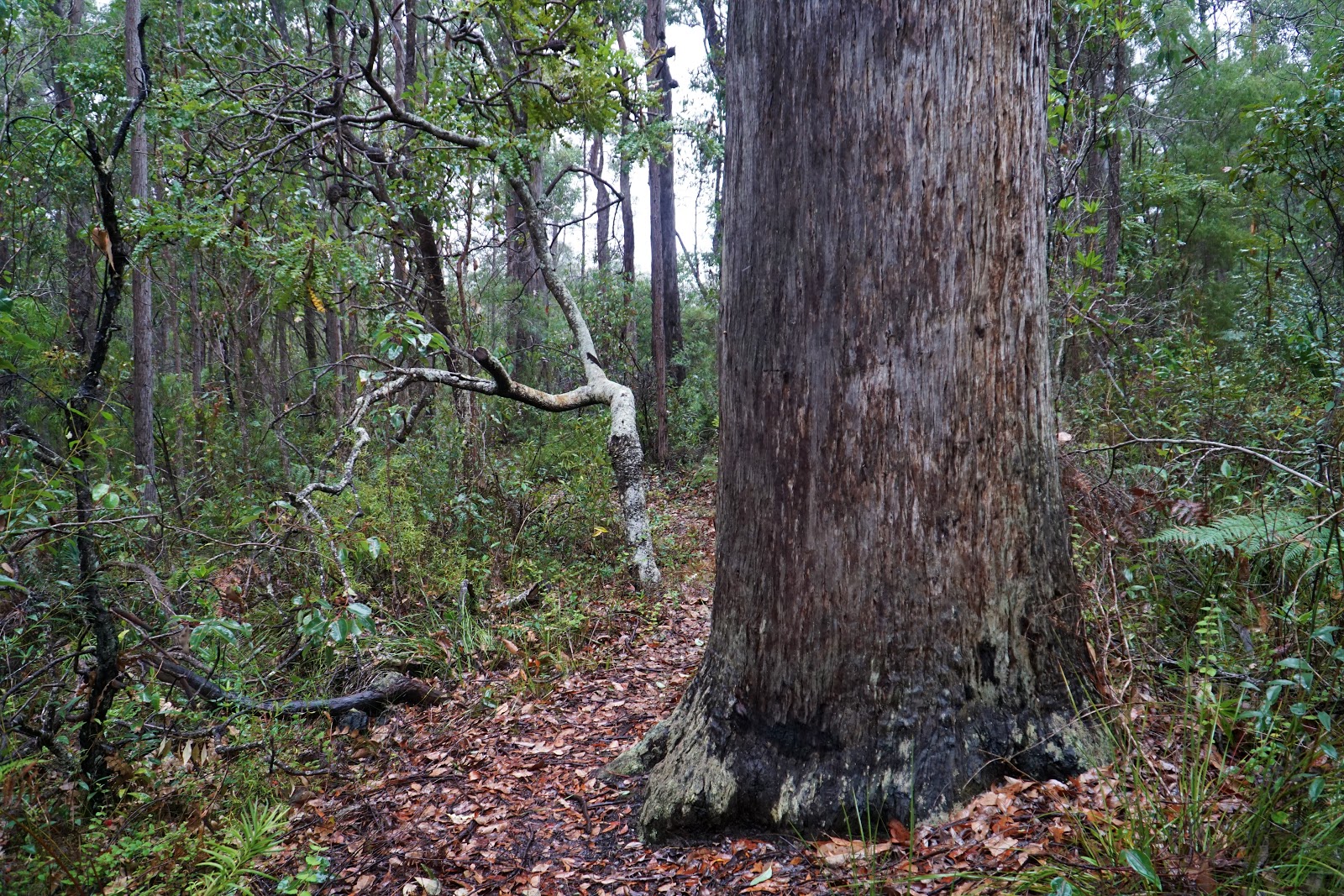
Initially, the trail follows a broad vehicle track. While vehicle tracks are generally a step down in trail experience from a purpose built walk trail, the grandeur and density of the Karri forest makes vehicle tracks a lot less objectionable than in thinner forest as it allows for the scale of the forest to be well appreciated.

The vehicle track walking was only a short stretch of the walk anyway, with the trail turning sharply to the left and heading up through a mixed Karri-Jarrah-Marri forest along purpose built single file walking track.

Initially gentle, the trail increased in steepness as it made its journey up to Mokares Rock.

Along the way, the trail heads through a handful of moss-covered granite boulders and has a similar appearance to the trail up Mt Clare heading towards Walpole on the Bibbulmun Track, or the Deep River Walk Trail.

Exiting the steep slope, Alissa and I found ourselves looking upon Mokare Rock. The rock is named after Mokare, an important Aboriginal leader who is remembered as a great peacemaker and mediator between the white colonialists and his Minang people. The Mokare Heritage Trail along the river in Denmark is also named in his honour, and a statue of Mokare can be seen in the city of Albany.

Alissa's biggest fear when doing the walk was that the rock would be slippery as she has a great fear of walking and slipping on wet granite, however the walk heads along a purpose built wooden deck that overlooks the forest below.

The view of the forest is excellent, and the rain added to the moodiness of the scene. It reminded me a lot of the view from Mt Pingerup along the Bibbulmun Track, which I also walked in similarly moody conditions.
Clearing the boardwalk, the trail heads through more mixed forest. Considering the bushfires that had gone through the area, Alissa and I were expecting to see severely burnt trees along the walk, however we were pleasantly surprised to find that the forest here seemed to have gotten away relatively unscathed, with some trees even looking like they had not been burnt for a very long time.


A very old sign along the trail talked about the mixed nature of the forest and specifically asks walkers to be careful with their cigarette butts as this is a volatile mixture that is very fire prone.


After walking around 80% of the main trail's kilometres, a short 720 metre return side trip leads to Smeather's Rock along the short Smeather's Rock Trail. Alissa was disinterested in the side trip so I continued on solo.

The walk begins as a sharp descent through the forest before levelling out and heading along the hillside towards the trails two main features.

The first is the Hollowbutt Karri, a Karri tree that has a burnt out buttressed base. This gave me some indication of what the Hollow Karri in Bridgetown Forest Park may have looked like before it collapsed. The Southern Forests seem to be full of these trees that have capture the imagination of walkers for generations; just that morning Alissa and I walked through another Karri with a hole in it along the Beedelup Loop Walk.

The side trip's main highlight is Smeather's Rock, which provides a lovely view of the forest below.


After completing the side trip, I returned to Alissa and the main trail as we began the gradual descent to complete the loop, which joined back onto the start of the track just before the bridge over the spillway. From there it was a short walk to the car. As we hopped into the car, the rain increased to a heavy downpour. Alissa, who had not even wanted to walk in the relatively gentle rain earlier, was very grateful for our good fortune to have finished just in time to avoid the worst of it.

In spite of the fact we walked the trail in pretty rainy weather, the Rocks Walk was an enjoyable short walk through beautiful high quality mixed forest that had gotten away unscathed by the 2015 Northcliffe fires. Mokare and Smeather's Rock were good highlights, and while I think there are better walks in the Southern Forests it was one of the nice ones, and well worth checking out.
Post-Script

With severe weather and massive swells forecast, Alissa and I made use of the opportunity to go check out the Gap at Torndirrup National Park. We knew we had lucked out when we arrived at the car park to find it repeatedly being hit by waves of spray. Heading to the platform, the rush of water up the Gap was just about the best Alissa and I had ever seen. The last time I saw it anywhere near this epic was in the late 1990s, and that was before the new platform was installed. The new platform makes the experience far more visceral, and I ended up quite happily drenched watching nature at its most dramatic.


Hi guys, great write up. The Southern Forests, hands down has to be one of the most beautiful regions in the whole of WA.
ReplyDeleteJust wondering, if you guys have ever walked the Canning River Regional Park in Perth? It's not a 'true' wilderness walk as such but does pass along a combination of river, swamps, wetlands and interesting forest sections. I have walked small sections of it & is quite lovely in winter, once the wetlands start filling up. And at some parts, you do feel that you are in a genuine wilderness despite roads and traffic being only a few hundred metres away!
I believe that there is a walking trail that starts at Kent St Weir in Cannington and then continues all the way to Gosnells along various sections of the Canning River. I think that you guys might find it interesting, as there are not many good walking trails on the Swan Coastal Plain.
Also, loved your writeup on the Spectacles (Beeliar Regional Park). Thanks, keep it up.