

Day One of Sydney's most famous overnight hike, this day on the Royal Coast Track explores the northern half of Royal National Park from Bundeena to North Era. Starting with a ferry ride from Cronulla, the day's walking features sheer coastal cliffs, wildflower-filled heath, idyllic beaches and several waterfalls. An outstanding day of hiking, this is a benchmark for a day of coastal walking on a multi-day hike
Distance: 18.1 km (one way from Beachcomber Avenue; add 1.5 kilometres from Bundeena Wharf)
Gradient: A mix of moderately steep descents and ascents, with more gentle sections and some flat beach walking
Quality of Path: Very clear and well maintained; a mix of unmodified rocky cliff-top walking, purpose built walk trails and stretches of beach walking. Most of the walk trail is on raised boardwalk
Quality of Signage: Largely well signed, with directional markers and trailheads along the way
Experience Required: Previous Bushwalking Experience Recommended
Time: 5-7 Hours, including lunch
Steps: Many formal and informal steps along the track, particularly along the ascent and descents from the beaches along the rocky shelves
Best Time to Visit: Autumn-Spring; the track would be very hot in Summer
Entry Fee: No, however camping fees apply at North Era Campgrounds
Getting There: From Cronulla, take the ferry across the Bundeena and follow signs to the trailhead at the end of Beachcomber AvenueEntry Fee: No, however camping fees apply at North Era Campgrounds

With a stressful two months of work behind Alissa and I, our midyear holiday to New South Wales was a most welcome break for both of us. With our last visit to Sydney being almost exactly four years ago, the trip was an opportunity for us to complete two overnight hikes that have been on the never-ending multi-day hike list since before the start of the Long Way’s Better - the Royal Coast Track and a walk through the Grose Valley in the Blue Mountains.

With an extended stay in the Blue Mountains after the Grose Valley hike, we headed south to tackle the Royal Coast Track first. Arriving at Cronulla Wharf for the ferry to Bundeena, what greeted Alissa was not particularly auspicious as the bay was entirely engulfed in dense fog that reduced visibility to dangerously low levels, and there was a question about whether or not the first ferry trip for the day would operate.

Thankfully, by the time of the ferry’s departure at 8:30 am, the fog had reduced considerably and it was clear enough for us to get on our way. While it is possible to get a taxi or Uber all the way to Bundeena, it is much cheaper and more enjoyable to take the ferry, as it provides an enjoyable a scenic start to the walk.

After landing at the wharf in Bundeena, walkers need to walk through the streets of the settlement to reach the Royal Coast Track’s trailhead. It should be noted that this is not included in the official trail’s kilometres, but only amounts to an additional 1.5 kilometres of walking.

NSW’s Parks and Wildlife Service had done a good job with signage through town, with street signage providing clear information about how to get to the trailhead.

Located at the end of Beachcomber Avenue, the northern trailhead for the Royal Coast Track is well signed and appointed, with good information about the walk and public toilets.

From the trailhead, the Royal Coast Track initially follows a broad vehicle service track for the first five minutes or so before turning off into purpose built walk track for almost the entire day.

The trail construction here is of an incredibly high standard, and it is clear the New South Wales Parks and Wildlife recognise that this is a popular and important trail that is worth investing in and are positioning it as a very high quality trail product. While trails in Tasmania and the Wilsons Promontory Southern Circuit feature long stretches of trail under boardwalk, the Royal Coast Track takes things to another level with kilometres upon kilometres of boardwalk.

While boardwalk is a dominant trail surface along the walk, there are also a lot of sections on natural surfaces, particularly near the coastal cliffs that are a signature of the walk. Coming to the first of these rocky platforms, Alissa and I were excited by the views of the sandstone cliffs which would become even more spectacular as we made our way further south.

The general character of this first day of the walk is a repeated back and forth between boardwalk through coastal heath and some occasional forest, and rocky sections along the cliffs. While the cliff sections are generally the more exciting stretches of the walk, the route of the boardwalk is well thought out and generally provides excellent views with few stretches of endless heath tunnel - particularly in these early sections.

After a stretch through heath, the trail reaches another section of cliff that provides good views just before reaching the descent to the Waterrun.

A rocky gully flowing into the Tasman Sea, Waterrun is reached via a steep series of steps that plunges down from the cliffs to the watercourse below.

The water flows down through the gully along the rock, with a small waterfall providing a lovely feature just before it reaches the water's edge.

Meanwhile, this lower shelf provides an excellent vantage point from which to view the waves crashing into the cliffs and collapsed boulders of Royal National Park's coastline.

Given the steps down, it was unsurprising that Alissa and I would immediately have to climb steps out of the Waterrun as it again made its way through lovely heath with flowering banksias providing some beautiful bursts of wildflower colour.

Until quite recently, the Coast Track continued through heath for a bit longer, however some new track work has brought the route along a series of soft and smooth white rock formations that gave us an indication that we were approaching the famous Wedding Cake Rock. The New South Wales government recently committed and incredible $9 million to upgrade the track and it is great to see that route improvements were definitely part of their considerations.

The views here are well worth the realignment, with some of the best coastal cliff views this side of Marley and Little Marley Beaches.

After about 100 metres from the first soft white formation, Alissa and I reached the famous Wedding Cake Rock. An overly Instagrammed feature of the park, the rock's white appearance is due to iron leaching which also has the effect of weakening the rock. As a result, the Wedding Cake Rock is highly unstable and it is possible it could collapse into the ocean at any minute. I was bemused then to see some hipsters blasting music and doing what looked like a fashion photoshoot standing on the rock. They seemed to have absolutely no concern for the fact they were standing on a highly unstable rock formation, even calmly remaining on the rock while checking that the photo looked good.

The latter annoyed me more; if you want to ignore signage and stand on an unstable formation that could lead to your death then I'm a firm believer you should be allowed to see out your choice to potentially die by misadventure, but they were also utterly selfish as they could see I wanted to take a photo of the rock but were standing there for ages doing nothing but look through their photos.

After finally getting a photo of the rock without selfish idiots standing on it, Alissa and I continued on the track towards Marley Beach. Unsurprisingly, the trail quality dropped off slightly just after Wedding Cake Rock given that these are areas that are not as regularly visited by day tourists. I must stress that when I say trail quality dropped off it was still of a very high standard, but it did not feature the deluxe boardwalks we'd be on for most of the walk.

I was surprised and delighted to find that the 'lower' standard track only lasted for 650 metres before again returning to boardwalk in spite of a vehicle track being located nearby. This is an example of that little bit of extra detail and effort that separates a good trail from a great one; the trail makers could have easily used the vehicle track as it is certainly expedient and cheaper, but instead they've spent the money and provided the outcome that creates a better experience for walkers.

The boardwalk ends at Marley Head, a headland that provides views down to Marley Beach below. Being July, there were a lot of people out and about on the trail at headlands such as this watching for whales migrating along the coast. Looking out to sea, we saw a whale breaching just a short distance away, however I was not able to get a particularly good photo of it in time.

I was however able to get a photo of this young crow that came to watch the humans as we watched the whales.

From Marley Head, the trail follows a mix of natural rocky surfaces and boardwalk down to the beach.

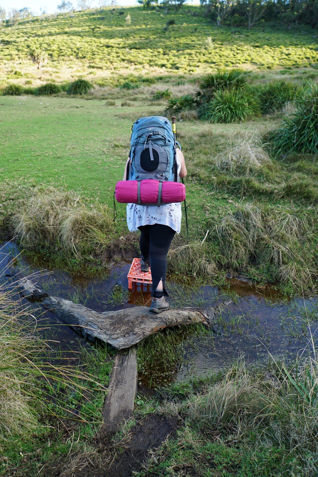
Upon reaching the beach, walkers have to negotiate Marley Creek. Having crossed many creeks including some fairly fast flowing inlet mouths on the Bibbulmun Track and the Cape to Cape Track in Western Australia, this shallow water body was not much of a challenge; it was more a matter of if we were going to keep our feet dry or not.

Thankfully, a series of rocks along the beach provided an easy crossing for us that maintained boot dryness.

At 400 metres in length, Marley Beach was an easy beach walk for Alissa and I, having completed our share of some really long beach walks on the Bibbulmun and Cape to Cape Tracks, as well as quite recently while walking in Cape Arid and Cape Le Grand National Parks. With a bit of West Australian pride, I noted that the beaches here were not quite as nice as the bleached white sand beaches back home - even if the overall deluxe track quality puts most of Western Australia's trails to shame.

At the other end of Marley Beach, the track rises up and follows along the top of a coastal shelf that reminded me of similar rock shelfs along the Bibbulmun Track.

The track is sited a reasonable distance away from the crashing waves, providing a safe but spectacular shelf from which to view nature in action. This really brought to mind fond memories of the section of the Bibbulmun between Rame Head and Peaceful Bay which has very similar scenery (albeit in a very different rock type).


We always joke that Alissa is a bit of a lucky charm when it comes to animal sightings and this trip was no different as we spotted a cute wallaby foraging in the low scrub along the coastal cliff. While I got a photo of the wallaby, Alissa managed to get a video of it hopping along the shelf with the wave crashing in the background that is ready to be our next viral sensation after her great quoll video from Frenchmans Cap in Tasmania.

At the other end of the shelf, the track leads down to Little Marley Beach, a charismatic small cove that certainly looked like an inviting place for a swim if we didn't have a campsite to push on to.

As with Marley Beach, Little Marley also features its own creek and it is obvious how these beach came to be amongst the rocky coast. Unlike Marley Beach, this creek did not flow into the sea and instead was a small inlet pond on the beach.

Leaving the short, 150 metre beach behind, the trail rises up almost immediately to once again enter a section of sheer sea cliffs.


What followed was over a kilometre of walking that stayed fairly close to the cliff edge and provided outstanding coastal cliff walking. It is amazing that such extended, high quality coastal cliffs are located so close to a major city like Sydney; from Perth our nearest significant cliffs are between 3-6 hours drive away at Wilyabrup on the Cape to Cape Track, the impressive Tasmania-like walls of West Cape Howe and the red sandstone cliffs of Kalbarri on the Bigurda Trail.

Additionally, while the cliffs continue onwards for more than a kilometre, the landscape is constantly shifting in ways both subtle and dramatic. At times the rock was white or a cream colour, while others like the section above had a golden-red mineral-rich colour and a certain pearlescent quality that shimmered as we made our way along.

Since leaving Wedding Cake Rock, Alissa and I had found the track to be relatively quiet in comparison, however everyone's hiking schedule must have lined up around the last significant section of cliff before entering a sustained area of boardwalk. This area was very busy as along this stretch we passed two large organised groups, and many couples and families perched along the rocks looking out to sea.

Given the high vantage point this section of the cliff was a perfect place for whale watching, and I could definitely see why people were stopping here to take in the view. The conditions were perfect; sunny but not too hot, and with whales frolicking in the waters below. Given the perfection of this scene, Alissa and I decided it was the perfect place to stop for lunch.


After lunch, Alissa and I continued our journey towards our destination at North Era. We still had 12 kilometres to go, and with winter meaning shorter daylight hours it was imperative that we didn't linger too long. As if to help us pick up speed, the next section was a fairly low key stretch that headed inland through heath on boardwalk, which allowed us to cover some kilometres at speed.

Nevertheless, the scenery was still enjoyable, and we did stop to take some photos of the banksias growing alongside the track. One of the great things about walking in other Australian states is seeing the similarities and differences in flora, and how these plants have diverged on different evolutionary paths yet remaining distinctly related in spite of being separated on different sides of the continent (compare the above with those seen near the Spectacles in Perth).

The next major landmark of the walk is the crossing of Wattamolla Creek. Just before reaching the creek, the trail heads through an area filled of large boulders and rock formation with the track passing right through them. This was an exciting change of scenery, and Alissa exclaimed, "this trail really has a bit of everything!"

The Coast Track crosses Wattamolla Creek just above a dam. This dam is apparently used as a swimming hole in warmer weather, but with a cooling Winter breeze and sunny but mild weather, there were no takers at the time of our visit.

Just above the dam is a small waterfall along the creek. Given that the campsite at North Era does not have a water tank or a clean stream from which to get water I was carrying an extra few litres in my pack just in case, however I made use of the creeks to refill my water bottles so I could drink more freely (and get to feel like I'm a real bushman). The advice I found online was that the creeks are safe to drink from, however I treated all water with my Steripen just in case of potential contamination.

Beyond Wattamolla Creek, the track passes through low forest that reminded me of an unburnt version of a thin Jarrah forest back home in Western Australia.

After about 600 metres through the forested section, the track reaches Coote Creek which is crossed over a very unnatural looking section of brown butumen above a small dam. The reason for this dam appears to be to maintain the flow of Wattamolla Falls below, which sadly cannot be seen very clearly from the track itself and is best viewed from Wattamolla Beach.

While the view of the falls is not great from the track, it does provide a nice view of Wattamolla Beach and the Lagoon. This was a really idyllic scene and is an area I would love to return to in the future to explore more.

With some track work be undertaken, Alissa and I walked through the grassy picnic area and then through the car park as the Coast Track continues beyond Wattamolla.

The next stretch of the trail had recently been burnt by an out of control bushfire, and the coastal heath was still recovering. While the sight of burnt coastal heath was obviously an unfortunate step down from what it would have been like previously, coastal heath tends to recover a lot faster than forest, and there was enough greenery on display to prevent the trail from being overly bleak in appearance.

Reaching a broad shelf along the rugged coastline, Alissa and I heard people cheering as whales were breaching very close to the coast. Finally, after failing to get a decent shot from our previous two whale lookout points, I was able to capture a photo of one of the whales while performing a dramatic tail slap. This was easily our best whale encounter since an extended show we witnessed while out on the William Bay Circuit back in Western Australia.

After being satisfied with our whale watching sojourn, Alissa and I continued along the coastal shelf towards the Curracurrang Gully crossing.


Unlike the sandy beaches of the other creek/gully crossings, the cove here had very little sand and is a more secluded and wild location.

On the other side of the creek, the trail one again rises up to head along more of the park's signature coastal cliffs.

This section was much more badly burnt than the stretch immediately south of Wattamolla Beach, with the taller, blackened skeletons of bushland lining the trail. This was not super exciting, but given it was a bushfire it can't really be helped and the views of the coastal cliffs meant that there were at least a lot of other quality sights to keep it interesting.

A fascinating aspect of this part of track was the fact we could see where the Coast Track had recently been realigned and just how severe the erosion had been. The old track looked deeply eroded by all the regularly foot traffic this trail receives, and it suddenly became very clear why the trail builders had opted for such long stretches of boardwalk over just fixing up the single file walking track. While it definitely makes the walking faster (admittedly at the expense of a certain 'wildness'), the boardwalk's main strength is in reducing the environmental impact of high visitor numbers, and will ultimately make the Royal Coast Track much more sustainable in the long term.

With the coastline snaking around a corner, Alissa and I could see that we would be heading along more spectacular coastal cliffs in the future, however closer inspection got us even more excited for the track ahead.

Along the cliffs, we could see a very tall waterfall flowing from the cliff top down into the sea, and it confirmed yet again what Alissa had said about this track having a bit of everything.

But before reaching the waterfall, the Coast Track crosses Curracurrong Creek. Not t be confused with Curracurrang Creek as crossed earlier, Curracurrong is a wider creek with a series of broad cascades along its course.

Rounding the other side of Curracurrong Creek, we were pleasantly surprised to see the cascades turn into a pretty waterfall. Continuing down the creek, the water flows over the cliff at another waterfall, providing two waterfalls for the price of one very close together.

Jutting out from the cliffs nearby, the aptly named Eaglehead Rock can be seen. With waterfalls and Eaglehead Rock all within minutes of each other, this area seemed superior in a lot of ways to the over the top Instagram fame of Wedding Cake Rock. I couldn't help but think that those who only had a superficial interaction with the park at the 'Grammable locations were really missing out.

Following another 300 metres of recently realigned track that took the walk off a fire trail vehicle track, the Coast Track crosses Curra Brook just above another series of waterfalls. This spot was one of the busier locations along the trail, and you could definitely see why given the beauty of the area.

Continuing along the creek, the water from Curra Brook flows over the edge of the cliff and was the waterfall we had seen earlier before crossing Curracorrong Brook.

After the brook, the track once again enters an area that has been judiciously realigned to take in more coastal views. Looking at satellite photos on Google Maps, it was clear that the route used to rise up higher through the heath while the new route stays closer to the cliff edge. This is why this is a great trail that lives up to its hype - there has clearly been a decision made to make the walking experience as spectacular as possible, and the realignment bears this out.

A section of heath walking after the coastal cliffs was probably the lowlight of the day's walking, as the heath had been severely defoliated by the fire. Nevertheless, there were a number of interesting plants through this section that seemed completely alien to us. Several tall stalks with flowers on top of them seemed like an invasive species making the most of the burnt heath and colonising the area, however we would later learn that these are a native known as the Gymea Lily and is endemic to coastal New South Wales.

While there was clear evidence that the boardwalk is intended to continue all the way through this burnt heath section, at the time of walking there was a long continuous stretch of sandy single file walk track. Given the flatness of the area, it made sense that this area was lower priority than sections that were severely eroded, but it did slow us down compared to the almost conveyor belt-like speed we were getting on the boardwalks.

After what seemed like quite a long time through unremarkable burnt heath (was really less than 30 minutes), Alissa and I were excited to see the popular Garie Beach coming into view. Having looked at the map earlier, we knew Garie Beach was a major landmark for us, as just over the hill beyond is North Era where we would be camping for the night.

Descending a series of stone steps, the track runs through what looks like an old camping flat which was being used as a picnic spot at the time of our visit. The grassy flat looked very inviting as a place to stay, and I think it is actually superior to the very low quality of the North Era campsite.

On the beach, Alissa and I crossed the very shallow North Rill with a short jump.

At around about a kilometre of walking, Garie Beach is the longest beach walk of the Royal Coast Track, however the sand was firm under foot at the time of our visit and didn't bring back any of the nightmarish memories of falling knee deep into soft sand on the seven kilometre long Mazzoletti Beach on the Bibbulmun Track.

Halfway along the beach is the Garie Beach Surf Lifesaving Club, which has kiosk facilities. While tempted to stop in, the wide beach meant we were not really keen to add some extra time and a few hundred metres to our day given camp was only a short distance away.

Beyond the Surf Life Saving Club, a trail reappears right along the vegetated hillside. Garie Beach signals something of a transition in the character of the coastline; where most of the coast north of Garie Beach is sheer cliff faces, the cliffs here are more eroded and rounded.

Just before reaching the blink-and-you'll-miss-it Little Garie Beach, a rock platform features some interesting cross-hatched rock formation that reminded Alissa and I of the Tessellated Pavement seen on the way to Tasman National Park in Tasmania.

Crossing a bridge and heading away from the coast slightly, the Coast Track passes though a small community of beach shacks. Built in the first half of the 20th Century before this area became part of the park, these shacks are a quirky reminder of earlier times. Like similar privately owned huts that can be found in Cradle Mountain-Lake St Clair, these simple cabins remain in the family of the original owners and a small annual fee is paid to Parks and Wildlife to maintain the cabin. While these cabins are off the grid, most have a water tank and solar power electricity, and would make a lovely escape from the crazy busyness of Sydney.

Passing the last of the cabins, the track begins its final rise. The view looking back clearly illustrates the very different appearance of the cliffs on either side of Garie Beach.

Alissa and I always joke that campsites seem to always be located after a steep climb, and North Era was no different. The climb to the top of the hill was a relentless series of steps to the top of Thelma Head. From what we were told be a local, it is possible to walk around Thelma Head at the bottom of the cliffs. While we saw locals walking that way, the track along the bottom is officially closed and we were keen to walk the official route in its entirety.

Walking across the top of the hill, it was a welcome sight to see North Era beach below. After descending along a series of stone steps, Alissa and I were delighted to be at North Era campgrounds with our kilometres for the day completed.

A large grassy area, North Era initially appeared to be a nice campsite however we would realise that there are some serious issues with the area. Much of the grassy was soggy and squelchy, and the area was criss-crossed with a series of muddy creeks. While toilets were supplied, they were really far away. That's not a significant problem, however to make matters worse the trails to the toilets were not maintained at all and required walking through muddy areas filled with the kinds of reeds that scream 'snakes live here!'.
All the creeks featured the crappiest crossings too; while I criticise Western Australia for going over the top by building bridges over even the most seasonal ephemeral creek, this was the complete other extreme. Given the millions spent on the track, it was a real shock to see how lacklustre the campsite was as it wouldn't take very much to improve it a little bit. Considering we had to pay, it didn't feel like value for money at all when you consider that the Bibbulmun Track huts in Western Australia are free - and let's not even talk about the sheer luxury of Lake Tahune Hut in Tasmania! Ultimately however, I prefer a great walking experience with a subpar campsite over subpar walking with a great campsite, so while it wasn't ideal, it wasn't a complete deal-breaker for me.

Alissa and I eventually found a nice dry spot in an area surrounded by creeks that we referred to as our moat. Behind us was a muddy crossing to the start of tomorrow's kilometres for an easy exit, and being far away from other hikers meant we could wake up early the next day and pack up for a dawn departure without annoying anyone. While having dinner and enjoying a rest at sunset, Alissa pointed out a bewildering sight of wild deer walking at the far end of the campsite! Being quite far away, I was not able to photograph them but it would have to rank as one of the more surreal animal sightings Alissa and I have had on a trail!
The lacklustre campsite notwithstanding, this first day of the Royal Coast Track was an exceptionally good day of walking that featured impressive coastal cliffs, numerous waterfalls, beautiful beaches and an assortment of smaller moments that kept it interesting from start to finish. The route for the track never seemed like it went anywhere or joined a boring vehicle track for the sake of cost saving or expedience, and to me it served as a great benchmark for what a day of walking on a coastal multi-day walk should be like. This would rank as one of my best hiking days of 2019 so far, along with the similarly exceptional coastal walking on the Le Grand Coastal Trail in Western Australia.
Clearly, the New South Wales Government have thrown a lot of money at this walk to bring it up to a 'Iconic/Great Walk' standard, and I would have to say that their ambition and $9 million investment has paid off as the walking experience is of a competitive 'world class' standard. The one thing holding it back is North Era campground, which is most definitely not something I would describe as 'world class' given its sodden nature and the poor infrastructure for a paid campsite. While I don't think huts or shelters are necessary or appropriate, some stepping stones at the creeks, some clearly defined trails to the toilets and perhaps some Tasmania-style tent platforms would go a long way to improving the campsite and lift up the one negative of the trail experience.


Thank you so much for sharing this informative post. Really i got exact information what i was searching Pavilions Gold Coast to know about our service.
ReplyDelete