

A 7.7 km forest walk in Bungendore Park, the Honeyeater Hike is the longest trail in the park's trial network. Starting at Albany Hwy, the well marked trail follows a series of vehicle tracks through the park, taking walkers to a lovely valley and heath filled with blooming wildflowers in the springtime. A detailed trail with the greatest concentration of boot cleaning stations, this is a pleasant walk option in the Perth Hills that is worth checking out
Distance: 7.7 km (loop)
Gradient: Mostly gentle with some moderately steep ascents and descents
Quality of Path: Mostly clear and well maintained unsealed vehicle tracks and single file walk track
Quality of Signage: Exceptionally well signed, with two major trailheads, very clear markers and information boards at clear points along the trail.
Experience Required: Some Previous Bushwalking Experience Recommended
Time: 2-3 hours
Steps: No formal steps
Best Time to Visit: Spring
Best Time to Visit: Spring
Entry Fee: No
Getting There: The trail starts at the car park on Albany Hwy. From Armadale, head down Albany Hwy from the Albany Hwy/Armadale Rd intersection and drive 3.4 kilometres to turn right into the car park on Dryandra Rd
A couple of years ago, I was invited by the City of Armadale to review a few of their walks as they'd recently gone through a process of cataloguing their trails in a bid to increase tourism to the area. While the work they'd done was certainly impressive, there were only a handful of longer trails on offer so my visits were limited to the the partly off-track Wungong Gorge Walk and the excellent Kangaroo and Echidna Trails in Roleystone. The news that the City of Armadale had recently undertaken a project to improve signage in Bungendore Park and that they'd extended the Honeyeater Hiker to be a 7.7 kilometre circuit was therefore very welcome, so Alissa and I finally went to visit a park we'd driven past at least 100 times in our regular trips down Albany Hwy.

For the car park on Albany Hwy, the Honeyeater Hike follows a linking trail to a major information shelter and trailhead. From the car park, the trail follows a broad vehicle track through fairly standard Darling Scarp scenery, and generally remains on vehicle tracks for almost the entire walk.

While broad vehicle tracks are far from my favourite kind of walking, I have to admit I was super impressed by the signage that the City of Armadale had put up for this walk. With coloured arrows on artfully rust-coloured posts, the walk directions were clear and easy to follow - and a major step up from the vague and often poorly maintained signage on the walks of the City of Armadale's neighbours at the City of Kalamunda.

Initially, the scenery along the walk was filled with blooms of yellow wattle that are a signature of the Noongar season of Djilba. Not long after the trailhead, the number of flowering species significantly dropped off, which illustrates just how much this walk is reliant on wildflowers for its main draw. This is definitely a walk to undertake during either Djilba or early Kambarang, as I can imagine it being a fairly boring walk at other times of the year.

Part of the excellent work that has gone into the trail infrastructure is the provision of benches along the walk. While I don't find these particularly necessary, Alissa and I are always reminded of a certain red pen-wielding hiker on the Bibbulmun Track who complained about the lack of benches on the trail, so whenever we see benches on a track we always joke that he would give it a big red tick of approval.

The trail junctions are very clearly marked on this walk, with the arrow markers being both differentially coloured and labelled with their trail name for ease of reference.

While the wattle along the initial stretch of the track was definitely a lovely start, the area did seem like it was probably Dieback-affected given the lack of taller trees. There was a clear transition in scenery quality as we entered a special conservation zone.

Thus began what is easily the greatest number of boot cleaning stations I've ever seen on a day walk; the map listed seven but I'm fairly confident it was even more than that! It is commendable to see such extreme effort going into conserving the environment along these walks, and I again give kudos to the City of Armadale for taking this as seriously as they have. I hope walkers will follow their lead and clean their boots and any trekking poles at the provided stations.

The walking quality greatly improved from here on. While still looking very much like scrappy, regrowth Jarrah, it was still better than what we had seen earlier thanks to a more dense understory and canopy.

The real treat along this stretch was the number of wildflowers in bloom, and it made for one of the most memorable parts of the Honeyeater Hike.


Continuing on the vehicle track, Alissa and I passed by at least two more boot cleaning stations in fairly quick succession.


An interesting feature of the walk is that they have marked major intersections on the Honeyeater Hike with letters like the above 'W6' at a junction with no entry. I've seen this kind of marker system used in Victoria, and it helps Search and Rescue when it comes to find people who get lost in the bush.

Descending towards a creek line, Alissa and I were intrigued by the large number of tall Kingia grass trees that were located along this stretch of the walk. Due to the combined impacts of logging, land clearing, Dieback, bushfires and prescribed burning, seeing tall Kingias are an increasing rarity.

As the trail continues its descent, Alissa and I passed more wildflower-rich heath just before reaching the creek. While not particularly impressive, the creek is apparently spring fed and thus is a more reliable water source in Western Australia's feast or famine Mediterranean climate.

As a result, the valley below is one of the more lively in the area, with a decent amount of both tree cover and heath as the scarp gives way to the housing developments of the Swan Coastal Plain.

After enjoying the Wandoo forests along the edge of the Darling Scarp, the trail inevitably began its climb back up. Heading through acceptable Jarrah forest, the moderately steep climb was well shaded and lovely on what was a very nice day for walking.

The top of the hill was marked by a quartet of grass trees growing out from a granite outcrop, providing a memorable landmark along this stretch of the walk.
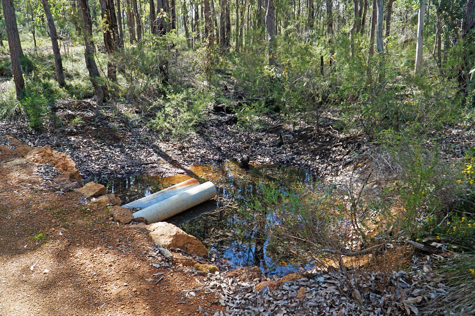
Not long after, the track crosses what Alissa and I guessed was the same creek we had encountered earlier, just a bit more upstream. Alissa and I were interested to know where exactly the spring was in all this; was it closer to the first crossing we encountered, or was it upstream from this crossing?

Reaching a trail junction, we were impressed to see that the sign makers not only included directional arrows but kilometre information as well. At this point, walkers who have bitten off more than they can chew or have run out of time can switch to the Robin Ramble and cut a few kilometres off their walk.

Alissa and I were of course here to experience the longest trail, so stuck to the yellow markers as we entered a more open stretch filled with Grass Trees.

The forest increased in height and density again as we continued along, with the boot cleaning station heralding the start of the highest concentration of boot cleaning stations I've ever seen, on the trail with the most boot cleaning stations I've ever seen!

Having spent so long on vehicle tracks, it was a pleasant surprise to see a marker pointing us onto a some lovely, narrow single file walking track for a change of pace!

Perhaps due to the narrow nature of the track, we very quickly encountered yet another boot cleaning station.


A few hundred metres later, Alissa and I were at yet another boot cleaning station which seemed almost comically close. They are clearly very serious about the Dieback issues in the park, and as seemingly over the top as this is, it is probably what was required for this to limit the environmental impact of human traffic. One has to wonder how many other parks really should have this level of cleaning stations along them.

As we continued along the single file walking track, it became clear to Alissa and I that we were actually walking on what was once a vehicle track that had grown back into a walk trail. With so much of the Bibbulmun Track on old vehicle tracks, it would be great if there was some kind of walker ethic to stick to one side of the vehicle track so the other side can become intentionally overgrown and be given back to nature.


While Alissa and I started at Albany Hwy given it was a convenient location we knew well enough, there is a second car park and trailhead reached from Admiral Rd. This entrance is clearly right on the edge of areas at severe risk of Dieback as unlike the Albany Hwy entrance there is a boot cleaning station right at the trailhead.

From the Admiral Rd trailhead, the collection of markers are so colourful and plentiful it looks like your about to collect some properties in Monopoly. With the Cockatoo Circuit (black) and Spinebill Stroll (blue) exclusive to the Admiral Rd entrance, Alissa and I turned right at the junction above for the home stretch back to the car.

Not long after the junction, Alissa and I reached our final boot cleaning station for the day as the track enters a section that is currently Dieback free.

You can immediately see how much is at stake here; with tall, mature trees crossing the track it really is one of the better parts of the walk and would be far less impressive if Dieback took a hold.

Along this stretch of the walk, the trail also passes by an interesting sight - an impressive looking high ropes course! Without any known ropes course in the area, it took a bit of a Google search to work out what this was, and I would later discover that this is part of Southern Hills Christian College which hires out the space as Camp Withnell to other school and church groups.

Leaving the school fenceline behind, the forest transitions to more open heath. An informative sign here highlights the three threats of Phytophthora (Dieback), Fire (here interestingly spelling out uncontrolled burns as being the main problem rather than using the more modern accountability-dodging prescribed/non-prescribed dichotomy) and Ferals (which is defined here as feral animals, but could just as easily apply to those who don't look after the area and ignore the boot cleaning stations).

While the forest was fairly scant through this section, the wildflowers went some way in making up for it.

Before long, Alissa and I were back at the trailhead near the start of the walk, with only short stroll back to the car park and the end of our first walk for the day.

Generally speaking, I prefer walks that have a lot of geographical interest along the way, whether from a river or a creek, rugged boulders or peaks or slot canyons, and it takes a lot for a relatively featureless forest walk to really impress me. While the Honeyeater Hike has many of the pitfalls of these kind of loops through the forest where the scenery doesn't change greatly and isn't a walk filled with 'wow' moments, I was actually quite surprised by this trail and enjoyed it for what it was.
I feel like the City of Armadale really need to be commended for doing something with this area and for stepping the game up when it comes to the quality of signage on a local trail in the Perth Hills, and for being serious about stopping the spread of Dieback. Hopefully other users will take note and do the right thing, as the park is currently a great place for wildflower spotting. While I don't think it will be making any 'Top 10 Hikes in Perth' list anytime soon, those looking for a relatively easy wildflower-filled stroll through bushland that is conveniently close to the city will probably find a lot to like about the Honeyeater Hike in springtime, and it is well worth checking out at least once.


0 comments:
Post a Comment