

An excellent unmarked route in the Darling Scarp, the Wooroloo Brook Walk explores one of the beautiful tributaries of the Swan River. Starting in Gidgegannup bushland, the walk follows old vehicle tracks and off track sections through open Wandoo forest and granite formations to create a stunning and relatively easy to follow route. Featuring waterfalls, creek crossings and stunning views, this is a great introductory off track walk
Distance: 14 km (loop)
Gradient: Alternates between relatively easy, gentle gradients and section of very steep difficult terrain, with some scrambling required
Quality of Path: Ranges from well formed vehicle tracks, informal bush pads and completely off-track sections with no obvious path. Several parts of this walk are unmarked and map reading skills are essential. The rocky scrambles would be very slippery after rain - extra caution must be taken.
Quality of Signage: Non-existent; this walk is an unmarked route and map reading skills are essential. Route information is available from Walk GPS.
Experience Required: Previous Bushwalking Experience Required. This is a navigationally difficult walk that is highly unsuitable for all but experienced hikers who are comfortable with off-track navigation.
Time: 6-8 Hours
Steps: Many informal steps, plus some scrambling required
Best Time to Visit: Late Winter/Mid Spring
Entry Fee: No, however access to the GPS file requires a subscription to Walk GPS.
Entry Fee: No, however access to the GPS file requires a subscription to Walk GPS.
Getting There: The trail starts from a car park on O'Brien Rd. Follow O'Brien Rd north from Toodjay Rd. The trail starts after a major U bend in the road, with the car park just before the bridge over Wooroloo Brook

While non-hikers tend to say there is nothing like a Perth Summer, hikers know that the Perth Hills are at their best through Winter and Spring when the creeks are flowing and the wildflowers are blooming. To celebrate a wet start to Winter, I felt like Alissa and I should aim to tackle an exciting and substantial walk in the Perth area after being emboldened by our recent attempt at the Four Ways to Z Bend Loop in Kalbarri National Park. Having already written up almost all of Perth's best walks of substantial length and quality, it was time for us to return to Walk GPS - the well known Perth Bushwalking website featuring a number of longer walks that often feature a component of off-track walking and generally require the aid of a GPS to complete. With our friend Louise joining us for the journey, the three of us headed out to Gidgegannup to tackle the Wooroloo Brook Walk.

Alissa and I had tackled Walk GPS's Wungong Gorge Walk the previous year after it was promoted by the City of Armadale as the 'Mini-Bibb', and found it to be an enjoyable walk that deserved to be turned into an official trail. The only problem was that we found Google Earth to be less than ideal as a GPS navigator, and had a few teething problems on our first trip out. While living in Queensland I was recommend ViewRanger, a mobile app that has a cool augmented reality feature known as Skyview that uses the phone's camera to put markers and routes into real space. This is basically like Pokemon Go for adults, and we decided to use this walk to test out this app's efficacy.
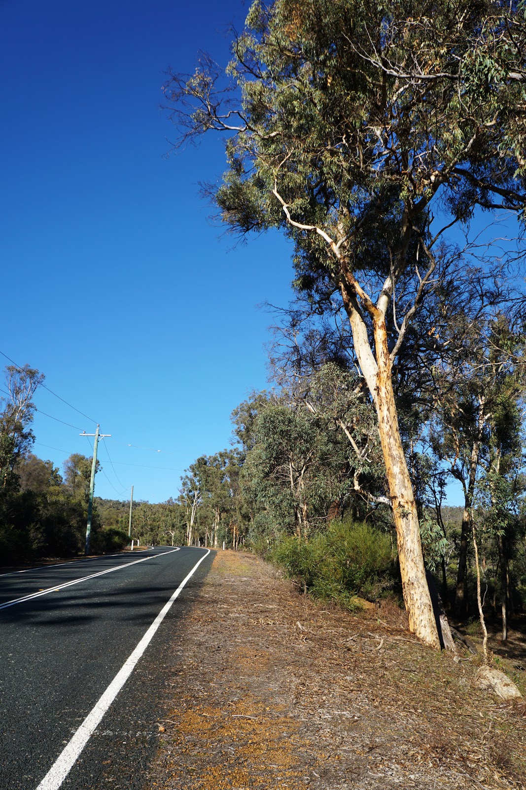
From the car park at O'Brien Rd, the trail runs through some lovely Wandoo bushland before heading along the road for a short distance.

This road bash section was only short, and before long Alissa, Lou and I were making our way through the open Wandoo woodlands to our next waypoint.

The app dutifully brought the three of us to a granite outcrop near a gauging station along the brook. Dave from Walk GPS has an obvious love for granite outcrops, and this was the first of numerous off track sections that were clearly chosen due to the fact they bring walkers to rugged scenery.

From the gauging station, the three of us followed an old vehicle track for a few kilometres. With most of the walk being on track, we didn't have to worry quite as much about navigation as some of Walk GPS's more consistently off-track walks and we could relax until we reached a confusing junction or the next off track section. This makes the walk an excellent option for walkers new to off-track walking or who prefer the comfort of a trail, and is often used by the Perth Bushwalkers Club as an introductory walk for this reason.

Following the vehicle track uphill, the walk passes the foundations of what looks like an old house. The area appears to be used as an illegal campground based on the number of fire rings built around the area, and there is also what looks like an abandoned truck fuel tank at the site. From here the track disappears as the walk enters one of its longer off-track stretches.

Predictably, the route passes by a granite outcrop before heading uphill through Wandoo Woodlands.

Wandoo is one of my favourite Eucalypts, and it features a more predictably open understorey than Jarrah. This makes it perfect for off-track bushwalking given the overall scratchiness of Australian heath. A particularly striking tree along this stretch was a dead Wandoo with an extremely golden appearance.

As it continued uphill, the route veered to the edge of the hills, providing lovely views down towards the Wooroloo Brook valley below.

With ViewRanger ably pointing us uphill towards our next markers, Alissa, Lou and I emerged from the forest and onto a vehicle track on the crest of the ridge. This would basically provide us with a continuous trail for several kilometres until we reached the first crossing of Wooroloo Brook.

The vehicle track heads north and then west, and features excellent views down towards the Swan Valley. After skirting the edge of the ridge, the vehicle track descends steeply to rejoin Wooroloo Brook.

While single file walking track is preferable to walking on vehicle tracks, the scenery of Wandoo woodlands in the sunny glow of a clear Winter's day made this a delightful stretch to walk. It also helped that it was basically all downhill all the way to the creek crossing.

Just before the creek crossing, the walk runs up a rugged side gorge of granite cascades that features a waterfall after heavy rains.

Although we had had some heavy rains over the previous week, it was obviously not enough to get the waterfall flowing properly. What we encountered was a gentle trickle down the rocks but I can imagine it being spectacular towards the end of Winter. Given the dearth of waterfall walks in Western Australia, it is almost unbelievable that this area is completely lacking in formed, managed walk trails.


Climbing to the top, the three of us stopped at the head of the falls. With little to actually look at waterfall-wise, we began the return journey downhill.

While the waters may not have been flowing as much as hoped, the view from this side gorge was well worth the climb as it provided excellent views downhill.

Back at the start/end of the side trail, Alissa, Lou and I continued on as we reached our first of three creek crossings. While the water was moving relatively swiftly, it was at least very shallow and thus quite safe and easy to cross. Given that the waterfall wasn't flowing, we all agreed that it was probably for the best given the multiple crossings as it would be much harder later in the year.

On the other side of Wooroloo Brook, the route continues by following vehicle tracks. This once again made for easy walking, as we simply had to following the road until we reached a T-junction and then turn left.

The next creek crossing is probably the track's most dangerous as the water flows over a smooth granite slab to a small waterfall right at the crossing itself. Alissa tested out the falls first and found that it was pretty slippery with nothing to dig into.

The next creek crossing is probably the track's most dangerous as the water flows over a smooth granite slab to a small waterfall right at the crossing itself. Alissa tested out the falls first and found that it was pretty slippery with nothing to dig into.

Exploring just to the left of the crossing, we found an easier section of the river to head across with heaps of small pebbles in the creek bed to sink into. While slightly deeper, this was a far safer place to cross than just over the top of a waterfall where there is little room for error.

Across the creek once again, the vehicle track takes walkers into Walyunga National Park. Regular bushwalkers in Perth will be familiar with Walyunga National Park as it is home to the Echidna Trail and an exciting part of the Avon River, however this part of the park is separated from the more visited areas by the river and the railway line that cuts the park in half.

The vehicle track basically runs alongside Wooroloo Brook before crossing over one more time. At this point the river was flowing at its fastest yet, however it was only about shin deep so was easy enough to traverse. This was our last creek crossing, with the rest of the walk being to a dry boot standard.

From the creek crossing, the track rises steeply to head along the top of the ridge. Considering we were right at the bottom of the valley, this was major increase in elevation (by Darling Scarp standards at least!) which was rewarded by some great views. In the distance we could see the side gorge we had explored earlier, which showed just how far we had come.

The track keep going up until it reaches a left turn. Looking at the map, it seemed weird that the route would head left instead of continuing straight as it is actually a shortcut. Having noticed how Dave from Walk GPS purposely takes the walk off course to see a great view or a granite outcrop, we immediately guessed that there must be some great views in store for us.

True enough, the track provides views down towards the popular part of Walyunga National Park, with Syd's Rapids, the railway line and the Avon Valley beyond being visible.

Meeting up with the track we had left earlier, the route follows pretty flat and easy vehicle tracks before heading off track.

With the route being largely on vehicle tracks, this was the first time in a long time that I had to pull out the Skyline augmented reality section of the ViewRanger app. The app made this section a real joy to walk as we didn't have to worry about missing a turn or walking too far. ViewRanger makes it really easy, and I was happy to declare this app a success.

Back onto another vehicle track, I realised that the app had seriously chewed through my battery and I now only had 18% battery and we still had a fair distance left to cover! From here on we would have to avoid the Skyline app as while I did bring a power pack I stupidly forgot to grab a USB cable for it!

This led to less clarity in our navigation, and we wandered slightly of course before finding our way back on track as it followed the bank of a dry creek.

With a vehicle track nearby, it seemed strange that the route didn't just follow the road. That was until we say a granite outcrop near the creek and it became pretty clear that we were taken here just to see it. Given how this area is quite off the beaten track, it really goes to show just how much work Dave has done to find these interesting spots as there must have been heaps of these off track excursions that yielded nothing worth exploring.

From the outcrop, a pad has formed heading uphill. Along this ascent, the three of us could see tall granite boulders to the right of the track, and we were convinced that the track would head there since it actually takes a small side trip after rejoining another vehicle track.

Disappointingly, the route did not explore the granite boulders and instead went to another granite outcrop with views across the valley. This was nice enough, however it was very similar to the views from the vehicle track after the last creek crossing which rendered this side trip a bit superfluous.

Back from the side trip, it was a simple matter of following vehicle tracks almost all the way to the car - but not before taking one final off track side trip to - you guessed - another granite outcrop!

While we joked about the predictability of the route going off track for another outcrop, this was actually one of the best on the walk as it provided lovely views and was a fitting end to the off track walking.

From there, we followed the vehicle tracks and just had to pay attention to all the correct turns. Just before reaching Wooroloo Brook, the walk leaves the vehicle track to run along the bitumen. From here, the track crosses Wooroloo Brook on the O'Brien Road bridge with the car park on the other side of the brook.

Having finished the Bibbulmun and Cape to Cape Tracks last year and having tackled most of Perth's day walks, I had been worried that Alissa and I had basically done everything worth writing up in Perth. The Wooroloo Brook Walk definitely proved that there is so much more to see in the Perth region - it is just the supply of trails to these places that is missing. Exploring the charismatic Wandoo Woodlands, passing a waterfall and offering an element of adventure in the creek crossings, this is exactly the kind of trail that I always wished Perth had. While I would prefer it was a marked track so I could be on autopilot in terms of navigation and repeatability, ViewRanger was a great tool that made this almost as easy to follow. This is an excellent walk that has reinvigorated my enthusiasm for bushwalking in the Perth region, so expect more Walk GPS write ups in the near future.


Wooroloo Brook Walk GPS Route (Darling Range) is a great outdoor adventure, but if you're looking for entertainment after your hike, Netflix MOD APK lets you stream unlimited shows offline. Perfect for unwinding after exploring nature!
ReplyDelete