

A short forest stroll in Korung National Park, the Carmel Walk follows a figure eight through a parcel of burnt Jarrah forest. Starting at Morton Rd, the trail loops through the charred trees over its first loop before passing a cherry blossom orchard and into the nicer second loop. Returning to the orchard, the trail passes by a section that is home to cockatoos. An uneventful walk that is not one of the Shire of Kalamunda's best
Distance: 5.1 km (figure 8 loop)
Gradient: Very gentle and mostly flat with some minor ascents and descents
Quality of Path: Mostly clear and well maintained unsealed vehicle tracks and single file walk track, as well as a section along road
Quality of Signage: Generally well signed, however there are a few junctions with missing signage that are very confusing and there is no trailhead. To avoid confusion, the Shire of Kalamunda's route description, map and/or KML file are essential.
Experience Required: Some Previous Bushwalking Experience Required, more so if not using the KML file
Time: 1-1.5 hours
Steps: No formal steps
Best Time to Visit: Autumn-Spring
Best Time to Visit: Autumn-Spring
Entry Fee: No
Getting There: The trail starts at the corner of Morton and Anembo Rd. From Tonkin Hwy, head east on Welshpool Rd East. At the end of Welshpool Rd, turn right onto Canning Rd then turn left onto Glenisla Rd. Take the next sealed road to the right onto Union Rd then the third right onto Morton Rd. Car park is at the corner of Morton and Anembo, with the trail starting just south-west of the intersection
After over a month since our last walk in the Perth area, Alissa and I headed out to tick another of the Shire of Kalamunda walk trails off our list. Having completed most of the walks over the last few years, the walks left are really becoming slim pickings, but on the recommendation of Mark from the Life of Py and his glowing review, I chose the Carmel Walk for our morning hike.

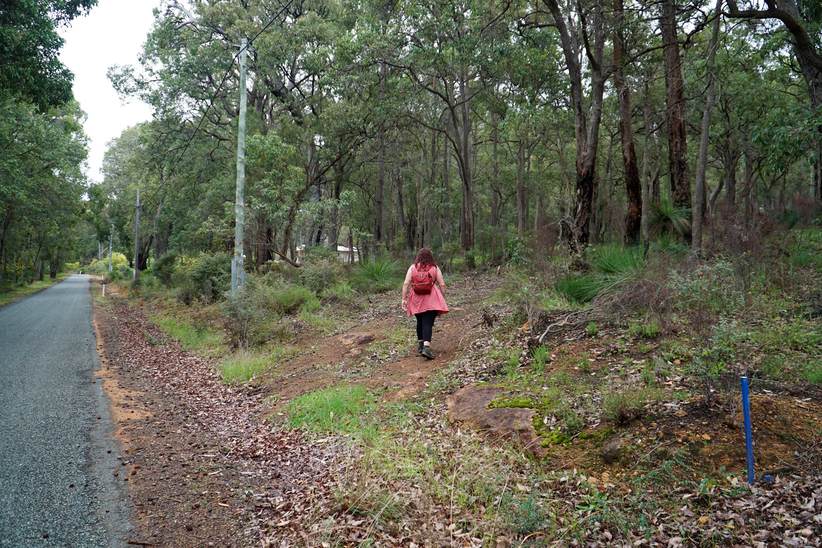
Starting from the car park on Morton Rd, the trail heads into typical Korung National Park forest - which is to say, predominantly scrappy regrowth Jarrah. This is far from my favourite type of forest, and it was made worse by the fact the area clearly showed the unsightly signs of having recently been the recipient of a prescribed burn.

300 metres into the charred forest, the trail markers point right to begin the first loop of the trail's unconventional shape, being a figure eight trail with a return leg at the start and in the middle of the two loops.

While it would have been impossible to even go one second through this forest without seeing flame-kissed Jarrah bark, the understorey of grass trees was at least a reasonable distraction and point of interest in the highly compromised landscape.

While I tried to remain positive, I have always found it laughable that Korung is somehow a National Park when other places like Monadnocks and Coalseam are merely Conservation Parks, and other places like the spectacular forest near North Dandalup Dam are merely known as 'State Forest 14'. Unless you're a budding pyromaniac, there is nothing particularly special here to warrant national park status, and I messaged Mark as we walked since I thought his recommendation must have all been a setup given my dislike for the bleakness of fuel load reduced forest.

Continuing along the trail, the charcoal scenery continued. Mark responded that I should have woken up earlier to experience the morning mist as he did when he visited the park two months earlier. While his photos certainly look more striking as a result, given the Fundamental Rule of Tourist Start Time (that they don't start their day until 10 am), most people walking through the area would miss out on the mist due to their late start, and would merely have blackened trunks to admire.

Having once been home to several unsanctioned mountain bike trails (and still popular with cyclists based on our experience), the park is a byzantine network of trails that vary wildly in type from unsealed vehicle tracks to single file walk trail to rougher goat tracks. The one good thing about the Mirkwoodesque horror that we were walking through is that markers stand out against the dark background.

To add to the apocalyptic scenery, the iconic burnt out rusted car garden feature that is common to trails in the Perth Hills makes for an iconic landmark on the first loop of the walk.

Just before leaving the first loop, a more open canopy provides a memorable change of pace in the deflagrated forest.

Passing a fallen tree which likely had its roots cooked by the fire, Alissa and I saw a rural property through the sooty landscape, which marked our departure from the trail's first loop.
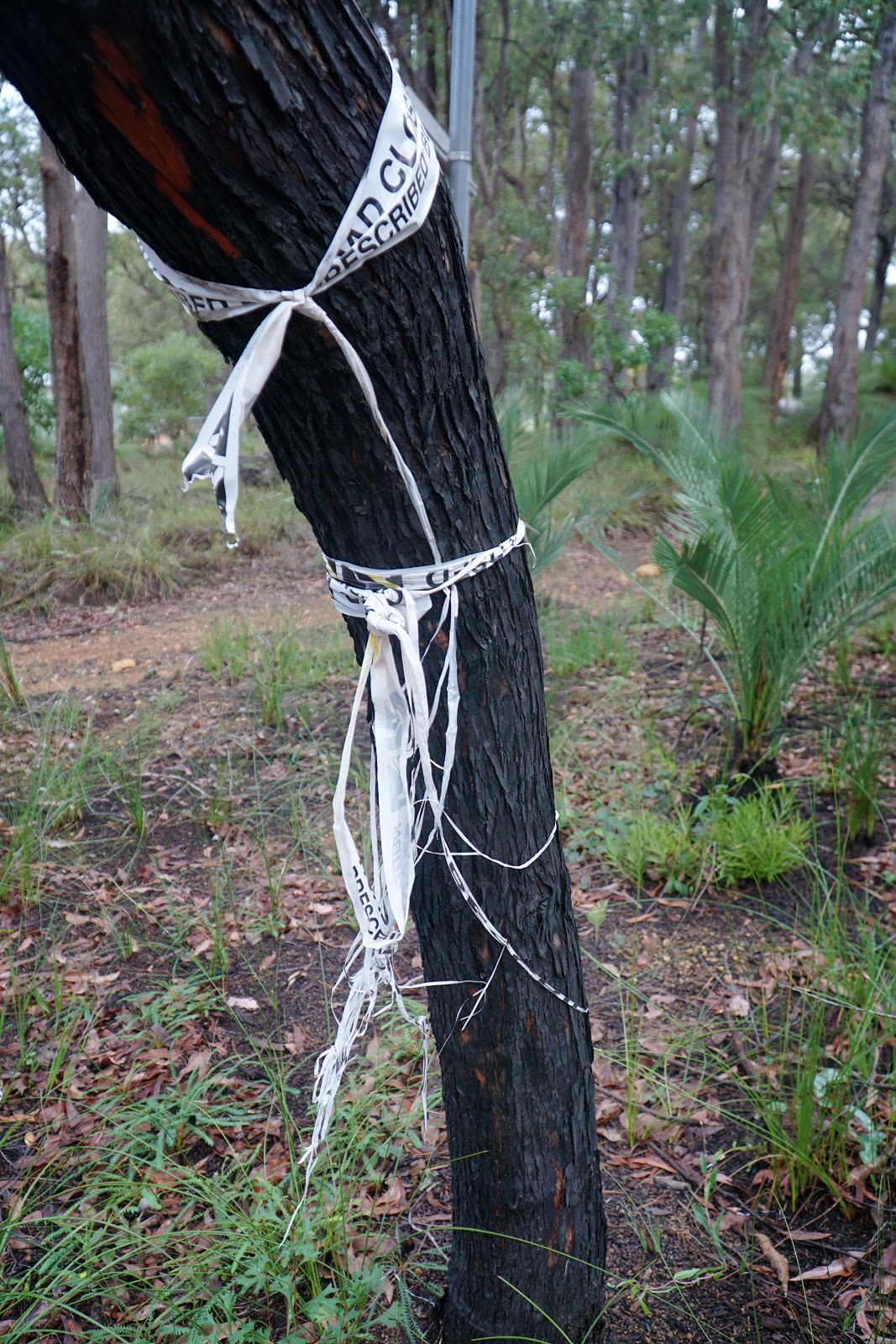
Just before reaching the farm, Alissa and I passed the remains of tape tied to a tree indicating that the trail had been closed due to the anti-beautification project that DBCA had dutifully prescribed to the area.

Walking along the edge of the orchard, the road provided something of a respite from the unrelenting post-incineration scenery.

That start of the second loop was marked by a significant increase in scenery quality, with the trees through this section being only mildly singed in comparison to heavily ravaged appearance of the first loop.

Through the lightly torched trunks of scrappy Jarrah, the vision of pink cherry blossoms in the orchard were a lovely contrast against the mix of grey, khaki and onyx that had predominated most of the walk.

It was a delight to see that some sections of the forest appeared to have escaped DBCA's backyard barbecue, with this particularly gnarly tree appearing to have avoided getting its prescribed dosage of enforced carbonisation.

It would appear that this are had received its flame-grilling earlier and/or less intensely than the first loop as the understory appeared less defoliated and with more obvious signs of recovery.

As we continued along, the forest became more obviously scorched once again as the trail became slightly more confusing due to some sections being less clearly marked. To add to the lack of clarity, we spotted a number of trees flagged with orange tape labelled "KMHT", which is short for 'Kattamordo Heritage Trail', a longer 1988 bicentennial project trail that has long since fallen into disrepair, but also runs concurrently in part with the Mason and Bird Heritage Trail.

While the trail runs concurrently with the Kattamordo in parts, the Carmel Walk does veer off the same route and it is best to remain vigilant at all trail junctions as there are some that are poorly marked. For this reason, it is best to follow the KML file that the Shire of Kalamunda offer on their website and/or read the map and track notes.

A cool feature of this stretch of the post-inferno forest is the remnants of what looks like an old ramp for a mountain bike trail that has since fallen into severe disrepair in spite of the fact it improbably escaped the fate of becoming firewood in this five year cycle.

Along the way, a diamond-shaped marker on a severely toasted trunk revealed that we were definitely on the Kattamordo Heritage Trail. These markers are usually a faded yellow colour and actually were common to both the Kattomordo and the old Bibbulmun Track, as seen between Gregory Brook and Donnelly River Village.

Reaching the perimeter track of this section of Korung National Park, Alissa and I had our Catholic school sense memories activated by a smell that was very similar to the incense that fills thuribles swung dramatically by priests or acolytes at certain mass services. The smell led us to the recently blazed grass trees of the adjacent private property, which also features a dam of blue coloured water just waiting to become Insta-famous like Black Diamond Lake in Collie.

After some confusion about whether we should turn left or right at the perimeter trail, Alissa and I consulted the KML and trip notes, turned right and continued along the trail's second loop.

Further along the fenceline, Alissa and I encountered the true source of the phenolic pungency as a section of the private property was still smouldering.

After genuflecting and accepting our smoke-filled benediction, Alissa and I continued along the trail as we reached a short stretch of road walking along the edge of a private property

While road walking is less enjoyable that walking on single file walk track, the green scenery was again a nice change of pace from the Desolation of Smaug that most of the walking had been up to date.
Keeping an eye out for the markers, Alissa and I turned right to return to another stretch of perimeter vehicle track walking through cremated forest.

A intriguing feature along this stretch of the walk was an odd sign nailed to well seared Jarrah growing in a mallee after its main trunk had been cut down. The sign featured odd symbols, and with Alissa being an aficionado of true crime podcasts, our imagination immediately went to it being the crazed work of a serial killer.

While I've clearly made a point of how enkindled Korung National Park had been at the time of our visit, I have to say that I enjoyed the above stretch of the trail as the mature trees provided some much needed deliverance from the overall scrappiness of much of the area's Jarrah forest.

At the end of the nice stretch of the walk, the trail turns back onto itself as it completes the second loop by passing the orchard and its iconic post boxes.

Passing through some boulders blocking the track from vehicular access, Alissa and I entered a section of forest filled with black cockatoos.

This was one of the highlights of the walk for me; while this is not a forest I particularly like walking through, it is one that provides food and homes for black cockatoos and it is always lovely to see these majestic birds when out on a walk.


After enjoying the bird sightings, Alissa and I continued on the trail as we completed the second loop and made our way back along the return leg back to our parked car.
Regular readers of the Long Way's Better will know that the heavily compromised regrowth Jarrah forest close to Perth is right near the bottom of my favourite kinds of forests to walk through. It should be no surprise that I didn't think the Carmel Walk was a particularly spectacular or special walk, and the lack of any real geographical interest meant it is not one I would rank amongst the Shire of Kalamunda's best trails.
While I'm often frustrated that the visual impact of lowering fuel loads are not often taken into account, I will admit that the close proximity to residential areas means bushfire reduction measures in this area are more of a necessary evil than it is in a stand of forest far away from human habitation. But it does not take away from the fact that this is sub-optimal Jarrah forest from an aesthetic enjoyment perspective, and I think we need to be honest that this is compromised for anthropocentric reasons.
Ultimately, I think your appreciation for this walk will greatly depend on how much the sight of heavily immolated scrappy regrowth forest impacts your enjoyment of a trail. If you can look past the non-pristine nature of the walk, it is a decent enough loop walk for someone who lives nearby and is looking to walk just over 5 kilometres. With far better Shire of Kalamunda trails (particularly Bickley Brook, the area around Rocky Pool and the truly excellent Whistlepipe Gully Walk Trail), I don't think I'll be doing this one again anytime soon unless it undergoes a remarkable Cinderella transformation.


0 comments:
Post a Comment