

A medium length, mostly off-track walk in Wandoo National Park, the Flynn Hills Walk GPS Route explore this seldom visited national park. Starting in open Wandoo woodlands, the trail passes through interesting granite boulders, up and over laterite ridges and through a surprising variety of forest and landscape types. While 96% off-track, this pleasant walk is a great way to test out your navigational skills
Distance: 14 km (loop)
Gradient: Alternates between relatively easy, gentle gradients and section of moderate terrain
Quality of Path: Mostly non-existent; this was is 96% off track. Being predominantly Wandoo, the understorey is mostly fairly open
Quality of Signage: Non-existent. This walk is an unmarked route and map reading skills are essential. Route information is available from Walk GPS.
Experience Required: Previous Bushwalking Experience Required. This is a navigationally difficult walk that is highly unsuitable for all but experienced hikers who are comfortable with off-track navigation.
Time: 4-5 Hours
Steps: Many informal steps
Getting There: The trail starts deep within Wandoo National Park. Head east along Brookton Hwy passing Christmas Tree Well, then turn left onto Yarra Rd. Follow Yarra Rd for 18.8 kilometres and then turn right onto Darkin Rd. At junction, keep left onto Warrigal Rd and follow it for 1.6 kilometres to then turn left onto Roberts Rd. walk starts just near the intersection
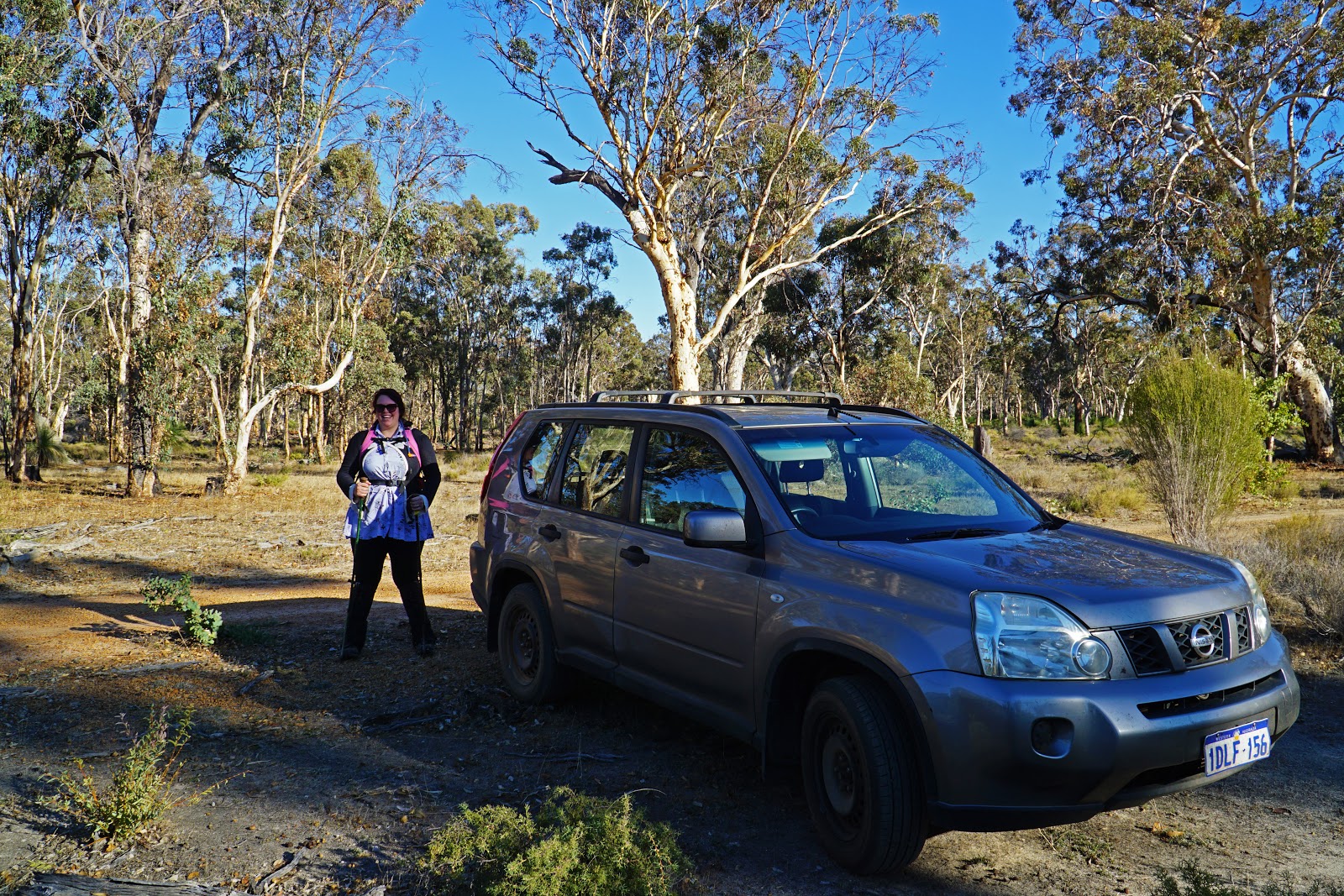
With June having arrived but with the rains still a week away, Alissa and I decided to once again avoid the more waterfall or creek-dominated walks closer to Perth and instead headed out to explore Wandoo National Park. A relatively obscure park featuring a significant stand of old growth Wandoo, our recent adventures in Mokine and Clackline following Walk GPS routes inspired us to tackle the Flynn Hills Walk GPS Route that makes its way through this national park.

Although Alissa and I have tackled a number of these GPS-based walks in the last few years, the Flynn Hills Walk GPS Route featured the least amount of on track walking we'd ever done, with a whopping 96% of the walk being off track! With no vehicle track to follow, we commenced the walk by immediately walking through the open, grassy Wandoo woodlands as we followed the tracker in the ViewRanger app.

Wandoo's more open understory is far more conducive to off-track hiking that the sometimes dense nature of Jarrah and Karri forest, and we were enjoying the pleasant scenery. Early on, we spotted a tree that featured and interesting burn. While we would see a lot of evidence of a recent prescribed burn in the area, this tree was particularly interesting as it looked like it had almost exploded with its branches all around. Eucalypts are capable of exploding during a fire due to the high oil content, but we wondered if the tree had been struck be lightning given that everything else around it looks fine.

Leaving the open Wandoo woodlands behind, the trail heads through some low bushes/mallee before reaching a broad, open grassland section.

Remembering the open understory of the Mokine and Clackline walks, I had decided to not bother with gaitors while Alissa decided to take the precaution. As we walked through the prickly grasses, I immediately regretted my decision, with prickles being caught in my socks and making for a scratchy walk.

Beyond the grass field, the walk joins onto a vehicle track briefly, and the relief from the prickly grass was like manna from heaven for my feet/legs.

Given the 96% off track nature of the walk, the vehicle track walking did not last long, and as the track rounded a corner the GPS route indicated we were to continue straight as we reentered Wandoo woodlands.

At points a surprisingly dense understory made progress slow going as we had to push our way through the bushes. Nevertheless, there was often a relatively obvious way to go where previous hikers had probably created less dense routes over time.

On the other side of the bushes, we returned to more open Wandoo with some particularly magnificent trees on display. The area was also filled with grass trees that looked to have been recently burnt by a prescribed burn.

The burnt forest would be a feature of much of the walk for the rest of the day, however Wandoo does seem to recover a lot more readily than Jarrah, so the walking did not have the bleakness that can be a frustrating feature of Jarrah-dominated walks in the Perth Hills. A number of granite boulders and outcrops along this stretch also helped to give it a lot of interest, and while less impressive than the Granite Wall in Mokine Nature Reserve, it was still fun to walk through the boulders.


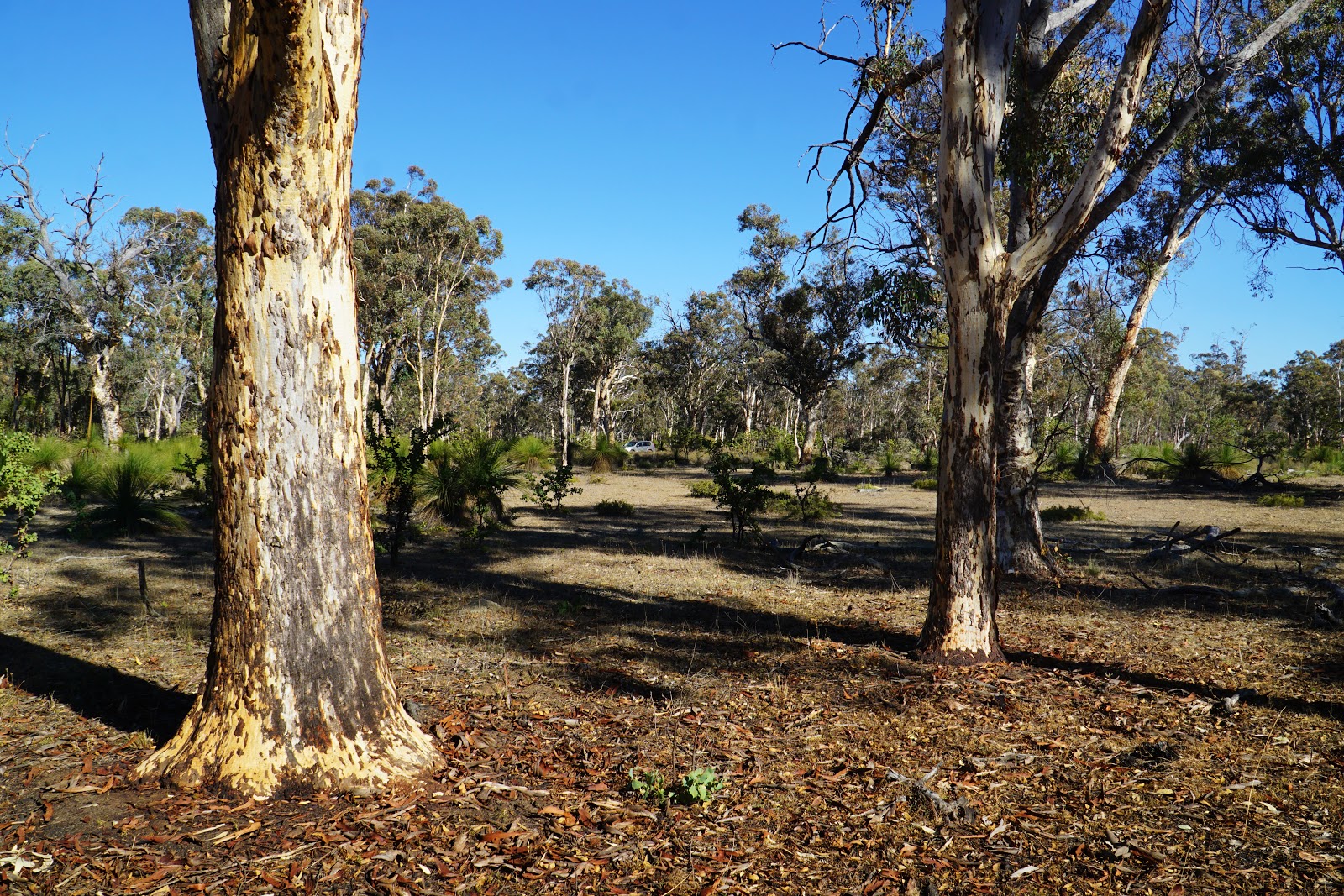
Leaving the boulders behind, the walk heads through an area of Wandoo with a very open understory. This would be the perfect spot for a campsite if this were an area with a multi-day trail, as the flat and open terrain would be absolutely perfect.
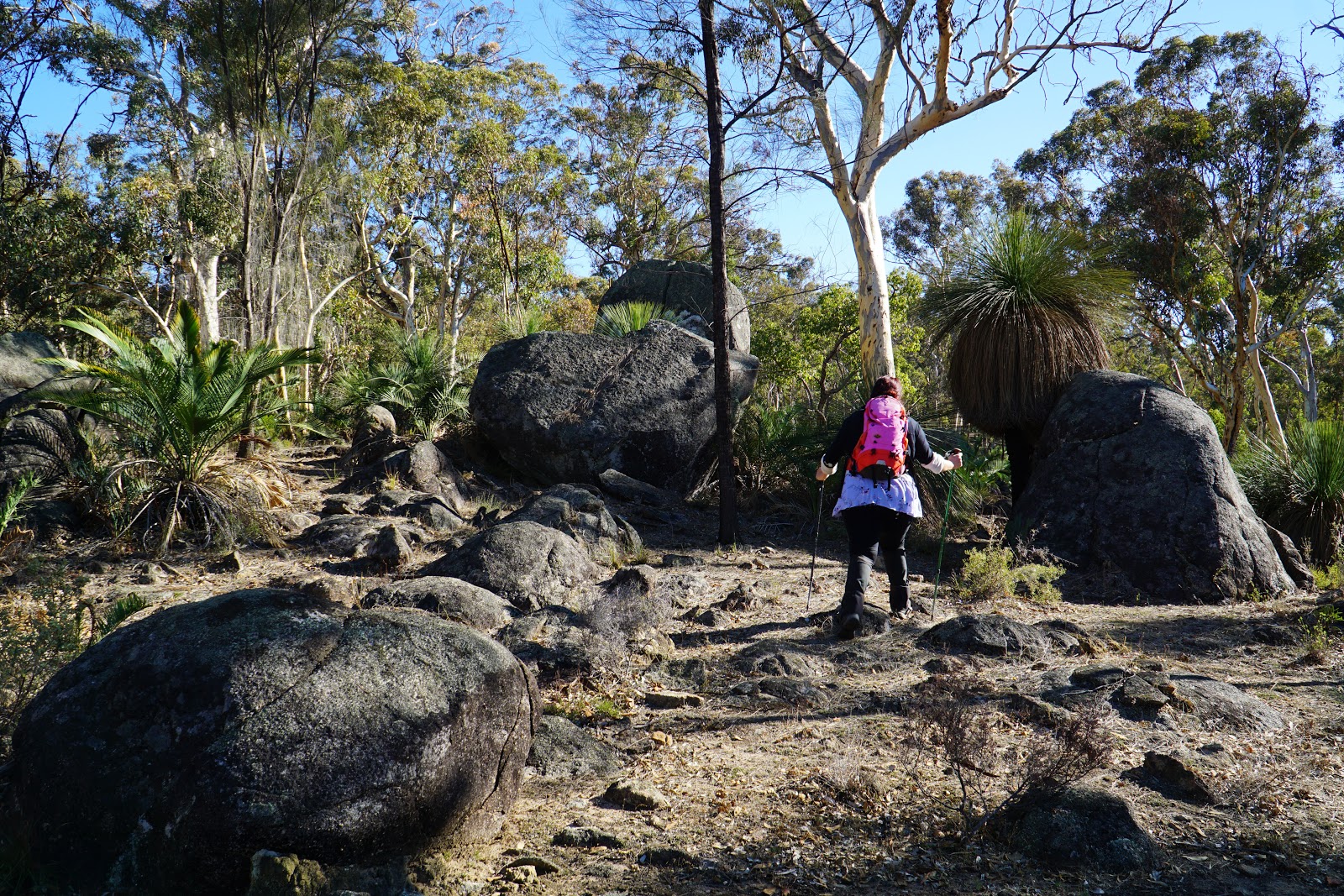
Veering away from the open Wandoo, the trail returns to a section filled with granite boulders for more excellent rugged walking.

Along this stretch, Alissa and I passed two large granite tors that were featured on the Walk GPS website. Being a fan of rocks on walks, this was one of the reasons I chose to do the Flynn Hills Walk in the first place.

Ascending slightly, the trail reaches the edge of a laterite breakaway before descending into the valley below. A fallen log provided a good rest stop for Alissa and I to drink some water before continuing on.

Before we knew it, Alissa and I were rising up the other side of the wandoo-dominated valley as we made our way to the top of another laterite breakaway.

Skirting the edge of the ridge, the route continues along the rim before reach the breakaway's flat top.

While the walk had not been that challenging, the flatness across the top of the breakaway and the open nature of the woodlands made for a nice and easy change of pace, and reminded me of sections of the Mokine Walk GPS Route.

Heading away from the flats of the breakway, the route heads over a large granite slab. While the breakways reminded us of Mokine Nature Reserve, these granite sections brought back happy memories of the Boyagin Rock Walk GPS Route, which was easily one of the best day walks Alissa and I did in 2018.

On the other side of the granite, the route reached one of its low points as it headed through some severely blackened, thin and ugly Jarrah forest. This was a real downer that Alissa and I did not enjoy at all, and it one of the reasons I consider this one of the less spectacular Walk GPS routes we've done.

Transitioning away from the hideous burnt Jarrah, the Wandoo forest we entered was as clear an illustration of why I consider Wandoo a vastly superior forest type to Jarrah. The wandoo in the area had been equally burnt to the Jarrah we encountered earlier, but the smooth barked nature of Wandoo means it sheds its outer later and does not appear as obviously scarred as Jarrah. Given this, I would think that trails through Wandoo should be far more plentiful than they currently are.

Continuing through more Wandoo forest that Alissa referred to as looking like they came out of a Heysen painting, the route joins onto the faint remnants of an old vehicle track for one of the rare 4% of on track walking we would be undertaking.

Leaving the short stretch of vehicle track, Alissa and I ascended another, larger granite formation that again evoked the granite slabs in Boyagin Rock Nature Reserve.

Across the top, the trail passes through some slightly burnt she-oak. The open understory and flat nature made this look like it too would make a great campsite if a multi-day walk was built through this area.

Leaving the she-oak behind, the route once again enters Wandoo-dominated woodlands. This section did however feature an interesting understory with an abundance of Zamia throughout the area. I recently saw some drawings of Albany from when the first European explorers landed there and in the drawings were some very large Zamias. Having seen large ones in Lesueur National Park it really had me wondering how larges these cycads would get if they weren't constantly being burnt by prescribed burns.

Rising up the Zamia-dominated ridge, the Alissa and I followed the GPS tracker through some dry gullies through the Wandoo towards a road crossing.

Excited to see a road, Alissa was disappointed by the fact we were going to cross the road and not head on it for a little while. Alissa pointed out that as I do the navigation, a walk that is this off-track made her feel like she's totally in the dark about where we were going, and she will be navigating a walk in the future so we can have the opposite experiences.

Beyond the road, the walking took a step down in quality as we entered an area of blackened Jarrah. By this stage, the lack of major landmarks was beginning wear on us and the sight of burnt forest didn't do very much for our levels of enthusiasm.

The blackened forest slowly transitioned to a more open area that reminded me a bit of that open stretch on the Bibbulmun Track between Sullivan Rock and Mt Cooke. Surprisingly, a faint trail that appeared to be an overgrown vehicle track that had become a single file walk track can be followed through this section. This made walking a bit faster in an area of fairly dense understory that would have been otherwise very scratchy.

The open section was interesting but ultimately less stunning than the Wandoo. It was a welcome change then to reenter Wandoo with some excellent views along the breakaway.

The walk initially follows the lower side of the breakaway before rising up again and follow the ridgeline until in narrows and descends.

Heading along the slope, Alissa and I passed through a jumble of large granite boulders. Wanting to follow the route precisely so we didn't get lost, I climb up the ridge while Alissa pushed on through the boulders, meeting up with me as I continue along the high ground above.


Walking together again, we ascended a grassy hillside before turning left. We now had less than a kilometre to go to reach the car and finish the 14 kilometre circuit.
Having done a few Walk GPS routes now, Alissa and I had to admit that the Flynn Hills Walk would be ranked near the bottom when compared to the near perfect Mokine and Boyagin Rock Walks, and the best moments along the North Dandalup Walk. Nevertheless, we agreed that you have to put this into perspective; sure, it was not as good as either of those, but the scenery was better than the vast majority of the Shire of Kalamunda walks and even some of the vehicle track-dominated walks seen in Perth's nationals parks. While the burnt Jarrah and the lack of major geological features brought it down, the Wandoo on display was really quite lovely and made for relatively easy off-track walking. I can't say I'd be rushing to do this one again, but it was a worthwhile and pleasant experience all things considered.


0 comments:
Post a Comment