

Day 2 of the Frenchmans Cap Track, this exceptional section of the track takes walkers from Lake Vera to Lake Tahune Hut. A steep, continuous climb, the track passes through some of the most beautiful rainforest along Lake Vera Creek before reaching the outstanding mountain views from Barron Pass. Heading across the ridge, the track ends at Lake Tahune Hut - the hut with the most spectacular view in the country
Distance: 4.5 km
Gradient: Steep, almost relentless climbing leading to Barron Pass with some undulating sections in between. Undulating from Barron Pass to Lake Tahune with some steep sections
Quality of Path: Clear and well maintained, however much of the rainforest sections are a tangle of roots and log ladders. Walking along the ridge top is mostly on rock with some mild scrambling required
Quality of Signage: Largely well signed, with some markers along the way and little to no track junctions
Experience Required: Previous Bushwalking Experience Required; this is not an easy walk and it is best that potential walkers gain experience on easier trails in Tasmania before tackling the Frenchmans Cap Track
Time: 4-5 Hours
Steps: Many steps, both formal and informal
Best Time to Visit: Summer
Entry Fee: Yes. National Park Fees apply
Getting There: No direct access to this section. Access to the start of the walk is via Lyell Hwy (A10). From Hobart, follow the A10 through Derwent Bridge. The car park is a further 29.1 kilometres west along the highwayEntry Fee: Yes. National Park Fees apply

Alissa and I have had mixed experiences with sleep on the track, with the kerfuffle regarding a certain Angry German Man on the Overland being the absolute nadir of our hut and campsite sleeping experiences. Sleeping in our tent at Lake Vera was glorious however; while inevitably slightly broken, it was one of the best nights of sleep we've had on a trail, and we were both glad to have chosen to sleep in our tent over the hut. While packing up a tent that was slightly wet from overnight drizzle is always a minor hindrance when trying to pack up as fast as possible, Alissa and I were the first group packed and ready to tackle the steep 360 metre ascent to Barron Pass.

The track runs alongside a section of Vera Creek that drains Lake Vera. An old wooden sign indicates a short side trail to a jetty overlooking the waters. This is a decent entry point for those looking to have a dip on a hot day, and we would find the jetty to be much more popular with walkers on our return from Lake Tahune.

A simple wooden bridge crosses the creek a short distance from the jetty as the trail enter a somewhat wet area along the banks of Lake Vera.

This wet area is the beginning of a transition to the dense, lush rainforests that dominate much of this day of walking. Along this stretch are a number of campsites that are much rougher and far less inviting than the wooden tent platforms closer to the hut. These campsites look to be a bit on the damp side, and I can imagine it being the kind of area that is popular with leeches.

From the campsites, the track continues along the banks of Lake Vera. The vegetation is largely dense and views are generally limited to mere glimpses, however occasional breaks in the forest allowed Alissa and I the opportunity to appreciate the idyllic beauty of the area.

The track begins to rise slightly as it enters an area of significant undulation before the start of the long, continuous ascent. Even at this early stage, the lush rainforest along the track was staggeringly beautiful, and it would only get better the further we went.

Initially, we thought this might be the start of the climb, however we were surprised to find the track descend steeply at points that required mild scrambling or butt sliding.

This area also marked the appearance of the famous Frenchmans Cap ladders. Ingeniously carved wooden logs in a variety of styles and applications, these are an iconic part of the track's character and a constant companion for most of the way to Lake Tahune. Apparently metal ladders were installed along the track in the early 1990s, however these have all since been removed with the wooden ladder reigning supreme along this steep mountain climb.


While most of the ladders along the climb are more like a series of steps that true ladders, there are genuine ladders to climb up and down along the way.

The walk gets really exciting once it reaches the section of Vera Creek that feeds Lake Vera and begins to follow it upstream. While it only follows the creek for about a kilometre, it is one of the most memorable aspects of the day's walking.

This stretch of Vera Creek is basically a series of waterfalls and cascades, and while none of the waterfalls are very large, the fact the creek is a constant companion marks this as outstandingly beautiful rainforest walking.

It helps that the walking is so gorgeous as the walking here became very steep, with the tangle of roots making progress slower than it would be on a similar incline through sclerophyll forest.

Alissa does not love a steep incline, however she found herself constantly engaged by the incredibly lush forests that surrounded us. As a result, she didn't mind the challenge of the ascent as any difficulty experience was amply rewarded by some of the best forest walking either of us have ever done anywhere in Australia.

The track crosses Vera Creek once more before veering slightly northwards away from the creek.

To the left of the track is a small waterfall flowing into a small mossy pool. This is a fitting finale to a great kilometre of walking following Vera Creek.
From Vera Creek, the track initial ascends slowly before the start of a steep and almost relentless climb to Barron Pass. Along the more gentle section, Alissa and I encountered a section of rock that appeared superficially to be cave-like calcium formations. Suspicious given that these kinds of formations tend to form in porous limestone not quartzite, this didn't seem right to me and I was proven correct when Alissa touched part of the formations only to find it was a wet and spongy growth that we assumed to be either some kind of fungus or moss.

Speaking of fungus, there were a number of beautiful mushrooms along the ascent including the vibrant red examples pictured above. While less diverse than the incredible variety of mushrooms Alissa and I had seen along the Lady Barron Falls Circuit in Mount Field, these were a lovely finer details of the day's walking.

John Chapman's smoothed out ascent simply shows the track continuously climbing from Lake Vera, and it does not provide any sense of how some sections might level out slightly and how steep the really steep sections are. With no real sense of how far we had travelled, I decided to push ahead at a steep and rocky part of the track as I felt like we might finally be reaching Barron Pass.

Emerging out from the forest, I was pleased to have my first glimpses of the quartzite peaks that surround Frenchmans Cap. Through the clearing I could see Sharlands Peak proudly reaching to the heavens. While made from much harder rock, the white appearance of the mountain made it appear superficially similar in appearance to some of the more jagged sections of the limestone karst landscape in Phong Nha-Ke Bang National Park in Vietnam.
While waiting for Alissa to catch up, the group of five we had met the previous day on a Scouts mission caught up to us. Initially, I thought that they would be powering far ahead, however they paused to deal with a slight problem - one of the two Scouts was hating the steep ascent and had said he would rather do anything than take one more step up the mountain. While they were deliberating what to do, Alissa and I decided to press on.

From the opening in the forest, the track levels out somewhat and I thought that maybe we were really close to Barron Pass.

How wrong I was. The steepest and most unrelenting section of the track was now before us with every rounding of a corner greeted with the view of even more steps and/or log ladders ascending. By this stage Alissa was getting pretty tired from all the climbing, and we let the scout group overtake us after they had made the decision to press on while the young scout returned to Lake Vera Hut for the night.

Seeing that I was keen to push on, Alissa told me to go ahead. After all the seemingly endless climbing, I was ecstatic to see the final log steps finally leading to Barron Pass.

The view from Barron Pass is one those great Tasmanian mountain vistas that fills you with the same awe that drove Gustav Weindorfer to declare upon climbing Cradle Mountain that "This must be a national park for the people for all time. It is magnificent, and people must know about it and enjoy it." This is magnificent country, and we were incredibly fortunate to have largely clear views of the landscape, with Lakes Gertrude and Cecily below and the proud peak of Frenchmans Cap emerging from behind a wisp of cloud.

Having had a moment to take it all in, I was joined by Alissa who was understandably elated to finally see the end of all the relentless climbing to be rewarded by the incredible views.

On either side of Barron Pass are two steep mountains that appear as sentinels guarding the mountain pass. To the north, the taller mountain is Sharlands Peak, while the small but prominent lower peak in known as Nicoles Needle.

South of the pass is White Needle and Philps Peak. While it is possible to climb both peaks, the climbing is considerably more dangerous than the marked track due to airy exposure. A duo of male hikers returning from Lake Tahune met us at the pass and were considering climbing White Needle but decided that if notoriously hardcore John Chapman is referring to it as 'airy' it was probably riskier than they were prepare to undertake.

Stopping for a quick snack break, the duo of female hikers we had met on the first day had caught up to us and had pressed on ahead of us. Having only day packs due to their decision to make the journey to Frenchmans a return trip to Lake Vera, they had the speed and agility to tackle the challenging terrain far better than Alissa or I. Soon we were overtaken by the scout group as well, which had me slightly disappointed at our lack of speed as I had wanted to stake our claim of bunks at Lake Tahune in the main space so that we could be away from the others in the bunk room due to my snoring and Alissa's paranoia about a repeat of the Angry German Man encounter.

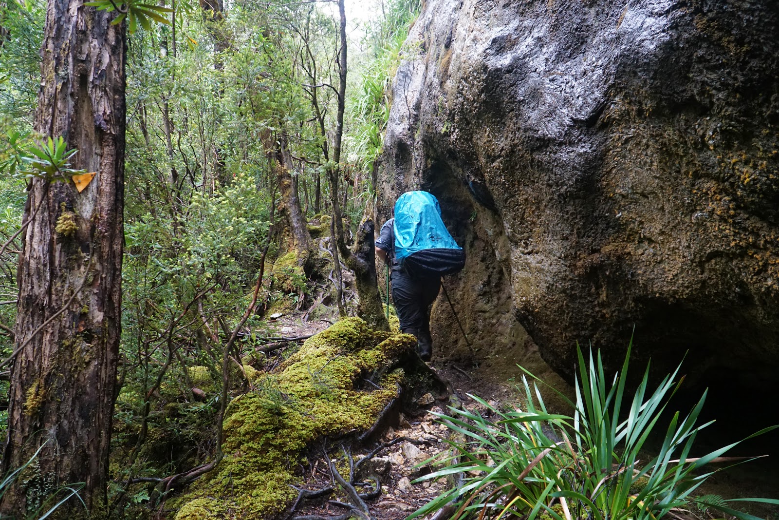
Initially descending into a small pocket of rainforest, the track continues into rugged, rocky territory and goes past a small cave. While lacking the grandeur of the nearby Daverns Cavern (a cave that can be visited off-track), this small cave/overhang has undoubtedly provided shelter to walkers who have been caught out by the notoriously fickle weather of the Tasmanian South West.

For a rock hopper such as myself, the next stretch of the track was a real treat as it passes through a field of boulders from a previous landslide. The way the track follows the mountain ridge provides a lovely circuitous route to Frenchmans that is actually relatively gentle for a good stretch.

This was a nice respite from the steepness up until Barron Pass and gave us the opportunity to take in the beauty of this alpine landscape.


Making our way along the ridge, the number of dead King Billy Pines along the track stood as a stark reminder of how damaging a fire can be to the alpine vegetation. These trees were burnt by a bushfire in the 1960s and in a lot of ways the pines never truly recovered in this area, with only a few smaller examples visible along the track and at Lake Tahune.

Looking back at Barron Pass, the view of Sharlands Peak, the needles and Philps Peak provided a stunningly rugged mountain view, with the white quartzite having a very different appearance to the more columnar and rubble-like appearance of the dolerite more common on the Overland Track and Walls of Jerusalem.

As the ridge approaches the Artichoke Valley, Alissa and I could see the two groups of hikers who had overtaken us from Barron Pass stopping to take in the views and have a bite to eat. Realising that the opportunity to get to Lake Tahune first had arisen, we picked up pace and continued on our way to the hut.

From the lookout point, the track descends a series of rocky scrambles as it follows the ridge line along an initially downward trend.

This descent is short lived and we were greeted by a return to some steep stair climbing through the dense vegetation.

While initially follow more natural looking stone steps, the topmost part of the ascent looks to have been recently upgraded with much more even wooden stairs. With Alissa struggling to keep up with my cracking pace, we agreed that I would press on to the hut without her given that the larger group behind us would give her something of a safety net should something go awry.

Up from the stairs, the track levels out again and provides outstanding views of the Artichoke Valley below.

With the clouds clearing, I could see the shape of several recognisable mountains in the distance, with the large expanse of mighty Mt Ossa and the highly distinctive Barns Bluff bringing back fond memories of our Overland Track hike in 2016.

Passing through a relatively flat area filled with low montane heath and bushes that look like a manicured garden, I was excited to see Frenchmans Cap was now right in front of me, with the Lions Head being the lower peak to the right. That meant that Lake Tahune was now only a very short distance away!

After descending a series of stairs and track that skirts the rim of the valley, I was excited to arrive at Tahune Hut. Newly built in April 2018, the new Lake Tahune hut replaces the older 1979 hut that had survived remarkably well but had grown too small to provide ample accomodation for the higher visitor numbers of this increasingly popular walk in the Tasmanian Wilderness. While significantly smaller, Lake Tahune Hut shares many of the design features that were pioneered at the massive Bert Nichols Hut, with the single pitch roof and modern style revealing the clear lineage.

As with the more modern huts of the Overland, an enclosed mud room is provided at the entry to the hut - a far better outcome than the small verandah offered at Lake Vera.

The main dining space is beautifully designed and spacious, with bunks along the back wall and in an alcove to the left of the door. Large tables with ample benches make this a really comfortable space to relax in, and it has a welcoming feeling that the cavernous size of Bert Nichols definitely lacked. A really cool addition that was not working while we were there was the fact that the hut is the first hydro-electric heated bushwalkers' hut in Tasmania, with passive heating panels in the roof and lighting(!) provided. While these panels were not working, the hut is well insulated and provided a lovely, warm respite from the cold.

I'm not sure if the law that public buildings in Tasmania must have artworks is still in place as it was at the time of the construction of Bert Nichols, but there is definitely an artistic element to the hut. All the walls are emblazoned with quotes by early explorers in the area, many of which feature beautifully poetic language that seems at once both more elegant but also more fanciful that is common in speech today. One supposes in the time before colour photography and the easy access to images we now have thanks to Instagram, it was hard to really give people a true impressionistic sense of place. The result is beautifully worded thoughts like 'If there be an Elysium on earth, it is this" or to describe the landscape as 'a vision of sublimity to remain in the mind for evermore'.

At the far left corner of the hut, a sliding door separates the bunk room from the main dining room. The bunk room can sleep 12 people comfortably, and in fine weather provides a nice view of Lake Tahune.

Wanting to be away from the others so as to not cause a noise-related nuisance, Alissa and I chose the bunks in the alcove to the left of the door. My bunk featured the a small name plaque with the names 'Dick and Pip' on it, while Alissa's was named for 'Jim and Una'.

Out the front of the hut is a wide wooden deck that is a perfect spot to sit out on a not too hot but sunny day. The girls we had met on the first day obviously appreciated the somewhat fine weather and made the most of this lovely deck, while Alissa and I decided to eat inside.

Between the alcove and the bunk room is an informative panel that provides a history of the three huts that have been built at the Lake Tahune site. A subheading describing Tahune Hut as having 'the most spectacular view of any hut in the country' is difficult to argue with - I doubt any hut in the country could possibly compare to the sight of the Artichoke Valley at the front with the mountains of the Overland Track in the distance, and Lake Tahune and Frenchmans Cap at its rear.

Even more information can be gleaned by reading the book 'Whose bed are you sleeping in?', which could well be the main art project associated with the hut. The names above each of the bunks in the hut corresponds to people who were important to the history of Frenchmans Cap and whose passion for this area has made it the fine walk that it is today. For example, Dick and Pip refer to Dick and Pip Smith who provided much of the funds for the track upgrade, and Jim and Una were a couple who were stalwarts of the Hobart Bushwalking Club. As a clear example of how much better Tasmania are at finding creative ways to monetise their national parks, 'Whose bed are you sleeping in?' can be purchased from the Lake St Clair Visitors Centre. Alissa and I grabbed a copy on our way back to Hobart.

All up, the walk from Lake Vera to Lake Tahune is only 4.5 kilometres, and yet this was one of the toughest days of hiking Alissa and I have done on a multi-day hike. While we are nor strangers to long ascents and in fact experienced an even great elevation gain on the Walls of Jerusalem Circuit, the wet tangle of roots made this far more challenging than a similar ascent on rock or sclerophyll forest by some margin. In spite of the difficulty, Alissa and I agreed that the challenge of the ascent was more than amply rewarded by some of the most lush and beautiful rainforest walking we've ever done, and then some of the finest rugged alpine scenery. The fact that both of these were experienced on the one day made the walk all the more extraordinary, and while the stair climbing did get monotonous just before the end, I would consider this one of the best and most perfect days of walking I've ever done.
But our day wasn't finished yet. With the clouds having parted and Frenchmans clearly visible, it became clear that while it meant another 466 metre increase in elevation on the same day we'd already climbed close to 400 metres, we would be tackling the summit later in the afternoon.
... to be continued...


0 comments:
Post a Comment