

An overnight hike in Fitzgerald River National Park on the Hakea Trail, this walk explores a wild and rugged section of the Fitzgerald Biosphere. Starting at Hamersley Inlet, the trail follows a lovely mix of beach walk and coastal cliffs before heading inland to a Whalebone Creek before a return side trip to the magnificent Quoin Head. With great facilities, this is a good overnight walk option in the park
Distance: 29 km (return; 17 kilometres return to Whalebone Creek + 12 kilometres return from Whalebone Creek to Quoin Head)
Gradient: A mix of moderately steep descents and ascents, with more gentle sections and some flat beach walking
Quality of Path: Largely clear and well maintained; a mix of unmodified beach walking, purpose built walk trails and a long stretch along an old vehicle track
Quality of Signage: Largely well signed, with clear markers and trailheads at major points with kilometre information
Experience Required: Previous Bushwalking Experience Required
Time: 6-7 Hours
Steps: Many formal and informal steps along the track, particularly along the ascent and descents from the beaches
Best Time to Visit: Spring, but doable from Autumn through to Spring
Entry Fee: Yes. National Park fees apply
Getting There: This overnight on the trail starts at the Hamersley Inlet car park car park. From Hopetoun, take Hamersley Dr into the national park and follow the road all the way to its end at Hamersley Inlet. The major trailhead is located at the endEntry Fee: Yes. National Park fees apply
After a night in Hopetoun following our summiting of East Mt Barren, Alissa and I set off back into Fitzgerald River National Park to explore a trail that had been on our bucket list for a number of years - the Hakea Trail. Having done its sister overnight trail - the Mamang Trail - in October 2016, the considerably greater distance to get to the eastern side of the park had thwarted our plans to complete this walk in either 2017 or 2018, and thus was the main reason for this visit to Fitzgerald River National Park.
Unlike the semi-circuit nature of the Mamang Trail, the linear form of the Hakea Trail means it is a bit more logistically challenging to walk the whole track and it entails either some or a lot of return walking if not completed as an end to end walk with a car shuffle. As such, Alissa and I decided to cover the walk in two separate pieces - a return walk from Hamersley Inlet to Quoin Head with an overnight at Whalebone Creek campground, and then I would do the Cave Point to Hamersley Inlet section as a day walk with Alissa picking me up at the end.

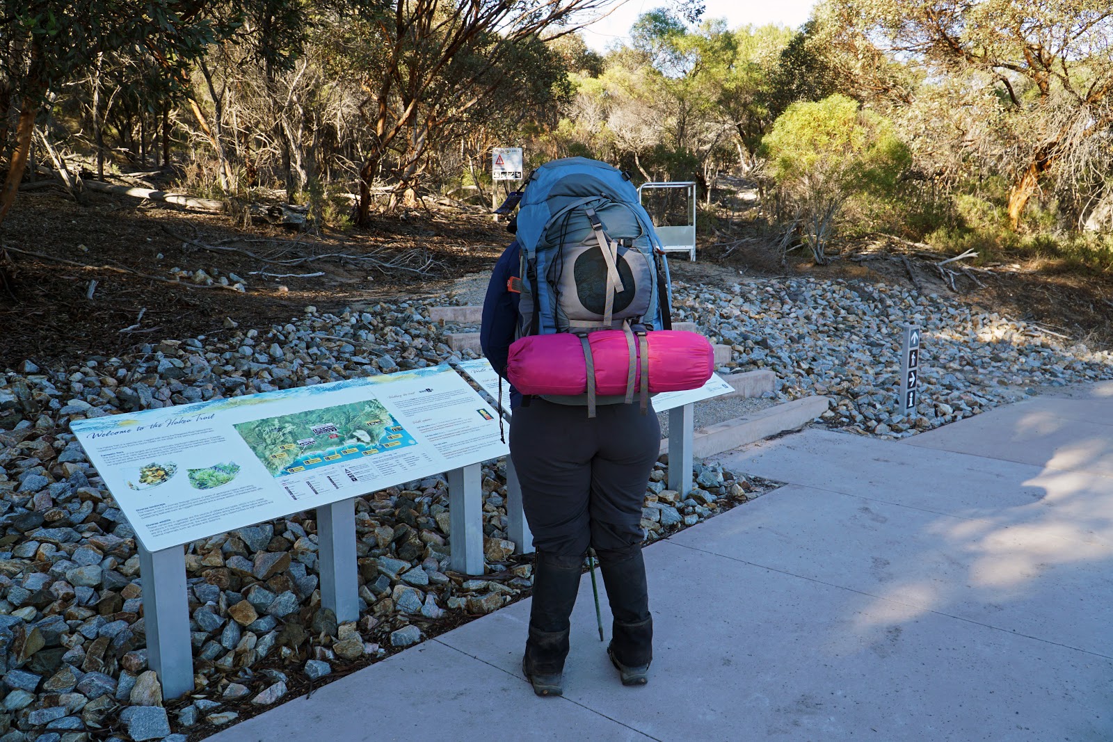
With our overnight packs and trekking poles at the ready, Alissa and I began the journey to Quoin Head from Hamersley Inlet via a linking track that provides access to the main Hakea Trail. At just shy of two kilometres, the linking trail is short enough but not that short, and I would be walking this stretch three times due to how we were breaking it up! Thankfully the walking here is quite pleasant, as it features a lot of colourful mallet woodlands to walk through.

While it might seem like the walk to the inlet should be relatively easy going, the trail is surprisingly undulating as it traverses the dunes to the coast.

Having done the Mamang Trail previously, Alissa and I knew that the overnight trails in Fitzgerald River National Park featured very detailed construction, with decked lookout points and benches. We were unsurprised then to see a lookout point less than a kilometre into the walk providing excellent views of the Hamersley Inlet.

While there was a brief break from the mallet through coastal melaleuca, the linking trail features a sustained section of walking through the golden-coloured mallet. While thin and narrow, these Eucalypts are a very charismatic tree, and reminded Alissa and I of similar types of Eucalypts we've seen along the Woylie Walk in the Dryandra Woodlands.

As we approached the closed mouth of the inlet, a high exposed sand dune provided another great view of the Hamersley Inlet. Unlike other inlets in the park, Hamersley is a deeper and more impressive body of water. A sign at the car park indicates that it is possible to hire a houseboat to explore the inlet, which sounds like a really cool and unique experience!

The mouth of the Hamersley Inlet is closed the vast majority of the time, however a large pool was located at the inlet channel at the time of our visit. While far from connecting the inlet to the ocean, the pool seems to be a popular spot for ducks to hang out as we saw a handful of ducks gathered by the water heading to and from Whalebone Creek.

Finally, after almost 2 kilometres of walking on the linking trail, Alissa and I found ourselves at Hamersley Beach and on the Hakea Trail proper. Upon arriving at the beach, we encountered the familiar sight of Fitzgerald River's iconic rugged coastal formations. Unlike most parks on Western Australia's south coast, granite does not feature strongly in the geology of the park. Instead, schist and quartzite form the major rock types and result in intriguing shard-like formations that are a world away from the smooth, rounded domes of granite.

Turning right and west towards Quoin Head, Alissa and I were intrigued by a section of beach that was covered in a mix of small pebbles and shells. Alissa said she could easily have spent several hours sorting through the rocks and shells, but with a fair few kilometres ahead of us we pressed on after a short stop.

The Hakea Trail heads through a section of particularly rugged coastline. The jagged formations here are particularly large and impressive, and have an alien lunar landscape appearance that would not be out of place in a science fiction film.

Guided by a series of tall yellow posts (sadly no longer the original orange colour they were initially painted in), Alissa and I reached the end of the beach and the start of a proper single file trail as we rose up along the top of a series of low cliffs.

These low cliffs were a beautiful and exciting stretch of track, and brought back memories of the Cape to Cape Track for Alissa and I.

From the clifftop track, the view back to the beach below was outstanding. Fitzgerald River is so blessed with such a bounty of beaches and coves that pretty ones like the one above simply go unnamed in the park brochures.

While the waves here are typical of the rough and dramatic waters that the south coast is famous for, the rock formations further out create a break. As a result, the waters beneath the cliffs were calm and crystal clear, and it made Alissa and I really want to go for a swim and snorkel if we only had our gear with us.

Heading away from the low cliffs, the trail rises up a series of steps as it follows the higher coastal ridge.

Initially the trail stay relatively close to the coast and provides views of the central wilderness area of the park in the distance.

However, the track ends up heading behind a natural screen of tall coastal heath as it provides views back inland to the park's central peaks. These inland sections were less exciting to walk at the time of our visit, but they would almost certainly be bursting with colour during the peak of the wildflower season.

The trail does not linger too long through the inland sections and returns to the coast at the Tamala Karst lookout. Unlike the ancient schist and quartzite that dominates the park, this section of the track passes through limestone dominated structures that are comparably younger. This again brought back happy memories of the Cape to Cape Track, which similar features a mix of old and newer rock formations.


This stretch of the walk that heads down to Central Whalebone Point features some excellent coastal walking, with a lot of interesting formations to look down upon from the trail.

Heading back up and away from the coast, the trail enters an intriguing section of low melaleuca that have been so windblown they are almost growing horizontally!

While walking in April meant we were not experiencing the park with its wildflower display turned up to eleven, their were still some flowering plants along the trail. A single-sided form of bottlebrush was the most common flower along the walk, even if its small size meant it was far from the overwhelming spectacle of being in the park during the springtime.

For a trail called the Hakea Trail, Alissa and I had noted a noticeable absence of Royal Hakea for most of the hike. We were thus delighted to enter a section filled with Royal Hakea as we reached the next section of coastal karst.

The coastline once again became rugged and extremely interesting as we made our approach to Whalebone Beach. The trail alignment here is excellent as it follows relatively close to the coastal cliffs and provides good views down to the beach below.


Reaching a section of vehicle track walking, the trail head inland towards Whalebone Creek campsite, however before heading inland Alissa and I took a moment to enjoy the coastal formations along Whalebone Beach.

As we were enjoying the views, Alissa was delighted to see a pod of dolphins below. As is common with these dolphin sightings, the photos do not do justice to the awe-inspiring nature of the experience.

After the dolphins had departed, Alissa and I followed the Hakea Trail towards Whalebone Creek campsite. The route descends to run alongside the dry creek, passing a set of steps that lead down to a Whalebone Cove side trip.

The brochure for the Hakea Trail vastly undersells the campsite facilities at Whalebone Creek. While the tent platforms listed in the brochure are a step up from the non-facilities on the Mamang Trail's campground at Fitzgerald Inlet, the hut at Whalebone Creek is built to Munda Biddi standard and features two water tanks and a toilet. Given the somewhat open and relatively featureless nature of the campsite compared to the picturesque campground at Fitzgerald Inlet, the hut is a major improvement on what could have been a pretty dull place to camp.

Having seen a Munda Biddi-style hut on the North Dandalup Walk GPS Route, Alissa and I were excited to actually be staying in one. With its wooden deck overlooking the valley meaning we could actually take our shoes off while walking around the hut, Alissa and I agreed this was a superior design to the Bibbulmun Track's sandy floors (Frankland River excluded).

After dropping our main packs and have a mid-morning snack, Alissa and I begrudgingly headed out to complete the 12 kilometre return journey to Quoin Head and back. With few clouds in the sky, the April Sun was warm and far from the optimal conditions to be walking, and it was hard to leave the comfort of the hut behind.

Leaving Whalebone Creek campground, the trail crosses Whalebone Creek itself and then joins onto an old four wheel drive track that used to be used by 4WDs to access the campsite.

Already feeling hot, the steepness of the climb out of the valley and the ugly nature of the vehicle track did not instil us with any great enthusiasm for this leg of the walk.


Just before a very steep section of the vehicle track, the Hakea Trail branches off the 4WD track and heads along single file walk track to provide views over Whalebone Cove.

This section is basically a loop diversion off the 4WD track and passes through an interesting mix of flora. The Royal Hakeas along this stretch are particularly lovely, and I can imagine the area being a riot of colours in the springtime. Being a diversion off the 4WD track does mean this is a longer way to go than continuing on the road would have been. I was have to say however that the long way's better, as the scenery is superior to the steep 4WD section and I can understand the reason why the route is what it is. Pro tip: for those doing a return walk to Quoin Head, it is possible to skip this bit on the way back by simply staying on the 4WD track.


Unfortunately, the walking after returning to the vehicle track is fairly boring and uninspiring as it is basically a long stretch of road walking. Alissa and I felt that the route through here was more expedient than inspired, and it was a massive step down from the quality purpose built single file walk trail we had experienced to Whalebone Creek. This was additionally disappointing as to get to Quoin Head Alissa and I would have to walk this dull section twice! This would be less of a problem if the Quoin Head end was more accessible, but it can only be reached by four wheel drive, meaning most walkers probably ended up getting a double service of the most boring part of the whole trail.

While Whalebone Creek campsite is supposed to be closed off to four wheel drives, it was disappointing to see that people clearly don't care about the closure and have driven along the vehicle track sections of the Hakea Trail. This has severely damaged the wooden bridge infrastructure along the walk, however given how dry the area is and how small the ephemeral streams are, it seems almost comical that they bothered to bridge these streams at all!

After several kilometres of non-descript and unexciting scenery, Alissa and I were alerted to the fact we were at the Whoogarup Lookout, which had little more than a sign to indicate it was any place of great significance. The main thing we appreciated about the lookout was knowing we were only 2.5 kilometres away from Quoin Head and the end of this seemingly endless stretch of boredom. While this area would admittedly be better in the springtime, this section of the track is heavily reliant on the wildflowers to be interesting at all and thus is a much more seasonal walk than the Tagon or Le Grand Coastal Trails I had undertaken earlier in the week.

10 minutes after the Whoogarup Lookout, Alissa and I were glad to see a marker indicating that we were leaving the boring road walking behind as we made our way along a single file walking track. From here the quality of the trail increased dramatically as it entered the exciting final stretch to Quoin Head.

Heading back towards the coast, the track crosses a dry creek bed over what would be a waterfall in heavy rains and features great views down to the coastline. The coastal formations here are rugged and interesting and I was finally beginning to feel like all the boring road walking was worth the effort.

Rising up and out of the valley, the single file trail skirts the edge of the coastal cliffs and provides views of some sea stacks just off the coast.

One such sea stack featured a proud eagle's nest at its highest point, making this truly an 'eagle view' unlike the Eagle View Walk Trail in Perth.

Rounding the corner a short distance along the trail from the sea stacks, Alissa and I could finally see the stunning formation of Quoin Head coming into full view.

The Hakea Trail reaches its western terminus at a lookout point overlooking Quoin Head. Having bought sandwiches and wraps from the bakery, Alissa and I stopped for lunch here, glad to have only the return trip to Whalebone Creek ahead of us.

While we'd been bored and disappointed by the road walking, Alissa and I agreed that Quoin Head was an outstanding formation, and we could see why the trail puts up with a few kilometres of relatively unworthy road walking to take hikers to this excellent location. The calm waters of Quoin Head Beach were also incredibly beautiful, and if not for the steep descent along a 4WD track Alissa and I would have been tempted to go for a swim. While this is the end of the Hakea Trail, for hardy off-track hikers this is sometimes just the beginning of their Fitzgerald River adventure as walking through the central wilderness is a possible if difficult multi-day walk that eventually links up the the Mamang Trail. Indeed, the early plan for Fitzgerald River was for the Mamang and Hakea Trails to be one long continuous multi-day, with just west of Quoin Head described in the original plan as 'the most difficult, remote, and spectacular with views of the ranges descending into the ocean'.

With no multi-day off-track plans this time around, Alissa and I headed back along the Hakea Trail after finishing our lunch.

The walk back was unremarkable as it was a return journey that was mostly along the boring vehicle track, however one interesting discovery was that there is a secret bench at Whoogarup Lookout just above the trail! It would appear that at the time the trail first opened there was a short side trail that led to this bench but lack of visitation led to the trail becoming overgrown, which has become a vicious cycle that's ensured its obscurity.

Taking the shortcut along the vehicle track, Alissa and I were relieved to see Whalebone Creek below. One of our great fears was that some bogans might have shown up in a four wheel drive while we were away, but we glad to find we returned to have the campsite to ourselves.

Or I should say, almost to ourselves. As we were setting up the inner of our tent on the upper bunk to keep out the mosquitoes at night, Alissa and I realised we had a guest in the form of a frog sitting in the corner of the bunk. Firm believers that old fashion names best suit animals, Alissa and I decided to name the frog Honorio de Consensio, in honour of some of the extravagant names that were popular in Singapore and Malaysia during the Portuguese era.

After spending some time relaxing at the hut, I decided to go check out Whalebone Cove just before sunset. It was really cool walking down to the calm waters of the beach and being able to see the sun providing its glow to a rocky side gorge.

The long coastal cliff on the western side of the bay was also impressive to see, with its jagged, layered forms sticking out like daggers along the water's edge.

Around the other side, the coastline apparently has a small cave according to an entry in the hut's logbook, however being by myself I was not super keen to go exploring given the potentially rough seas.

After exploring, Alissa and I had dinner, played some cards and went to sleep. The next day we packed up and returned along the Hakea Trail to Hamersley Inlet, during which I was stung by bees in the face twice(!) - this is definitely a 'bee risk area'!
Given the stunning nature of Fitzgerald River National Park and the fact the Hakea Trail is considered one of Western Australia's Top Trail by Trails WA, I had massive expectations for this overnight journey on the trail. Perhaps those expectations were too lofty as it was not quite as perfect as I had hoped it would be. While I thoroughly enjoyed the stretch from Hamersley Inlet car park right through to Whalebone Creek, the vehicle track walking was not exactly the world class experience the marketing promised, although the pay off of the spectacular Quoin Head and the remote wilderness beyond did end up being worth the detour. I think the comparison that immediately came to mind with this walk was the Le Grand Coastal Trail which was a far more adventurous and less risk averse walk, whereas this return walk section of the Hakea Trail seemed to play it safe (and cheap) from Whalebone onwards until the return of the single file walk trail to Quoin Head. Nevertheless, for the most part this is an enjoyable walk that I was glad to have done. I think some of its weaknesses would be negated by the wildflower displays in Spring, and it would be my recommendation to others considering doing this stretch of the walk to wait until September or October to experience this trail at its very best.


Why do you love slagging off The Bibbulmun Track facilities (Huts etc.). If you want up market huts etc. then expect to start paying for those facilities. The Bibb is entirely Free and compared to most of the places I have hiked/walked beats them hands down with regards to facilities and infrastructure. By all means make your comments about the wonderful tracks and facilities you discover but don‘t be so damned negative about the Bibb. If can‘t say something good then say nothing, was the way I grew up.
ReplyDeleteHi there, I think you've completely misread what I wrote. I merely said that the Whalebone Creek hut is superior to the Bibbulmun, not that the Bibbulmun Track facilities are bad. For one thing to be better than the other, it doesn't mean the less good one is inherently bad as a result. If you look elsewhere on the blog, you will see that I've literally praised the facilities as World Class.
DeleteI've never criticised the Bibb for having crappy facilities, even though I feel that aspects of the actual walking itself are boring, severely compromised and not as stunning as other walks in other parts of the world.
You may have been brought up to not say anything if you didn't have anything good to say, but the Bibb would not be what it is today if someone hadn't been critical of the substandard Bibb that existed before the 1998 alignment. I was brought up to strive for excellence rather than champion mediocrity. I don't see any value in pretending everything is awesome when it isn't and being overly praising of things that are unworthy. Why not strive for better by pointing out where things could be better?
Hi Don - do you remember if Quoin head also had a shelter and water tank? or was it just Whalebone?
ReplyDelete