

An excellent mountain walk in the Waikato region of New Zealand, the Karioi Track takes walks to the summit of Mt Karioi near the town of Raglan. Starting at Te Toto Gorge, the trail rises up through beautiful, dense rainforest through an adventurous mix of ladder and chain assisted climbs and muddy scrambling. With spectacular views of the Raglan coastline, this extinct volcanic mountain will definitely thrill experienced hikers
Distance: 12.5 km (return)
Gradient: Largely a gradual uphill walk with moderate to very steep section
Quality of Path: Generally clear and well maintained
Quality of Signage: Well signed at all trail junctions, however signage is inconsistent. At the start of the walk it says to ignore pink signs and follow the orange signs, however is marked with pink signs in its middle section
Experience Required: Bushwalking/Tramping Experience Required
Time: 5-6 Hours
Steps: Several steps and ladders and some near vertical sections that require chain assistance
Best Time to Visit: All year
Entry Fee: No
Entry Fee: No
Getting There: The trail starts at Te Toto Gorge car park. From Raglan, take Wainui Rd until the intersection with Calvert Rd. From here, turn left onto Whaanga Rd. Continue on Whaanga Rd for 5.5 kilometres. Te Toto Gorge car park is located in a bend in the road with the trailhead on the opposite side of the road

With our focus in November shifting to training hikes for our end of year New Zealand trip and the uncomfortably hot weather in December limiting our hiking opportunities, Alissa and I didn't walk any new trails between my first New Zealand work trip yielded a visit to Rangitoto Island. With work hilariously sending me to New Zealand the week before our end of year trip, I decided to make the most of my weekend in Hamilton by heading out to tackle the Karioi Track. Having missed a few weeks of training hikes in Perth due to the unpleasant heat, I wanted something tough to get me ready for the holiday and the continuous ascent of the 756 metre tall extinct volcano Mt Karioi in the nearby beachside town of Raglan definitely fit the bill.

The trail starts at a bend in a winding unsealed road along the coastline, with a fairly large car park indicating that this is a popular area for locals and visitors. Before starting the trail, it is well worth taking the short walk to a lookout point along the coast that provides stunning views of Te Toto Gorge and the rugged cliffs of the Raglan coast.

After taking in the coastal views, I headed across the road the the start of the trail. Located somewhat dangerously in a bend in the road, the start of the track is eroded and somewhat uninviting, even if the trailhead and information did instil me with confidence that this was a proper managed trail.

Climbing over a stile and taking note of signage indicating that I should follow the orange markers, the trail immediately begins its ascent as it follows an old wood fence line.

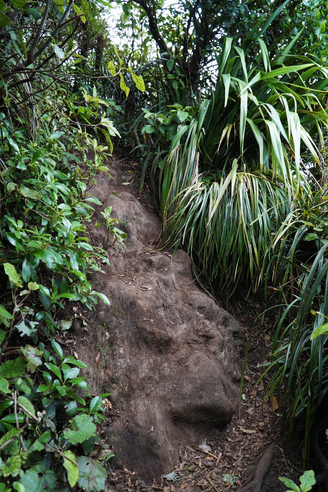
At this early stage of the walk, the ascents are fairly moderate and pass through some lovely rainforest scenery. Being a fan of temperate rainforests in Tasmania that share a common Gondwanan ancestry with New Zealand, I knew this was going to be a walk that was right up my alley.

Emerging out from the initial rainforest pocket, the trail becomes steeper and less interesting as the forest transitions to dense grasslands from the neighbouring farm. Walking up the steep hill here certainly got my heart pumping, and while not overly exciting I was glad to be getting a workout given the two Great Walks Alissa and I would be doing in just over a week.

Reaching the top of the grassy section, the views back down to the coast were excellent. While sunny skies would have made for a cheerier image, I found the grey clouds of the day to be rather dramatic and helpful in taking evenly lit photos within the dense rainforest that was to come.

Thankfully the grassy section of the trail is not overly long, and once cleared it is basically almost continuous walking through spectacular rainforest. This certainly brought back happy memories of hiking in Tasmania, particularly bringing to mind the first day of the ascent to the summit of Frenchmans Cap.

The walking through the rainforest was initially more moderate than the steep ascent through the grassy section, however it became increasingly steep as it reached the top of the first smaller peak of this extinct volcano.

The views from this high ridge were excellent, showing the slopes of the mountain and the coastline beyond.

Even better however were the views of Mt Karioi's summit itself. From here I could see that the trail would have to dip down for a bit before rising up again to reach the summit.

From the rocky ledge overlooking the summit, the trail features the first section of chain assisted walking as it leads to a ladder. I remember thinking this was nothing particularly challenging and that the chains of this walk may have been overhyped. Little did I know at the time the most serious chain climbing was still to come.

Before descending the ladder, I took a moment to appreciate the views of Mt Karioi once again. From here on the track is almost entirely in dense forest or with views of the surrounding landscape but with no views of the summit until the last push, making this a view to savour.


Beyond the ladder, the track continues its descent and at times features tricky rugged sections.The volcanic rock has been eroded fairly smooth in places, and the Department of Conservation (DOC) have helpfully bolted a rock climbing hold in place along a short rock scramble.

As the terrain eased off, I became slightly concerned. The sign at the start of the walk indicated that I should not be following the pink arrows along the trail as they were seemingly in place to mark where rodent traps had been placed. Yet here I was along the ridge with no orange markers in sight, and nothing but pink arrows pointing the way forward. Having seen no obvious trail junctions, I had to trust that I was going the right way, but it certainly made me feel a bit uneasy and unsure that I was headed in the right direction.

This uneasiness turned into one of those exhilarating 'the trail goes where now?!?!?!' moments when I saw where it was taking me. After some relatively easy going walking with only mild ascending, the trail shifted gears significantly as a long chain led up an almost vertical scramble up muddy roots and rocks.

This was tough but fun going, and I laughed a bit when I realised that the first long stretch of chain was followed by yet another chain to get to the top of the climb. Being from the excessively risk averse Western Australia this was a far cry from the children's safety scissors-style trails that are common in my home state, and I'm pretty certain something like this would not be allowed by DBCA. While I understand the public liability fear, the difficulty and risk is exactly what made this such an exciting walk as it felt much more like an adventure than the average walk in the park.

The proliferation of pink arrows went out of control by this point, and I still hadn't seen any orange arrows to give me the confidence that I had gone the right way.

Next was arguably the most difficult part of the trail as the track climbs an extremely steep and muddy section. At times the eroded track is as steep as the section with the chain without the assistance and it was up to me to use tree roots and thicker vines to pull myself up the muddy track.

At the top of the muddy ascent, I was grateful to see some wooden signage, culminating in the side trip track junction leading to a lookout point. It confirmed for me that I was definitely going the right way at least and that I hadn't just stumbled upon a sketchy disused section of trail, but a sketchy official section of trail!

With my eye on the prize, I decided to forego the lookout point and save it for the return journey back down the mountain. The main track does actually reach a clearing in the forest that provides excellent views back towards Raglan, and I would later discover that the lookout views were not a dramatic step up from what I saw at this point of the track.

From the lookout trail junction, I was relieved to see orange trail markers yet again with these continuing all the way to the summit.

While the trail was not as steep going forward, it was nevertheless very muddy and slippery. I had decided at the start of the walk to not use my trekking poles since I didn't want to have the hassle of cleaning them and then having to show them to Australian Customs on my way back over and then show them to New Zealand Customs again when I returned a week later. I have to admit I regretted this decision through this section, as every muddy, slippery descent had to be taken slowly and carefully as the risk of falling was very high.

With the trail being for the most part a continuous green rainforest tunnel, it was a nice change of pace to briefly enter a clear section of trail.

Given the relative lack of views since the ladder descent earlier along the walk, it was hard to gauge just how far up I had gone, and the views back down to the coast from here finally allowed me to make sense of my progress up the mountain.

After the clearing, the walk was mostly fairly easy forest walk through rainforest filled with shaggy moss trees before the trail increased in steepness about 20 minutes from the summit.

Along the ascent, it was nice to finally be able to see the summit emerging out from the forest - my first views since descending the ladder just over an hour earlier.

With the summit in view, I thought it was going to be an easy stroll to the finish but the trail actually has some tricky sections as it seemingly makes it way around the summit to approach from another angle. There is a section here where the track appears to have been eroded away and thus required a scramble down some roots and then climb across (or a precarious large step across) to get to the other side.

Not long after, the end was finally in sight with the summit marked by a transmission antenna.

Just before the antenna, a ladder climb is the last main obstacle to reach the summit.

From the summit, the views back across the ridge were as stunning as advertised. The volcanic nature of the scenery certainly brought to mind the jagged mountain shapes I had seen while living in South East Queensland, particularly Mt Cordeaux in Main Range National Park.

The views of the coast were also worth savouring. While the cloudy weather meant the views were not exactly crystal clear, I was still able to see Potoorangi Bay and the Te Ariaotewiwini Inlet.

After enjoying the summit views for a few minutes, the weather began to take a turn for the worse as a light drizzle began to fall. With storm clouds moving in and nothing to be gained from staying up at the summit in a downpour, I began the descent of the mountain.

The walk back down was a bit faster going than the climb up, however it was still something I had to do carefully given the slipperiness of the mud. Unfortunately, I did eventually slip as I made my way along the side trip trail to the lookout, falling backwards onto a rocking outcrop. While my backpack to the brunt of the fall, I did injure my shoulder as a result and had shoulder pain for the next three weeks as a result.

The worst part was the view from the lookout was disappointing to say the least. While the rain certainly reduced the visibility, the lookout point was just not that spectacular compared to the view from the summit, and as mentioned earlier there are very similar views that can be glimpsed from the main track itself. As such, I don't really recommend the side trip unless you're not planning on pushing through to the summit.

After the lookout, the descent of the chain was significantly more scary than the ascent. This definitely felt like one of those points where a mistake would lead to injury or death, but it is the kind of dangerous that makes you more focused and considered in your movements, and thus is paradoxically less risky than slipping on muddy sections of track that seem safe by comparison.

In fact, I would fall over again along what would seem like the safest part of the track. Leaving the muddiness behind and reentering the grassy section, the narrow, rocky track caused me to twist my ankle and fall over in pain. Luckily the injury was on minor, however it certainly made me realise how much my walking style is heavily reliant on the use of trekking poles. From there, it was a short walk back down to the car park with my second day
New Zealanders I've met tend to be a bit dismissive of Hamilton and the surrounding area, and it certainly felt like tourists skip through this area to check out the North Island big ticket items of Tongariro, the geothermal wonders of Rotorua and Taupo and the idyllic Hobbiton. The Karioi Track then was a wonderful surprise; this was a spectacular adventure of a mountain summit walk that experienced hikers prepared to face its challenges will definitely enjoy. If this was in Western Australia where mountains are scarce, this was easily rank as one of my favourite mountain walks. Definitely not for the 'faint of heart' or the inexperienced, but for those with the required skills the Karioi Track is highly recommended.


0 comments:
Post a Comment