

Day 2 of the Tongariro Northern Circuit, this day takes trampers over the famous Tongariro Alpine Crossing. From Mangatepopo Hut, the track runs through a valley before an 800 metre climb to Red Crater's spectacular views of Mt Ngauruhoe. Descending through the Emerald Lakes, the track runs through a stark and rugged moonscape to Oturere Hut. A fantastic day of hiking that lives up to its reputation as one of New Zealand's best
Distance: 12 km (one way)
Gradient: Mix of gentle terrain, and a very steep 800 metre ascent and steep descent from Red Crater
Quality of Path: Largely very clear and well maintained from start to finish, with well constructed stairs along the first part of the climb to Red Crater. Some loose scree sections on either side of Red Crater
Quality of Signage: Well signed at all trail junctions, with expected time and kilometre information to the next landmark
Experience Required: Bushwalking/Tramping Experience Required
Time: 4-5 Hours
Steps: Several steps in places, especially leading up to Red Crater
Best Time to Visit: Great Walks Season; at other times alpine experience is required
Entry Fee: Yes; this is one of New Zealand's Great Walks and must be booked ahead of time
Getting There: The track starts at Whakapapa Village. From State Hwy 47, head towards State Hwy 48 and follow the road up to Whakapapa Village. Parking for the Great Walk is located across the road from the lawn before Chateau Tongariro with a parking permit available from the visitor centre, located a short walk up the road. The trailhead is located behind Chateau Tongariro on Ngauruhoe Terrace. For those looking to do this as a day walk, access can be arranged by shuttle organisers for the Tongariro Alpine CrossingEntry Fee: Yes; this is one of New Zealand's Great Walks and must be booked ahead of time

For our second day of the Tongariro Northern Circuit, the plan had been the usual sunrise wake up, quick breakfast and get going, however the hut warden at Mangatepopo offered us some sage advice; if you want to avoid the massive crowds on the Alpine Crossing, you want to start at 5 am. By 7 am the mass bus loads have already begun, and if the weather is good we could expect literally thousands of people to be doing the walk. With this sage advice, Alissa and I were up at 4 am, and in our customary fashion ate breakfast at breakneck pace and were the first ones out the door at 4:30, ready to experience what would end up being one of my favourite days of hiking ever.

While we could see the glow of first light in the distance, Mt Ngauruhoe, Mt Tongariro and the saddle between them meant the valley was still shrouded in shadow, and we were glad to have quality head torches for the first, largely dark hour of the walk.

The track through the valley alternates between running through the flat plains in the middle and skirting some more rocky sections that veer left to the watercourse running below Mangatepopo Hut.

At what is the three kilometre mark for the Tongariro Alpine Crossing (not the Northern Circuit), Alissa and I encountered the first warning sign about the weather. Given that this is a popular walk with non-hiker tourists, a lot of walkers would not have the experience to know when to pull out. Given the potentially dangerous changeability of alpine conditions, the signage provides important information so walkers can at least make an informed decision about whether or not they should press on.

With almost perfectly still wind conditions and clear skies, there was nothing for Alissa and I to worry about, and with the sun's rays starting to be visible we were now able to walk without the aid of torchlight.

The track veers back to the watercourse towards the end of the valley. This is due to a black lava flow that covers a good section of the valley. While safe and with the volcanoes monitored constantly for geological activity, it is important to note that this is an active volcanic zone - as would become very obvious along the descent from Red Crater.

At one point, the track provides clear views down to the watercourse, showing the water cascading down a series of rocks that have been polished smooth over time.

Clearing the large section of lava flow, the track passes through a flat, gravelly section as it makes its way to the end of the valley.

With my eye on the prize of getting to the top of Red Crater as early as possible, Alissa and I skipped the short side trip to Soda Springs, which appears as a short waterfall. This feeds the watercourse we had been walking along earlier and one suspects must have a certain fizzy, carbonated quality given the name.

With the track veering eastwards, Alissa and I were now heading towards the crux of the day's walking - the 800 metre ascent to Red Crater. Alissa and I have had experience with this sort of elevation gain in a day thanks to the fantastic day of walking from Lake Vera to Frenchmans Cap's summit on the Frenchmans Cap Track, however many people we'd spoken to had spooked Alissa by saying it was extremely hard and one of the most challenging days of walking they'd ever done. As such, Alissa suggested I push ahead at my fairly speedy uphill pace while she tackled it at her own tempo.

Pushing on by myself, I passed the sign that hut wardens had put up the previous day to discourage walkers from doing the crossing in bad weather. I would assume the warden would have had to take this down before the main rush began at 7 am as it would surely confuse those who wouldn't have known about the bad weather the previous day and looked up at the sky and wondered what they were talking about.

Given this is an extremely popular walk, DOC provide a number of toilets on the track, starting with a couple here before the big climb. DOC have done a commendable job to prevent these from being an unsightly blight on the landscape by giving them a rock camouflage colour scheme to blend in. Annoyingly, the warden informed us that some people still don't use the toilets provided or do their business in a Leave No Trace fashion.

After crossing a short bridge over a dry watercourse, the real climb began as the track winds its way up to the saddle.

The first bit of the climb is fairly easy; it is a series of sloping sections mixed with stairs. With cool weather, it didn't seem like much of a workout yet either.

As the steepness increases, a warning sign indicates that that was the easy part and indicated that if you found it challenging then it is best to turn back. Given it was not challenging at all, I kept going.

While definitely within my comfort zone, the next stretch was definitely more challenging as it was an almost continuous up with some steep stairs in places. That being said, the overall experience of it being a very well constructed set of stair meant it was just a matter of one foot after the other, and lacked the challenging technical nature of a scramble. Certainly, this was several times easier than the wet, muddy climb to Barron Pass on the way to Frenchmans Cap.

With the glow of golden hour bathing the peak of Mt Tongariro, I knew I was almost done with the first part of the ascent.

Having made it up to saddle, I took a moment to have a breather while I took in the glory of Mt Ngauruhoe. Made famous for being Mt Doom in Peter Jackson's Lord of the Rings films, Mt Ngauruhoe is a a beautiful volcano and a classic mountain. In the past, Mt Ngauruhoe used to be climbed regularly, and it was one of the reasons I initially wanted to do this walk back in 2016. Since 2017, DOC has discouraged climbing Ngauruhoe as the peaks of the volcanoes in Tongariro National Park are considered sacred to the local Maori people. As someone who chose not to climb Mt Warning when I lived on the Gold Coast because of its religious significance and who supported the closure of the Uluru climb, I could not in good conscience climb Mt Mt Ngauruhoe and while it is technically still possible, I hope others would be respectful enough to do the same.

After all the continuous climbing, the track offers walkers a bit of a respite as it makes it way across a relatively flat section. DOC has placed a few toilets here for walkers to use before the final, steep climb to the summit of Red Crater.

At the end of the flat amphitheatre-like space, a final warning sign indicates that the hardest part of the walk lies ahead. At this point, the loose rock and exposure to the wind would make this a treacherous section to walk in bad weather and walkers should take heed of the warnings even if it is disheartening to get this far only to turn back.

With almost perfect weather, we had no such worries to contend with and I made my final push to the summit. Unlike the well manicured track earlier, the track here is rough and loose under foot, and can be steep at points. While again within my comfort zone, this was definitely tiring work, and I stopped quite a few more times compared to the other sections.

Halfway up this last ascent, the track provides the first unobstructed views east of Mt Ngauruhoe. From here we could see the barren looking landscape we would be passing through later in the day on the way to Oturere.

But before then, there was still more to the ascent with the track skirting around a conspicuous boulder before turning right towards the summit.

Before the final push, I took a moment to look back at Mt Ngauruhoe which was looking spectacular bathed in the golden glow of the morning Sun.

Rounding the corning, it was interesting to see an actual prominent summit come into view, and it was a real surprise to see people standing at the summit as I had assumed I was going to be the first person to reach the 1886 metre summit of Red Crater today.

The home stretch up to the summit is a fairly narrow ridge with steep drop offs on either side. It was pretty obvious to me that this could be a fairly treacherous stretch of track in inclement weather, and I was extremely grateful that we had been blessed with such favourable weather - especially considering the wind, rain and low visibility of the previous day.

Reaching the top, I was congratulated by the small group who had made it up before me. Talking to them, they explained that they had come from the other car park and that I was indeed the first one up from the direction of Magatepopo. With the 800 metre vertical ascent over with, I now could look around and appreciate how magnificent the views from Red Crater are, beginning with one of the best viewpoints of Mt Ngauruhoe on the entire track.

While Mt Ngauruhoe is obviously the centrepiece of the Tongariro Northern Circuit given the walk goes all the way around the mountain, the walks most jaw-droppingly beautiful views are to found looking east from Red Crater. From here, the large Blue Lake can be seen in the distance while the smaller Emerald Lakes and several active geothermal vents lie just below and along the track. With the day walkers who had reached the summit before me heading back down, I was able to have these views to myself - a rare and wonderful gift given how popular this walk is.

While chowing down on a Snickers bar Alissa had bought me as a victory snack once I got to the summit, I put my pack down while I took in the rest of the volcanic landscape. From the top, the track allows walkers to peer down into Red Crater, which is as red as advertised. I was paranoid about dropping my gear down as the summit area is fairly small and the drop off significant; there would be no easy way of getting anything once its fell into the crater other than sliding down a steep and treacherous scree slope.

After half an hour on the summit and a few other hikers passing through, I saw Alissa reaching the last stretch of the walk to the summit. Once at the top, Alissa agreed that the climb was no where near as difficult at Frenchmans Cap and that those who had said it was 'the hardest thing they've ever done' had scared her for nothing. I said to Alissa that while she often compares herself to my hiking experience, she has to remember that by this stage she's completed at least 20 Multi-day trips and hundreds of day hikes, so she is a very experienced hiker who has done a lot of challenging walks compared to most people we meet while out hiking.

After Alissa had a moment to catch her breath and taking in the spectacular views, I got Alissa to take a photo of me looking like a smiling idiot in front of Mt Ngauruhoe, clearly very happy to have ticked something off my younger self's bucket list.

From Red Crater it is basically a sharp descent as the track passes by and then through the middle of the Emerald Lakes. With numerous vents along the track from her until the end of the lakes, there was a thick smell of sulphur hanging over the landscape.

The slope here is brutally steep and made up of loose scree. Having trekking poles definitely helped, and I basically embraced the looseness by skiing down sections. Alissa was more cautious as she felt less confident in hitting the brakes in a fall.

Just above the three Emerald Lakes is a rocky outcrop/lookout perfectly located for a 'grammable photo opportunity. It seemed like everyone doing the crossing either stopped to take a photo or have their photo taken at this spot, and Alissa obliged me by taking the photo above.

The steepness starts to level out to a more gentle descent as the track passes the first of the Emerald Lakes. Seeing them up close was a real treat as we could see a yellow hue ringing the green water. These lakes get their colour from the minerals that are dissolved within them and the algae that thrive in their acidic waters. Given the acidity, these lakes are not suitable for swimming, and walkers are advised to wait for Oturere if they really want a swimming fix.


Just before reaching the last of the Emerald Lakes, the Northern Circuit and the Alpine Crossing part ways. The Alpine Crossing turns left and northwards towards the Blue Lake while the Northern Circuit heads south. We had originally considered taking the side trip to the Blue Lake, however decided against it after the hut warden indicated it was not really worth it. As such, we continued onwards past the last of the Emerald Lakes.

The track runs right along the last lake. At this point, I was delighted to see another couple coming in the other direction carrying Aarn packs. I feel like owning an Aarn pack is like belonging to a secret society, as whenever you see someone with an Aarn and it's distinctive front pockets you can't help but acknowledge each other with a smile and a knowing comment of 'nice pack'.

Before continuing on, Alissa and I stopped for a short break as Alissa had her celebratory Snickers. Known for being a bit clumsy, Alissa chose the Snickers bar with the most apt descriptor on it's wrapper.

After the snack, Alissa and I took one last look back at the Emerald Lakes before beginning the next descent.

After leaving the last of the lakes behind, the track passes by one of the most active geothermal vents, which makes it look like a smoking mountain. From this point, Alissa and I got our first glimpses of Mt Ruapehu, which would be a constant companion for the rest of the walk.

The descent here is fairly steep, with the track entering a somewhat barren desert-like valley.


As we descended, Mt Ruapehu began to disappear from view again while Mt Ngauruhoe continued to loom large.

Following what was a times a narrow ridge that required some mild scrambling in places, Alissa and I were relieved to finally be on the flats of the valley for a very easy home stretch. With no clouds in the sky and 5 kilometres winds, the temperatures were beginning to warm up, and Alissa and I were really glad to have woken up early as it would have been more uncomfortable later in the day.

Through the rocky, barren looking section, the track crosses a number of shallow creek beds that are probably mostly flowing after the snow melts in the springtime. Given this was summer, the creeks were mostly dry, which only added to the barren feel of the area.

The landscape looked like the kind of area you would drag Gollum along through while he yells 'it burnses!', although we would learn that these scenes were not shot here but in a similar looking area. Still, the view of Mt Ngauruhoe looming overhead helped fuel the sense we were on a One Ring-destroying mission to Mordor.

As we continued southwards, Mt Ruapehu began to dominate our view. Looking like another classic mountain, Ruapehu's snow-covered peak is home to the North Island's only glaciers. It reminded me of a less peaky version of the Paramount logo.

The track winds through an area filled with rocky pillars. Alissa and I both had the same thought independently that this looked like an area where we might encounter an Orc raiding party, and Alissa and I took turns yelling 'find the halfling!' in the style of Lurtz, the vile Uruk-hai leader from the Fellowship of the Ring.


While most of this section was filled with rock and dotted by small tufts of grass, one particularly stark section of the track passes through a moonscape of tall pillars of rock jutting out of the volcanic sand. The feel was not dissimilar to the Pinnacles Desert in Western Australia, although the rocky pillars were larger and more misshapen.

As we continued on through this stark landscape, Mt Ruapehu continued to be a constant companion on the horizon. While would not being actually heading towards Tongariro National Park's tallest mountain, the way it always appeared directly in front of us gave the impression that it was our ultimate goal. In a lot of ways it worked as an 'anchor' for our views, and as a fan of mountain views I certainly couldn't argue with that!

Rounding a corner, Alissa and I were delighted to see Oturere Hut was only a short distance away.

As with the previous day, Alissa and I were the first people to the hut, with a few stragglers still hanging around to depart to either Mangatepopo or Waihohonu Hut. One of the other options for doing the Alpine Crossing as part on the circuit is to leave much later in the day when the numbers are lower, and some of those leaving late would have been sagely waiting it out for the tourist hordes to thin out.

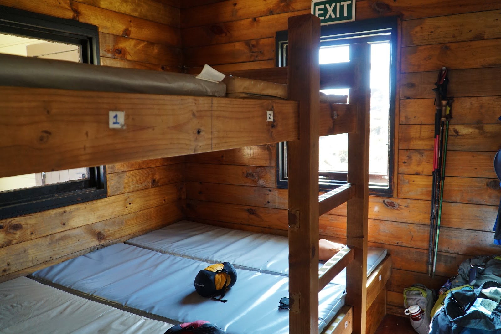
Upon entering Oturure Hut, it was clear that this was a step down from the already non-luxury Mangatepopo. The living space was small and cramped, and even had bunks along one of the walls.

It did at least feature stoves like in Mangatepopo, but in an even more cramped configuration. Where Mangatepopo had the stove separated on either side of the kitchen, all four burners were right next to each other which is hardly ideal given the bottleneck at dinner time.
Alissa and chose a bunk in the front room as we considered it would be better to be in a room rather than in the main space. Given that this was New Year's Eve, it was highly likely that there might be celebrations going on until midnight, and given we would be going to sleep early we wanted to not be kept up by others.

In spite of the less stellar hut, it was great seeing Mt Ngauruhoe clearly. After a while, it is easy to became a little blasé as you see the mountain constantly, but I had to remind myself how rare and special this was, especially given Alissa and I come from the flat lands of Western Australia.

Having arrived so early, Alissa and I basically had all of the afternoon ahead of us. A worthwhile side trip that can be reached for the hut is a short walk to Oturere Falls. With the Emerald Lakes being too acidic and the Blue Lake being restricted from swimming due to being sacred to the local Maori tribe, this is the only swimming opportunity on this day of the track.

The water was super cold and the pools were not overly deep, however I took the opportunity to stand under one of the cascades to have a bit of a wash and cool down.


Given that this day from Mangatepopo to Oturere follows the famous Tongariro Alpine Crossing, I had very high expectations for this day of the Tongariro Northern Circuit. My expectations were met and even surpassed; this was an astonishingly beautiful and unique day of walking that ended 2019 with a bang. Alissa and I have done a lot of hiking during the last five years of the Long Way's Better and even before the blog, and very often we encounter landscapes that, while unique, I can recall seeing something that serves as a reference point. Much of what we saw on this day was totally unique, and gave the area a sense of discovery and alien newness that was very enjoyable. While the 800 metre ascent was definitely not easy, it was easier than we expected and was more than amply rewarded by the views at Red Crater. This is easily my favourite day of hiking in 2019, and one of my favourite days ever documented on the Long Way's Better. Even if you don't have time for the full circuit, this day of walking comes highly recommended.


0 comments:
Post a Comment