

A short but enjoyable walk in Korung National Park, the Bickley Brook Walk explores the brook just above Bickley Reservoir. Crossing the brook at a bridge, the trail rises up to provide stunning views of the Swan Coastal Plain and neighbouring valleys. Descending another creek then rising to mature Wandoo forests, the trail descends to a second brook crossing to complete the loop. One of the Shire of Kalamunda's better walks
Distance: 3.2 km ('tadpole' loop - a main loop with a return section)
Gradient: Mix of gently undulating and moderately steep walking
Quality of Path: Relatively clear and surprisingly maintained. Track varies from purpose built walk trail to old vehicle tracks with uneven gravel to bitumen road
Quality of Signage: Some signage, but no trailhead and several turns being poorly marked. It is best to consult the Shire of Kalamunda's page for the track notes.
Experience Required: Bushwalking experience recommended given the lack of signage
Time: 1 Hour
Steps: No formal steps, but some very eroded tracks with informal steps
Best Time to Visit: Late Winter/Early Spring
Entry Fee: No
Entry Fee: No
Getting There: The trail starts on Hardinge Rd in Orange Grove. From Tonkin Hwy, take Maddington Rd North-East. Maddington Rd becomes Hardinge Rd. Car park facilities are available at Hardinge Park.

Having just written up three epic Walk GPS walks in a row, Alissa and I decided to put the ViewRanger app away and head out for a navigationally easy walk for a change. With a number of smaller Shire of Kalamunda trails left to do, Alissa and I decided to tackle two of these trails with our first stop being to a very familiar car park on Hardinge Road to complete the Bickley Brook Walk.
Hardinge Road is a lovely picnic area right by Bickley Reservoir. It is a place Alissa and I have visited many times as it is also the start point for the 'Baby's Grave Walk' - the loop track we have done many times that combines the Mason and Bird Heritage Trail with the New Victoria Dam Walk and goes past the gravesite of a pioneer baby.

Having walked the Mason and Bird Trail many, many times since my first visit in 2012, I haven't really been on the look out for Shire of Kalamunda markers, so it was really interesting to see one nailed to the tree along the sealed path leading towards the dam.

When the path reaches Hardinge Road, the trail heads alongside the road and follows a well worn pad. Why this has never been formalised as a path is a mystery, especially given that it is clear everyone walks along the verge rather than the road.

The sealed part of Hardinge Road ends at a roundabout with the continuation of the road blocked off by walls of limestone rock and a solid metal gate. Heading along the road leads to a trailhead for the Kattomorda Heritage Trail. Arguably one of the most enigmatic trails in the Perth region, the Kattamorda has largely disappeared and has become overgrown in places, however a few hardy walkers tackle it every year. Mark from the Life of Py has the most comprehensive write up of the walk and a GPX file can be found online. Alissa and I would be saving that long walk for another day however, and we instead followed the Shire of Kalamunda marker pointing left towards the brook.

Back in 2010, a friend and I explored this area after completing the Mason and Bird Heritage Trail and said we'd come back to explore it another time. While said friend has now moved to Canada, I'm glad that I've finally gotten around to exploring this area eight years after the fact!

Given that Shire of Kalamunda trails vary greatly in quality, Alissa and I were pleasantly surprised to a see a wooden bridge crossing Bickley Brook. This level of construction is rare on a trail in Western Australia, so it definitely pointed towards this being one of the better Shire of Kalamunda trails.

The bridge offered excellent views of Bickley Brook in action. With all the recent winter rains, the brook was flowing well, with the surrounding area lush and full of life.

The walk track continues along the brook and offers more views of the water as it gently cascades down the granite.

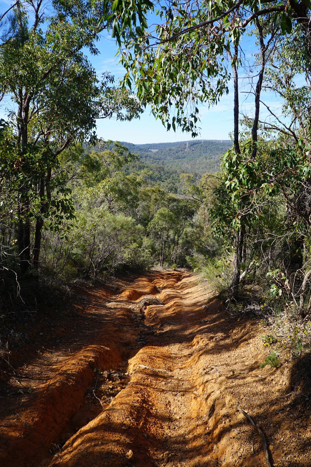
At an old vehicle creek crossing, the walk track disappears as the trail heads up a heavily eroded vehicle track. This is a moderately steep and continuous climb, and Alissa commented that while short this at least had some degree of challenge to it.

Near the top of the climb, there were a number of Dolerite boulders that looked like constructed walls for afar. Near the rock pictured above is a fairly inconspicuous arrow pointing to indicate walkers should turn left. This is not overly clear, and walkers need to be paying attention to the downloadable trip notes to ensure they follow the correct route.

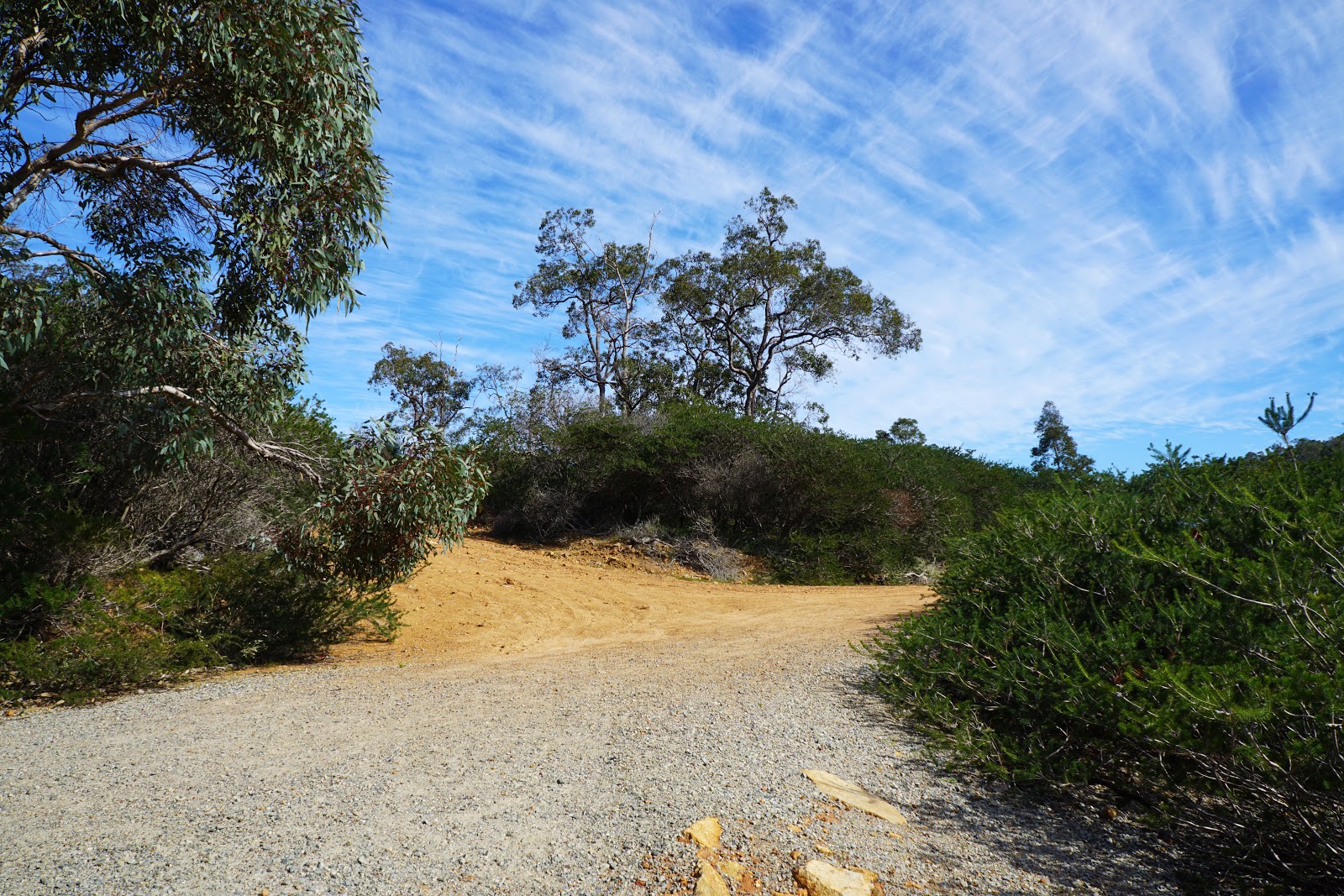
Having found the correct turn, Alissa and I continued along the vehicle track as it continued to climb but in a westerly direction.

August and September are my favourite months to get out and about in the Perth region as the waters are flowing and the wildflowers are in bloom. This was illustrated beautifully along this walk, with a myriad of wildflowers all along the walk.

Being high above the valley, the trail provides some good views down to the Swan Coastal Plain. But of course, just about every walk in the Perth Hills offers such views, so it is something that has become decreasingly special with every walk we do.

Of much more interest to me was the view to the south across the valley. I've long been interested in the network of vehicle tracks and trails that link Bickley Reservoir to Ellis Brook, and it something I'd like to explore in the near future.

Beyond the valley views, the granite formations near to the track and the tall Wandoo made for enjoyable walking.

Right near the top of the climb were a large number of wildflowers.

Looking north across the next valley, the next hill along is home to the Lions Lookout Walk, which also features a riot of colourful wildflowers at this time of year. When we last did that walk, we had seen Bickley Reservoir below, so it was interesting to now be on the other side looking back at the landscape of Lions Lookout!

From this high point, the track descends towards the next creek along and follows the creek through a lovely shady section of the walk. Being a relatively hot day (for August anyway), this was a nice cooling treat.

From the creek, the track rises steeply to the highest point of the entire walk. Given the gentle-looking creeks, Alissa and I were a bit surprised by how up and down this walk really was - especially given that the Mason and Bird/New Victoria Dam Loop is pretty easy going in comparison.

At the top of the climb, Alissa and I were rewarded by views of some particularly beautiful tall Wandoos standing proudly on the hill. At this point, the track goes off in a number of directions, and I believe if we had turned left we would have eventually joined into the Lions Lookout walk. Instead, we took the right turn (or the third exit of the roundabout as the track notes refer to it), and headed steeply downhill.
Heading down this steep and deeply eroded slope, Alissa and I could see the New Victoria Dam in the distance. Being fond of the Baby's Grave Walk, Alissa came up with the excellent idea that tacking the Bickley Brook Walk onto the front of the Mason and Bird Trail and then finishing with the New Victoria Dam Walk would make for a really enjoyable circuit walk of reasonable distance.

The vehicle track returned us to the river crossing we had been at earlier, with Alissa and I having to use a series of stepping stones to get across to the other side.

Again, the trail offered us some lovely views of Bickley Brook in flow. This is why I always try to save walks with creeks for this time of the year - they really are at their best after some good winter rains.
Following the walk trail, Alissa and I found ourselves back on the unsealed section of Hardinge Road as we turned right to complete the walk back to the car and the end of a short but enjoyable trail.

Having enjoyed the Mason and Bird Trail and having ventured to Bickley Brook before, I had higher than usual expectations for this Shire of Kalamunda walk. What Alissa and I discovered was even better than we had expected, with some lovely lush scenery along the creeks and some surprisingly engaging walking along the route. While some Shire of Kalamunda walks like the Channel 10 Tower Walk represent some of the worst walking in Western Australia, there are also great trails like Whistlepipe Gully that are among the best. The Bickley Brook Walk is definitely closer to Whistlepipe in my esteem, and it is one that I'd happily walk again - perhaps, as Alissa suggested, in combination with the Mason and Bird/New Victoria Dam Loop.


0 comments:
Post a Comment