
The first day of a three day trek from Northcliffe to Pemberton, the journey to Schafer campsite is an easy day of walking on the Bibbulmun Track. Initially passing through impressive forests near Northcliffe, the track passes through a mixed bag of farmland that varies from idyllic to relatively dull. After returning to Karri Forest, walkers are rewarded by the lovely Schafer Campsite - complete with a perfect dam for swimming.
Distance: 14.5 km (one way)
Gradient: Largely gentle gradient with very few hills
Quality of Path: Very clear and well maintained.
Quality of Signage: Well signed, with the Waugal providing very clear directional information.
Experience Required: No Bush Walking Experience Required - this is an easy day's walk
Time: 3.5 Hours
Steps: Very few
Best Time to Visit: Best to avoid from January-March during the Bushfire Season
Entry Fee: No
Entry Fee: No
Getting There: Northcliffe is easily accessible via Pemberton-Northcliffe Rd from Vasse Hwy. The Trailhead is located across the road from the Northcliffe Visitor Centre in Northcliffe Forest Park.

With the restrictive heat of Summer beginning to wane, the Easter long weekend frequently marks the beginning of the walking season in Western Australia. With four days off, it also provides an excellent opportunity to undertake one of the shorter multi-day sections along the Bibbulmun Track. With this in mind, Alissa and I headed out to Northcliffe to walk the two night/three day section to Pemberton. The walk begins across the road from the Northcliffe Visitor Centre in Northcliffe Forest Park, with an abandoned rail trail leading from the Visitor Centre car park.

A clear signpost indicates that the rail trail will take walkers south towards Albany. As we were heading north, we left the rail trail and headed into the Forest Park.

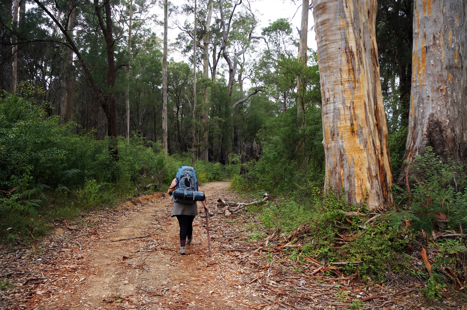
The Forest Park is a nice introduction to the Karri Forest that will dominate the rest of the three day walk. A dense understorey predominated the start of the walk, with larger Karri trees appearing further into the forest.

A short distance into the walk is the Acacia Picnic Spot, which looks a bit like a somewhat makeshift version of a Bibbulmun Track hut, complete with toilets. Although I'm sure it is actively discouraged, I couldn't help but wonder how many times this shelter has been used by hikers as an alternative to staying in town.

Beyond the Acacia Picnic Spot, the track follows an old vehicle track through impressively large stands of mature Karri.

This time of year is the shedding season for Karri, with strips of thick bark all over the forest floor. The peeling bark revealed trunks in a myriad of colours, illustrating the reason behind the tree's scientific name of Eucalyptus Diversicolor.

Crossing Muirillup Rd, we encountered the first major signs of the recent controlled burn that was undertaken in the area.

The Bibbulmun Track had been heavily diverted just a week earlier due to the fire, so we were fortunate enough to be able to follow the much more scenic original route while also getting a chance to see the effects of a controlled burn so soon after the fact.

The burnt forests to the left of the track provided an interesting contrast when compared to the Gardner River to our right. Decidedly low at this time of year, the river still provided some pretty views.

Along the way, we encountered the base of a once tall Karri with its roots still smoldering from the burn. Alissa initially wanted to climb up to have a closer look, but we agreed that it was probably a bit dangerous with the fire still burning underground.

A bridge across the Gardner River marked the end of the Forest Park, with farmland predominating for much of the rest of the track.

Following the tree lined Smith Road, the track passes by several farms.

Along this quiet rural road were large berry bushes. Knowing that Blackberry is a weed frequently sprayed with poison in these parts, Alissa and I refrained from trying any just in case, however we later heard from another group of walkers that they had stopped to pick berries and were fine afterwards.

One section of Smith Road passes by a field of cows. The placid cows must be used to a lot of foot (and Munda Biddi cyclist) traffic, as they seemed very calm as they watched us walking by.

The track crosses Middleton Road. This is where we would have joined the Bibbulmun had we been required to take the diversion, which would have resulted in us missing some of the best walking of the day.

Although the farmland beyond Middleton Road was nice enough, this was the most dull part of the walk.

The main issue we had with this section was the hard unsealed road that made for fatiguing walking, and reminded Alissa and I of how much we disliked the final stretch of the Bibbulmun heading north into Walpole.

After several kilometres of the fatiguing road, we finally reached the end of the farmland. This next stretch started out as a sandy, low-lying swamp but progressively grew denser as it transitioned to Jarrah and then Karri-dominant forest.

The walking in this mixed forest reminded me a lot of the Blackbutt Trail in Bridgetown Forest Park - albeit considerably better maintained.

Surrounded by Karri Forest, Schafer Hut is a lovely location. We were greeted at the hut by two other groups of walkers - a group of four originally hailing from the Pilbara and a fairly experienced older couple. We would be joined by a group of group of three girls we had passed near the Acacia Picnic Spot earlier in the day. With the older couple staying in their own tent, the nine of us were able to share the hut with relative comfort and space.

The best thing about Schafer is the hut's close proximity to a good size dam. Partly on private property, a section of the dam is roped off for walkers to use. Being sweaty from the day's walk, it was nice to have a cooling dip. While the dam was relatively clean and safe to swim in, the banks can be a bit slippery, so watch your step getting in.
This first day of walking was one of the easiest sections of the track that we have walked, with the gentle terrain and relatively short distance making it ideal for beginners. While some of the views in the Northcliffe Forest Park and the first section of farmland were very scenic, the boring section on the unsealed road took away from an otherwise pleasant day. Still, getting to swim in a safe dam right by Schafer hut was a real treat, and I would recommend Northcliffe to Schafer and back as a good section for those looking to transition to overnight hiking.

With the restrictive heat of Summer beginning to wane, the Easter long weekend frequently marks the beginning of the walking season in Western Australia. With four days off, it also provides an excellent opportunity to undertake one of the shorter multi-day sections along the Bibbulmun Track. With this in mind, Alissa and I headed out to Northcliffe to walk the two night/three day section to Pemberton. The walk begins across the road from the Northcliffe Visitor Centre in Northcliffe Forest Park, with an abandoned rail trail leading from the Visitor Centre car park.

A clear signpost indicates that the rail trail will take walkers south towards Albany. As we were heading north, we left the rail trail and headed into the Forest Park.

The Forest Park is a nice introduction to the Karri Forest that will dominate the rest of the three day walk. A dense understorey predominated the start of the walk, with larger Karri trees appearing further into the forest.

A short distance into the walk is the Acacia Picnic Spot, which looks a bit like a somewhat makeshift version of a Bibbulmun Track hut, complete with toilets. Although I'm sure it is actively discouraged, I couldn't help but wonder how many times this shelter has been used by hikers as an alternative to staying in town.
Beyond the Acacia Picnic Spot, the track follows an old vehicle track through impressively large stands of mature Karri.

This time of year is the shedding season for Karri, with strips of thick bark all over the forest floor. The peeling bark revealed trunks in a myriad of colours, illustrating the reason behind the tree's scientific name of Eucalyptus Diversicolor.

Crossing Muirillup Rd, we encountered the first major signs of the recent controlled burn that was undertaken in the area.

The Bibbulmun Track had been heavily diverted just a week earlier due to the fire, so we were fortunate enough to be able to follow the much more scenic original route while also getting a chance to see the effects of a controlled burn so soon after the fact.

The burnt forests to the left of the track provided an interesting contrast when compared to the Gardner River to our right. Decidedly low at this time of year, the river still provided some pretty views.

Along the way, we encountered the base of a once tall Karri with its roots still smoldering from the burn. Alissa initially wanted to climb up to have a closer look, but we agreed that it was probably a bit dangerous with the fire still burning underground.

A bridge across the Gardner River marked the end of the Forest Park, with farmland predominating for much of the rest of the track.

Following the tree lined Smith Road, the track passes by several farms.

Along this quiet rural road were large berry bushes. Knowing that Blackberry is a weed frequently sprayed with poison in these parts, Alissa and I refrained from trying any just in case, however we later heard from another group of walkers that they had stopped to pick berries and were fine afterwards.

One section of Smith Road passes by a field of cows. The placid cows must be used to a lot of foot (and Munda Biddi cyclist) traffic, as they seemed very calm as they watched us walking by.

The track crosses Middleton Road. This is where we would have joined the Bibbulmun had we been required to take the diversion, which would have resulted in us missing some of the best walking of the day.

Although the farmland beyond Middleton Road was nice enough, this was the most dull part of the walk.

The main issue we had with this section was the hard unsealed road that made for fatiguing walking, and reminded Alissa and I of how much we disliked the final stretch of the Bibbulmun heading north into Walpole.

After several kilometres of the fatiguing road, we finally reached the end of the farmland. This next stretch started out as a sandy, low-lying swamp but progressively grew denser as it transitioned to Jarrah and then Karri-dominant forest.

The walking in this mixed forest reminded me a lot of the Blackbutt Trail in Bridgetown Forest Park - albeit considerably better maintained.
Surrounded by Karri Forest, Schafer Hut is a lovely location. We were greeted at the hut by two other groups of walkers - a group of four originally hailing from the Pilbara and a fairly experienced older couple. We would be joined by a group of group of three girls we had passed near the Acacia Picnic Spot earlier in the day. With the older couple staying in their own tent, the nine of us were able to share the hut with relative comfort and space.

The best thing about Schafer is the hut's close proximity to a good size dam. Partly on private property, a section of the dam is roped off for walkers to use. Being sweaty from the day's walk, it was nice to have a cooling dip. While the dam was relatively clean and safe to swim in, the banks can be a bit slippery, so watch your step getting in.
This first day of walking was one of the easiest sections of the track that we have walked, with the gentle terrain and relatively short distance making it ideal for beginners. While some of the views in the Northcliffe Forest Park and the first section of farmland were very scenic, the boring section on the unsealed road took away from an otherwise pleasant day. Still, getting to swim in a safe dam right by Schafer hut was a real treat, and I would recommend Northcliffe to Schafer and back as a good section for those looking to transition to overnight hiking.


0 comments:
Post a Comment